Smart Suburbanism by Gunnar Røe (FCL Lunch Talk)
Gunnar Røe argues that smart city plans fail because they ignore suburbs and their social costs. He uses Oslo to show how density-focused strategies create governance problems across regions, and describes a research project tracking mobility, inequality, and jurisdictional conflicts in suburban areas.
Chapters
Thank you for having been welcomed here and to have this talk at your.
Section here at the nus. I'm from the department of Sociology and Human Geography. Mainly I do research and teaching within urban studies, urban planning. And the last year I've also got an increased interest in smart cities or smart city strategies, or I would rather say smart urbanism, or.
My interest is mainly in social implications of smart city strategies. As you will see.
University of Norway is, well, big university in the Norwegian context. Actually now it's the second largest, surpassed by the university in Trondheim, who's merged with a lot of other regional small colleges, become the biggest one. It's the oldest university. And within social sciences, I think it's especially strong in the Norwegian context and maybe also in more global context because social sciences are quite strong in the Scandinavian countries and within the university also as well.
So I'm a human geographer, but I'm part of this department of geography and so sociology, we're together, which is quite good. And we don't have physical geographers, if anybody's physical geographers. I don't know if anybody's geographers at all. But.
Many geography departments around the world have a combined physical and human geography. But our department is all the kind of social science part of geography.
Well, to my talk, I'm going to say something first about smart cities. I know that's a concept that you work on a lot, many of you. I guess.
I'm going to say something about my take on it and then I'm going to tell.
About why I'm interested in suburbs because I think one needs to have a regional city wide perspective when developing smart cities. Not only focus on the city center and the kind of high end technological solutions and those things. And especially I'm also part of a larger international network of researchers doing research on suburbanism. So I'm trying to kind of couple those two themes that I'm interested in, smart cities and suburbs. And I've got funding for a project that's called Smart Mobility Suburbs, which I'm going to tell also a bit about.
Please. I know there's. There's going to be some time for questions and discussion at the end, but if somebody has a question while I'm talking, please feel free to raise a hand and ask. I think that's better instead of forgetting what to say at the end of the lecture. So please just interrupt me. It's no problem for me at all.
I will just show you this image and it's.
Maybe it's Provocative to say that this is smart city for technocrats. My.
Motive for saying that this is the kind of image that after smart city has become a buzzword and also strategy. I think the way of dealing with all the physical flows and technologies systems of the city is I think the dominating take on smart cities, which is a good thing that to use technology to solve a lot of problems and to make the city more effective.
But there's another take on smart cities as well that increasingly social scientists are interested in. Namely both the utilization of the network infrastructure, which is a kind of technological view of things, but also focusing on social inclusion residents in public services.
And the socio technical connections between technology and how people use technology.
And of course the role of social capital relations between people. How can smart city technology make that more efficient or better? In different ways. And then there are the social consequences with regard to gentrification and social inequality. And those things that I also will talk a bit more about.
There's been a lot of studies on or increasingly there are been studies on smart cities and there are rankings, more or less thorough rankings of smart cities. Who's the best smart city in the world? This is from an investigation that some researchers did on different aspects of the smart city. So they divide between the smart economy, smart people, that is education like the creative class by Richard Florida how many people do have a university education, bachelor education, masters and so on. Smart governance, inclusive governance, participation and so on. Smart mobility, that is the share of public transport, smart environment solutions that care for the environment and smart living solutions for homes. And everyday life is mapped between different European cities. And it's.
It's not very.
Surprising that the cities in northwestern Europe is at the top of the list and in central Europe it's at the top of the list of this.
Mapping of smartness among cities. But I think still.
It may hide some of the real problems mechanisms that drive forward through the smart cities in a way. So this is just an example of how one do research on smart cities. The things that I'm really interested in is the social implications.
And I think many of the smart city strategies or policies that are developing are a bit superficial regarding the social implication. They may be too optimistic. They may underscore certain consequences.
They may not have sufficient knowledge on the actual social implications or how to create good practices or processes to achieve a truly smart city.
So even if there's a discourse, a growing discourse on on smart cities as something that has to be to develop local communities and that has to do with social learning and so on, I think much of.
The really strong driving force is within the business driven technology development.
And that necessarily isn't bad. They shouldn't be decoupled from each other. That's my point. So I think the understanding of the social technical processes are crucial. And I think there is danger that the development of smart technology may focus on areas where people can pay or companies can pay for that technology. Especially because the more welfare oriented modern infrastructure system is being.
Downscaled in many countries. Also countries that have had a quite strong welfare state, like Norway and like Germany, other countries, new types of technology is not necessarily part of that way of thinking of kind of equal opportunities to access types of infrastructure. So it may lead to.
Increased social inclusions. It may also.
Emphasize on or increase segregation and also may lead to some sort of gentrification in some urban areas. So social inequality is a word that has to be considered alongside.
Smart city development.
So what about suburbs.
Introduced by saying that I'm interested in suburbs and that I think a smart city strategy needs to have a city wide regional perspective that includes the suburbs. And that's because when it comes to efficiency, transport sustainability.
Suburbs have a problem or cities with suburbs, all cities have suburbs and much of the growth actually in most cities, the urbanization taking place now globally also in developing countries.
Is mainly suburban. Most people move to suburbs or most people live in suburbs. In the United States, even.
More people live in suburbs than in cities or city centers and the central areas and cities and rural areas together.
So this is a main kind of issue for urban development in the future, which is less addressed in the smart city discourse, I would say.
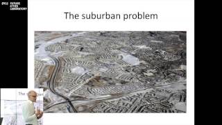
So the suburban problem is of course about urban sprawl, the spreading out of housing functions, roads.
That covers large tracts of land but also creates long travel distances. So I want to.
Point at different, I will just point to different aspects that are problematic with the suburb and then say something about the need to study the suburb and to understand the suburb in order to create a truly smart city, including its smart suburbs. Well, there's one of the suburb that relates to form and style. And I guess that's in the kind of popular view of suburbs in TV series like Desperate Housewives or even Mad Men, where they also picture the suburb in a certain way. This is a dominating image and it's often connected to especially the American North American suburb. This is a picture from California, as you may have guessed. This is from Canada, from Toronto. But these images are quite representative for the typical middle class or upper middle class suburb of western cities. Here in Singapore, I guess it's very little of these kinds of suburbs, if there are any at all.
I haven't traveled all around the city, but. But I haven't seen much of it yet. And I've heard that there's little of these kinds of suburbs. You may correct me if I'm wrong, but that's my impression.
Louis Mumford, in 1961, he wrote very critically about suburbs, which kind of pinpoints this popular critique and the critique from intellectuals and urbanists of the 1960s and 70s, that this is a multitude of uniform, unidentifiable houses lined up inflexibly at uniform distances on uniform roads in the treeless communal waste. There are some trees there, but inhabited by people of the same class, the same income, the same age group, witnessing the same television performances, eating the same tasteless prefabricated foods from the same freezers, conforming in every outward and inward respect to a common mold manufactured by the central metropolis.
So this pinpoints the homogenization and.
The social segregation of the suburbs.
Which of course, some people would say that's not a problem.
But the flip coin of this is that in many of those cities that have segregated suburbs, we'd have inner cities with big social problems.
Not always, and things are changing, but it may be seen as a problem. And then there's a transport problem that maybe has gained most attention the last 30, 40 years. And I'm just showing here a figure from quite famous investigation done by the two Australian researchers, Newman and Kenworthy in 1989, presented in the book called Cities and Automobile Dependence, which illustrates.
The correlation between annual gasoline use per capita.
This was in 1980, the data for that investigation, and urban density.
So it's not surprising that the urban sprawl, typical midwestern western American cities of Phoenix and Houston lies here with a low density and very high gasoline use per capita. And Hong Kong at the other extreme here, which is probably the densest city in the world with a very high degree of public transport. 90% or so of all traveling is done by public transport.
And then you have a cluster of European cities here, a cluster of Canadian and Australian cities there. Of course, this is a very simple correlation between two variables and things like mean income, public transport system, gasoline prices will affect on the use of gasoline, of course. But there has been done more research. I was part of a research project that had a look at 22 Nordic cities. And even when we took into account in multivariate analysis things like gasoline prices, public transport system and other socioeconomic variables, there was a Correlation between density and.
Gasoline use or energy use for transport. So this is part of the suburban problem that research has shown.
Without doubt there has been a lot of project underlining this, that urban sprawl, low density development.
Creates more transport than denser developments. So that's part of the suburban problem, which is well known.
But what is actually a suburb is it always easy to know? Especially because areas that have been suburbs turn into cities or are kind of engulfed by.
Growing dense city like structures. In 1999, one of the more famous suburban researchers, Richard Harris, together with Larkham, made a definition focusing on that the suburbs should have to a certain degree a peripheral location in reference to the city center. They should have a residential character, low density with often high levels of owner occupancy.
That rules out the most of Singapore, I guess a distinctive way of life, suburbanism as a way of life and separate identities for communities of. Not the municipal level, which is kind of. I think it's specifically for the American context and the British context. In 2010, after doing some more research, he had modified his definition so he still kept the peripheral location and that the residential density should be intermediate.
Between those of the city and the country, the rural areas and the relative newness. So for instance, the residential character and the distinctive way of life is taken out. And I think there are two reasons for that. First, that many suburbs are increasingly also workplaces. There are shopping centers, a lot of other things going on in the suburbs. That's the one thing. And the other thing is that actually researchers have shown that many new developments in the city as part of gentrification, as part of new build gentrification, new condominiums and so on. The people who live there, they have the same way of life or lifestyle as suburbanites.
So it's increasingly difficult to draw a line between the suburbs and the city. So it depends on what aspect you're looking at. If you're looking at mostly the transport aspect, or if you're looking at the cultural aspect, or if you're looking at segregation, you could make different assumptions.
So Oslo, I'm going to say.
Something about the development of suburbs in Oslo. And my project in studying the suburban landscape of Oslo and especially how to develop some smarter suburbs. Because quite clearly one of the main problems for many big cities is the suburbs or the spread out area of the cities or the city regions. This map shows. Well, here's the map of Oslo. Have anybody of you been in Norway?
Okay, so I guess you've been to Oslo as well, and maybe Bergen and.
It's a nice city and it lies at the end of one of these fjords that the glaciers made 20,000 years ago, when the whole Scandinavian area was covered by inland ice during the ice ages. So we have a lot of islands with.
Communal places, recreational areas, beaches and so on that you could visit during the quite short summer from May to September.
It also lies in the south of Norway, which is a long country. The polar circle is here.
And up here it's mostly treeless and quite cold. It could be like 5, 6 degrees Celsius during the daytime in summer, but you have the midnight sun, so you would feel like it's light still.
So there are large differences. And in Oslo, the Oslo region, that is.
The built up area of Oslo, what's marked as yellow hair. Today, approximately 1 million people live in that area. And within the municipality of Oslo, which is within this red.
Delineation, 650,000 people live. So it's a relatively small capital or city compared to other European capitals. So a medium sized city one could say. But still it has the same challenges and the same opportunities as many other cities. These gray areas are the areas with workplaces and commercial activities. So on this picture you can see that commercial activities and workplaces are spread out in the suburban landscape and not only in the inner city. And it's increasingly being spread out. This has been going on for a long time, for instance, in American suburbs, where there's a long time since the commercial activities and workplaces in the suburbs outpaced the city center. In European cities, the city center is more important and has not been through the same kind of spatial, social, economic problems as in many American cities, of which Detroit is the most extreme example. As you know.
So well, this is the situation in Oslo.
And if we look at the population development, as I said, the municipality of Oslo is now.
650,000. But what I want to show here is that.
From the Second World War until the mid-90s, the population in the inner zone of Oslo, approximately that area I showed you.
Had been going down and now there's a re urbanization taking place.
But.
It'S not taking population from the suburbs because the suburbs within the municipality of Oslo are also increasing. And the population from approximately 1990 is increasing. There was a slight downward trend as many other European cities experienced during a kind of post industrial phase where, where a lot of workplaces and industrial activities were laid down.
But then the pull of the city has started again.
The prospect is that the population of Oslo will increase with 3, 400,000 people. In the next 30, 40 years. So it's, in percentage, one of the fastest growing cities in Europe, I think, together with Stockholm, of course. London grows more in absolute numbers, but in percentage, the growth is lower.
If you look at the population development in the suburban municipalities around Oslo, one would see that they follow the same pattern. So city growth is not only about the core, it's about the whole region. The whole region is growing. So when the city, with all its activities, cultural amenities.
Workplaces and so on, institutions, state, private, attracts people, it attracts people to the whole region, actually. And that's because also the region has quite effective transport system, public transport system, and also quite a effective road system. But in Oslo, we have a metro, we have trams in the central areas of the city, we have suburban trains and there are buses. So for being a city of that size, it's quite good and quite varied compared to a lot of other cities. I should think that the metro system is similar or a little bit smaller than the Singapore system. Not that many departures and arrivals, but it's fairly good compared to the size of the city.
So something about the history of suburbs of Oslo. One of my key points is that it's really important to understand the history of suburbs, to understand how to deal with the suburban question or the problem, and how to redevelop, retrofit, make the suburbs smarter.
So I've tried divided it into different.
Parts of, or phases of production of the suburb in Oslo, which I think probably will be similar to the phases you would see in other Western cities. At least.
In the 1800s, when the city really grew from like 20,000 inhabitants to. To 300,000 inhabitants just in half a century.
The wealthy people built their first suburbs at places in the city today, which is really considered part of the inner city. Even if these villas are still here, they are now the district for embassies and law firms and things like that.
And they're surrounded by the dense city, but these areas are preserved. I think this was actually the first kind of wealthy suburb in Scandinavia. Hohmanspin, in the 1850s built just behind the Royal Castle on the west side. And one feature of Oslo which is really important is that there's a clear division between east and West. I think most people who go there will feel that quite quickly. The working class has been traditionally living in the east side, on the east side of the river, while the upper middle class and the elite has been living on the west side.
There are some exceptions, but that's the main rule, and it's being strengthened Also through immigration, immigrants mainly live on the eastern side. Also the eastern suburbs, the estates with blocks of flats and the white.
Also the white immigrants, like Americans and Swedes and Danes, they live on the western side.
More or less dominated by semi detached and detached housing. The other part of suburbanism in this early phase was unregulated working class suburbs in the eastern part. So this was the western suburbs for the affluent, and this was the eastern suburbs for the working class coming to the city. And because this was outside the municipal border of the city, they built their houses in wood. Inside the municipal border. They had to build in brick, but it was cheaper to build in wood. So that's why these wooden cities grew up. And now some of these areas are very popular and are gentrified and same price level as the western part of the city. So that's also part of this change that that has been taking place.
During the first half of.
The 20th century. As in many European and United and American countries.
Modern urban planning system came into place to deal with the problems of the industrial city. Pollution.
Social problems, health problems, a lot of people living in small spaces. And in Norway, there were four different types of.
Ways of intervening for the state in the building of the welfare state system and urban planning. First, there was public housing policies.
Nothing like the kind of policies you have in Singapore, which is very sophisticated and which is really covering a lot of the housing. So there were social housing, state housing bank and cooperative builders that built many of the suburbs on the eastern side for the working class.
But now today, social housing, or rented social housing is a very limited part of housing in the city as a whole. And that's the same situation for most Norwegian cities. People prefer to own their own home. And even what was built as social housing is today owned by people, but also through a kind of cooperative organization that.
I think does make people.
Responsible for their community because they own their house, so they sell it on the market afterwards. And they still pay some rent to a collective organization that takes care of the environment. And they also take part in work for the environment. So they will have it will be their own economic interest to take care of the area around their house. And then you have public land use policies, protection of recreational lands, later agricultural areas, transport policies. As I said, the car sale was rationed until 1960. You couldn't buy a car without applying for that, but then it was free. And then the kind of automobilization of the city started. There were a lot of public transport investments. And one could say that there was A building up of what Simon Marvin and Stephen Graham has called the modern infrastructural ideal. The world first aid infrastructure. And then you had urban planning through comprehensive and rational plans.
Also regional plans. And I'll say something more about afterwards. This is example of the master plan of Ulster from 1950, which is kind of related to Abercrombie's plan for London or.
Similar plans for Stockholm or for Amsterdam. Many cities in the late 40s and early 50s in European countries and I guess also in other parts of the world made detailed master plans for the development of the whole city. And these yellow areas here are new housing projects. And they were actually implemented. All of these areas were built according to this plan. So this was the kind of heyday, the prime time of planning, where the. I guess like Singapore is today, where the government owns much of the land. The government, they bought the land from farmers in this area, in this valley, for instance, the Gurudal Valley. They expropriated the land and they owned the land and then they started to build on it. That's not the situation today. The government owns very little land.
So the ownership of land is very crucial when one is going to do a public planning or when the government is going or the state is going to be involved in planning. Another feature which is important for this plan is that between all.
Dwelling areas.
And these are recreational lands with woods used for hiking and so on. So there was pulled up a strict line that they still have kept that it's not allowed to build north of this. And that's part of the reason for this kind of band like structure of the city that you are not allowed to build in these recreational lands because there's a culture of hiking and skiing in the winter, cross country skiing. And all areas should be accessible from or the recreational areas should be accessible for all housing areas in these new developments. Some of these green corridors.
Have been developed over the years. But that was the idea of the planners, a quite sophisticated plan for. For developing new areas.
And this is what it looked like. This is first so called Drabant P from the German word Drabant, which is then outside of something, a satellite smaller than the British new towns, but comparable, a little bit smaller also than the satellites and new towns of Stockholm. Approximately 20,000 inhabitants. It's satellite town.
I went to Punggol the other day, which is quite similar but much larger than these satellite towns that were built in Oslo in the 1950s, 60s and 70s. But also this kind of housing was built, semi detached and detached housing. So 22 of those satellite towns were built. And then you had also a large scale self building and municipal planning of detached and sema, detached housing and extensive infrastructure development. And increasingly, because it started out when they planned these type of dwellings in the 1950s.
The car sale wasn't free, so it's planned with public transport only.
Very little parking places also. But then later on, during the 60s and 70s, they had to also take into consideration that people would have cars. And they of course, would increasingly have cars. Then came a quite fierce critique against these satellite towns, which I think you had similar critique all over Europe. You had it in Holland, you had it in Britain, you had it in Sweden, you also had it in United States. But I think, for instance in Britain and United States it was very coupled with.
Social housing and so called problem estates. So this is just a picture of a movie from the 1950s, which is very positive, optimistic. It's a kind of a sitcom movie.
Picturing a new family with a child moving to these satellite towns. While this one is a highly critical Marxist film from the 1970s, picturing two guys who were semi criminals protesting the society.
So the discourse of the 1970s was that these satellite towns, they were no good, they created social problems, they created criminals, they created drug use. So there was a kind of architectural determination, which later has been revealed by researchers, that it was not only about the architecture, it was also about.
A lot of people with social problems put in the same type of dwelling in a small area.
But there was a focus on children and the upbringing of children. That was not the.
These satellite towns were not suitable for the upbringing of children. For instance, when the housewife was making dinner up there couldn't actually see what the child was doing during the daytime. So there were a lot of analysis that actually.
Concluded that these types of dwellings should not be built anymore. So in the early 1970s, those kind of projects were stopped.
And at the same time there was a change in the policy and planning regime.
A doctoral thesis by Thomason says there was a change from planning to change society. Use planning as a tool to change society and build society. And the part of the welfare state project to planning to correct the society, to just adjust whatever how society develops. And there was a deregulation of the housing and loan market during the 1980s and municipalities and their role as supplier of building lots and owner of land was weakened step by step. They sold the land, they sold public housing, they sold their assets. The state housing bank pulled out of house building. And private actors would increasingly take the risk in building. So today, the situation today in Oslo is that between 80 and 90% of all development plans that has to be made when you're building a housing project, for instance, are being made by private actors, developers.
House builders and their architects, and not by the municipal or sector state authorities.
So then there's the next phase, which we are more or less in now, where it's a kind of after planning phase, where much of the transformation of the suburban landscape like this in the western suburbs, where you can see the old villas from 1910, 1920, 1900 and in between there's densification going on. We call it appleyard densification because it's mostly privately driven people selling off a parcel of their lot or building a house for their son or.
Daughter in law and so on. But there is also gentrification going on in these old satellite towns, some of them the most attractive ones, close to the hiking areas and close to the city. Actually Those from the 50s and 60s are those most popular for young professionals, highly educated and so on. And then you have a process of urbanization going on in the suburbs. This is from Lies, which is @ the border between Oslo and the very wealthy municipality of Badum, the most wealthy municipality in Norway at all, with 120,000 inhabitants.
So these are condominiums and quite expensive apartments in one of the nodes in the transport system in this municipal area.
And then the last phase that I'm going to describe is, which is the kind of the future, the aspects of. Or the future.
How future will. How they will develop in the future. In this area.
There'S been launch the plant that was adapted just before Christmas, which I think is similar to the kind of plant that remained with the 60s and 70s, many ways a regional plan that focus on energy efficiency, on reducing transport, especially with car.
And the main aspect of this plan is that there are designated.
Nodes in the railway transport system where densification development, the development of regional cities state in place. So this is an urbanization of suburbia, urban region in suburbia. So that means actually that the municipality of Baru, which is here for instance, will, if this plan is going to be implemented, will it will not be allowed to build a housing area there or there.
All housing should be concentrated around this regional city, more or less. And of course there are a lot of places here that are not very satisfied with this plan, like these small places with like 5,000 inhabitants that are going to be marginalized in the new transport system.
So this is a planned urbanization of suburbia and it's also a centralization of growth along these urban corridors. And the goal is to develop regional cities, or what I would call multifunctional micro cities, because it's not like the city for Bosco, but it's going to have increasing the number of shops and so on. I live just outside of Oscar. Here, just five minutes of walking in center of Oscar, which has between 150 and 200 shops, several workplaces. The train to also leaves every 10 minutes. It takes 18 minutes to the center.
So it's really quite well functional, well functioning.
Mini CV or microservice. So there's some intensification on notes of.
These nodes promoting public transport. But there are some, some problems, of course, because this land involves different municipalities, it involves cooperation, it presupposes corporation cross borders.
Which is not very easy. Always the county, this is two counties actually both. One is the county owned and one here. And here is another country. And it's really hard for them to procreate. For instance, it's actually really hard to develop a new public transport corridor out to the development area where the old airfield or the old airport was. That has been really difficult, showing how difficult this governance thing is. And then there is also the question, if the people who move to these micro cities, who are they? Are they families? Are there elderly pensioners who can afford it because they sell their detached houses in their suburbs, what kind of transport practices do they have? Could we expect them to use public transport? What about families? Could they live in these areas? So the challenge is.
That it presupposes participatory governance across spaces and borders. And it's also superimposed on this private planning system that I talked about, where 90% of the plans are actually after initiative by private developers within the kind of framework that the public or the state allows for. It relies on increased investment in public infrastructure. And now it's just been decided that one is going to build a new motorway highway into the city from the western suburbs, which has been highly debated, and will of course increase car traffic, because now there's a queue. And if you open up for larger capacity, the speed will increase until more people will use that larger capacity. And then you have the same queue again. Research shows that.
So the question is, will regional planning work this time?
And there's a problem of social engineering, which I think is a problem for all smartest city strategies, because we kind of presuppose that people are rational, utility maximizing in economic terms. But are they? That they have certain lifestyles, they have preferences they have an everyday life complexity. And what are the mobility practices of in movers? Will lifestyles and practices change? Developing new cultures, maybe. One could expect that, hopefully. And who will be able to move into the smart suburban micro cities? Will it be mainly the wealthy, pensioners, elderly? Or could we expect that child families would also do that? This is my last slide, and this is just about the project that I'm heading now, where we're going to look at the conditions for this transition towards low energy mobility future in new suburban centers like this one at Skagen, outside of Oslo. The picture is not very good when it's blown up into this proportion. But you, you may see it. We're going to look at mobility practices, we're going to do an empirical study of that and social implications as well as the governance issue. How could one expect to develop governance with cooperation between different municipal bodies and between private and public actors and also the civil society, which is important in the country like Norway? Thank you so.
Much.
More from FCL







Day 1 - Policy Innovation for Urban Transitions | Future Cities Symposium & Exhibition 2025