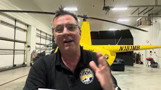
Top Ten Check Ride Tips Live Now!

Kenny Keller hosts a live session with Gary Cleveland, Rene Surprise, and Kenneth Koch debriefing student checkrides in R22 and R44 helicopters. Kenneth Koch demos a prototype inline fuel strainer with a 30-micron filter seeking STC approval. The group promotes a $0.99 Kindle book on checkride tips and a $50 membership discount.
Questions this video answers
July 25, 2018
$0.99
TAZ50OFF
Thursday morning at 9:00 AM at Oshkosh (AirVenture 2018)
Chapters
Aha. And we're recording. So I'm gonna come hand the video or the mic over to you. We're doing the simple, simple thing today, just one mic, we're gonna pass it around. So I'm gonna let Gary tell you he's been out flying with one of our ground school members from the Virgin Islands. So just give him a brief description what you guys been doing and then introduce him, bring him up here and he's gonna talk about something he's developed for aircraft that he wants to share with everybody. So we're celebrating the book Top 10 Checkride Tips. The link is there, go grab it. For 99 cents please leave us some Amazon feedback. That's how we drive that thing up to number one. We want to hit number one before Taz gets his award. Thursday morning at 9am and today 50 bucks off yearly or unlimited private commercial instrument or CFI. Gary made the code TAZ50OFF T A Z5. Oh, alright, well want to let us know what you've been doing today Gary, and tell them about your student. I preluded earlier that there's a student over there and I said nobody's told me whether he's passed or not. I'm sure he will. But so quick, cover that first and then lead into your member that's here right now with us.
Okay.
Rene Surprise, who I've worked with for about 21 hours in Yar44 over the past week and a half. He's from Texas. One of our members came here to train and wrap up his rating and I got news that he passed his checkride, got news straight from the examiner. He called me and said good job, he did an excellent job. And he's on his way back so we'll get him on camera when he walks back in. While he was gone I got to fly with a member of ours from the Virgin Islands. This is the second time he's come here for a flight review. Last time in the Enstrom, this time in the R44. So we just got back in from about a one hour flight around Plymouth, going through all the procedures to make me comfortable signing them off for the flight review. Interesting story. Kenneth Koch, who I'm talking about, he's developed a product that may prevent a near catastrophe that cost him an Angstrom a number of years ago. And I'll let him talk about that.
Kenneth.
Jump in there man.
So this is Kenneth Koch.
Thank you.
From the Virgin Islands. And how'd your flight review go today?
Went good. I was a little. It's Been a year since we. Since I flew with you last time. And it was, you know, your skills are definitely deteriorate if you don't use them, it's a perishable skill. So it was a little rough, but then it smoothed out. Things started to come back a bit more, but it was good. You're patient with me and I appreciate that. In a very rough beginning, how would.
You rate your flight instructor, say on a scale from 1 to 10, 10 being absolutely awesome.
Oh well, I mean 10, of course. No question about it. I mean just for the patience alone to let me wobble us around in a hover for, you know, six minutes, you know, that's good.
Well, tell us what happened that made you decide to develop something like this and then describe what that is after that.
Okay, I will.
When you get ready to describe it, if you want to move up here where they can see it better, you can see exactly what they're seeing.
Gotcha. Okay.
Up there if you want to do.
Yeah, I will. Let me talk and then I'll. Sweet. Okay. Number years ago I bought a Nstrom 280Amodel and I had 120 hours and I wanted something for time building in my own personal helicopter fly. No reason to get a certificate if you can't fly some. So this had been sitting in a garage for a number of years and had been using some regular fuel in it, automobile fuel. And the sump ended up getting over full which clogged up the little fuel filter in line. And I ended up having two cylinders lost. And being an A model, it was little heavy for it being anyways a great flying ship. I love Enstrom's to death. And it just cost two cylinders to go and I had to put it down rather hard which you know, caused the main gearbox and the tail rotor to snap. And once you have destroyed the attachments for the engine, the transmission, you pretty much in that model how much it cost, it was totaled. So that prompted me to. To think of just something I could come up with which is just a kind of a fuel strainer. It attaches on the.
Kenneth to bring that around to the camera so you get a close look at it.
It attaches in the inline tank with the little extents here. And you just put it in and it locks in like this. And then the fuel cap has an air vent and clicks. So it just locks in securely. You can't pull it out. And when I designed this, I wanted to be durable. Last for 20 years. This is aircraft aluminum on the bottom and Then just mold plastic with a 30 micron filter on the bottom. See, it's long. I wanted that on purpose. You can stick your fuel nozzle down in here to go about, you know, here you could pull full pressure of the gas of the fuel through and it'll still stop any debris that's in a dirty tank from getting into your sump. Yes, we all have the sumps and we expect them to do their jobs. But I've always liked to go into the ounce of prevention method. And this would just be something that I thought of, would just be an ounce of prevention to keep that from happening. This is my only prototype. I'm working on trying to find somebody who is interested in this kind of thing as I am. And that's how I came up with it and basically what it does.
So the next step would be to find an investor and get an stc.
Yes. Yeah, I do have to do the stc. I just went through the patenting process. I was kind of doing one thing at a time because everything takes time to get done. Nothing just works overnight.
Do you want to tell them how they can get a hold of you name or email if they want to talk to you more about development of your product?
Yes, sir. Thank you for. It's really simple. Get a hold of me. Send me an email@mkoch123 0fourahoo.com My name is Kenneth Cook, spelled Koch. Call my cell phone anytime. 340-227-0211. I am looking for some. For some help and in developing further, like I said, it's patented and it works. I've tested it on couple different vehicles. It also could be reconfigured to work on heavy equipment.
It works on the R44, works on the R44 cap. We tested it down on there, so. But yeah, if you forget how to get a code hold of Kenneth Koch. Garyelicopterground.com and we'll get you his email.
That's it. Thank you, Gary.
Very good. Good flying today. And we'll see you tomorrow for a little cross country.
Exactly. Thank you.
Tell them we're gonna roll a Taz video.
Okay.
Everybody wants weather, right?
So if you're.
I got several Taz weather videos. So we'll roll a few of those while we take a little break and we'll be back.
Okay, well, if you didn't catch the beginning of the video, Taz is getting his award for 2018 Flight Instructor of the Year. They're going to give it to him Thursday morning. At 9am Central over at Oshkosh. And we plan to be there to see him receive that. And we're honoring him today by playing some of the videos that he's made for our instrument course. So we'll go ahead and roll some of those and take back and look at it.
We'll be back shortly.
We'll be back shortly.
Hi, I'm Taz Chrisman and welcome to Instrument Weather. Today we're going to talk about moisture and precipitation, stable and unstable air. Then we're going to finish up with clouds. Alright. Air contains moisture or water vapor. The water vapor content of air can be expressed in two different ways, relative humidity and dew point. Relative humidity relates to actual water vapor present in the air to that which could be present. Temperature largely determines the maximum amount of water vapor the air can hold. Warm air can hold more water vapor than cold air. As you can see on this graph. It basically takes a snapshot of an entire day. As the sun comes up and the air starts heating up, you can see that the relative humidity goes down. So the warmer the air, the more water that it can hold. Air with 100% relative humidity is said to be saturated and air with less than 100% is unsaturated. If you look at this picture right here, you can see we have a 12 ounce glass of water has 6 ounces of water in it. Therefore its relative humidity is 50% full. On the other hand, you have a 4 ounce glass and you have 4 ounces of water in it. It is 100% humid or 100% full. Dewpoint is the temperature to which air must be cooled to become saturated by the water already present in the air. So if you look at this graph here, you can see that 10 degrees Celsius can hold 9 grams of water, whereas 20 degrees can hold 17 grams and then 30 degrees can hold 30 grams. So as the air warms up, it expands and therefore it has more room for more water. When water vapor condenses on large objects such as leaves, windshields or aircraft, it will form dew. When it condenses on microscopic particles such as salt, dust or combustion byproducts, it will form clouds or fog. If the temperature in dewpoint spread is small and decreasing, condensation is about to occur. If the temperature is above freezing, fog or low clouds will most likely develop. The growth rate of precipitation is enhanced by upward currents. Cloud particles collide and merge into larger drops and in the more rapid growth process. So as you look at this picture here, you can see as we have Updrafts that air cools down, the water is able to condense, and then it also is able to impact with other water and grow bigger droplets, thus creating clouds. This process produces larger precipitation particles and does so more rapidly than simple condensation growth. Upward currents also support larger droplets. Because the up currents are pushing the water up, it has more of a tendency to resist gravity. So therefore the up currents will hold the water nuclei up in the air a little bit longer until it gets relatively too big, and then it will fall and form rain. If wet snow is encountered at your altitude, then the temperature is above freezing. Since melting snow has been encountered, the freezing level would be at a higher level. So you can look at this graph over here. So we've got cold air up above, and then you've got that little warm area that's probably where you guys are flying. And then you get the cold air underneath. So as the cold air, as the moisture falls out of that cold air into the warmer air, it'll start to melt. If it hits your aircraft, it will produce freezing rain or sleet or any kind of number of things, such as that rain falling through the colder air may become super cool, freezing on impact as freezing rain, or it may freeze during its descent, falling as ice pellets. The presence of ice pellets at the surface is evidence that there is freezing rain at higher altitudes. Atmospheric stability is defined as the resistance of the atmosphere to vertical motion. An unstable atmosphere allows an upward or downward disturbance to grow into a vertical or convective current. So if you look at this picture over here, as you can see, if we have unstable air, what happens is that air molecules are wanting to rise. So as they continue to rise, it creates that unstable atmosphere. The water is able to condense and it forms those clouds. We'll talk more about that when we get to thunderstorms. But that's basically how they start to form. Those thunderstorms moving on over to the stable side there, it's resisting that upward motion. As it resists the upward motion, you don't get the vertical development and therefore the water molecules don't necessarily condense as quickly. And then you got the neutral there, which is basically every day.
Alright.
Characteristics of unstable air are cumuliform clouds, showery precipitation, rough air, which gives you turbulence and good visibility, except for when you have blowing obstructions there. So obviously if you have turbulence, it's moving all the air molecules around. So it's going to get rid of any kind of haze or any kind of pollution or anything that Might be out there with the exception of the blowing obstructions like it's talking about there. If the if you have large gust fronts or lots of wind, it can pick up particulates and move that around as well. Characteristics of stable air are stratiform clouds and fog, continuous precipitation, smooth air and fair to poor visibility in haze and smoke. So here's a couple good pictures there. So poor visibility. Got those stratiform clouds nice and flat, not much vertical development. Determine the stability of the atmosphere requires measuring the difference between the actual existing temperature lapse rate of a given parcel of air and then comparing that to the dry adapt adiabatic lapse rate or three degrees per thousand feet. The bigger the divergence between the dry adiabatic and the actual existing ambient temperature lapse rate, the more unstable the atmosphere is. The closer they are together, the more stable. All right, let's talk about some clouds. So cloud types are divided into four families. We have the high clouds, middle clouds, low clouds and clouds with extensive vertical development. The first three families are further classified according to the way they are formed. So here's a good graph showing you the high, middle and low clouds. High cloud family is made up of ciriform and includes cirrus, cirrocumulus and cirro stratus. They are composed almost entirely of ice crystals. Clouds formed by vertical currents in unstable air are accumulous, meaning accumulation or heap. So basically they're heap clouds is a good way of thinking about it. They are characterized by their lumpy, billowy appearance. So like the picture shows right here, you've got those big billowy clouds. Clouds formed by the cooling of stable layer are stratus meaning stratified or layered. They are characterized by their uniform sheet like appearance. So here's a good picture of some stratus clouds. They're nice and flat, kind of the nicer, you know it's going to give you a nice day. So like this picture shows right here, they're nice and flat. The prefix nimbo or the suffix nimbus means rain cloud. A heavy swelling cumulus type cloud which produces precipitation is a cumulonimbus cloud. So here's a bunch of pictures of those. Lenticular clouds are associated with mountain waves. Crests of standing waves may be marked by stationary lens shaped clouds known as standing lenticular clouds. Mountain waves and lenticular clouds indicate strong turbulence. So out here in Vegas we get a lot of these coming over the mountains and you can always be assured that there is definitely some turbulence with those. If you see those Kind of try to stay clear of them. Alright, this is what we talked about in this little section here. Moisture and precipitation, stable and unstable air and then we finished up with some clouds. Please leave any comments you have below and look forward to you in the next class.
And here you go with a quick update from Taz at Airventure.
Hi Kenny, this is taz from Airventure 2018. Just wanted to say hi to everybody, all the Hogsmen members and to pick up our top 10 check ride tips which is available now on Amazon.
Alright so we'm sure he's out there having a good time. So make sure you make a comment in there below for Taz. Support him in his 2018 flight Instructor of the Year. That's why he's there at Airventure right now. He's getting his award Thursday morning at 9am so so I'm going to play roll another video for you. Another one of Taz's weather videos here in a minute. Just want to re mention that we just launched the book today, top 10 checkride tips authored by myself and Dan Taz Chrisman. We worked on this together. Top 10 checkride tips. You can get it on Amazon for 99 cents. Paperback will be available in just a few days. So if you would give us a like and a share on this video and comment in support of Taz at Oshkosh Airventure 2018. We want to hit Amazon number one before he gets his award on Thursday just because I think that would be really cool if he could get a number one best selling book right before he gets his award from the faa. He deserves everything that he gets. Every piece of recognition that he has gotten so far he deserves. So we also run a special today, $50 off any yearly or unlimited membership. Private pilot, instrument pilot, commercial pilot, certified flight instructor. Go to world go to www.helopterground.com during checkout for any of those membership levels just enter the code taz for taz. Taz 50 off, click apply and it'll show you the discounted price on any one of those memberships. So we have sounds like maybe coming in right now. Can't tell if it's them or another aircraft. We have a gentleman coming in, just passed his checkride out in Toledo and he's coming back with an instructor who they both want to jump on camera as soon as they get here. So I'm going to roll another Taz video while we're waiting. The cool thing is his name is Rene, one of our ground school members. All the way from Texas, traveled all the way up here to finish up with us and he did a super job, showed up really prepared, watched the videos and his check ride was today, Tuesday, Saturday night. I said, hey, you want to proofread the book before we make it go live? And he took home a paper copy, read through it, came back, said he really enjoyed it. So we're going to ask him to give us an honest opinion today how much the top 10 checkride tips helped him prior to going to the ride, along with using ground school where he cemented his knowledge. So I'm going to walk over here to the board and pull up another Taz weather video for you. Everybody loves weather, so we thought, you know what, let's roll some of Taz's weather videos. So here you go with another weather video from taz.
Hi, welcome back. I'm Taz Christman and I'll be continuing aviation weather for ifr. In this lesson we're going to cover common IMC producers. We're going to talk about some air masses and fronts and finally we'll finish up with some turbulence. Fog is a surface based cloud composed of either water droplets or ice crystals. Fog is the most frequent cause of surface visibility below 3 miles and is the most common and persistent weather hazard encountered in aviation. We have several different kinds of fog as you can see here. We're going to talk about a few of them. Fog may be formed by cooling air to its dew point or by adding moisture to the air near the ground. A small temperature dew point spread is essential to the formation of fog. An abundance of condensation nuclei from combustion products makes fog prevalent in industrial areas. Fog is classified by the way it's formed. Radiation fog, or ground fog is formed when terrestrial radiation cools the ground, which in turn cools the air in contact with it. When the air is cooled to its dew point or within a few degrees, fog will form. This fog will form most readily in warm moist air over low flat land areas on clear, calm nights. Here's another picture. You can kind of see it. It's got the heat radiating from the surface at night cools the bottom air until it reaches the saturation point. Further radiation cooling at the top of the fog layer deepens it and then the fog forms at the surface, thickening as the cooling continues. From back in the Midwest we got a lot of this fog in the evenings. Out here in Nevada, not so much. But when you're around areas where you have a lot of moisture, you'll see this advection Fog, sea fog is formed when warm, moist air moves over colder ground or water. So in this case it's going to need a wind. So that wind is blowing that moist air over the colder ground or water. An example is an air mass moving inland from the coast in the winter. So you guys around San Francisco, you see this quite a bit. As you can saw on one of the earlier pictures upslope, fog is formed when warm, moist, stable air is cooled to its dew point as it moves up sloping terrain. So here again, wind is required. So that wind is going to blow that, that warm, moist air up into the mountains. As the air is pushed up due to the mountain, it's going to cool, it's going to get to its dew point, it's going to condense, and that fog is going to form on the side of the mountain. The cooling will be at the dry adiabatic lapse rate of approximately 3 degrees per thousand feet. When a body of air or air mass comes to rest or moves slowly over a large geographical area that has fairly uniform properties of temperature and moisture, that air mass acquires the temperature and moisture properties of the area that it covers. So as you can see the pictures here, so you can see the general regions, we've got seven different regions, air masses, that we typically talk about in weather. The way that each one of these masses changes, we call that air mass modification. In the picture off to the left here, you can see they're talking about colder weather or colder air at minus 15 degrees Fahrenheit moves over the water, picks up some of that moisture, and then moves over that cold land there with the snow or thing. It's a little bit warmer, but because now it's moister, it's going to create that snow. So that's that air mass modification that we talk about. So here again we're going to talk about air masses in front characteristics of an unstable air mass. We talked about it earlier, but here's a recap of it again. You're going to have those cumuliform clouds. It's going to give you some showery precipitation. Generally you're going to have rough air and turbulence. And then you will have good visibility. Because remember that turbulence, the unequal raising and lowering of the air is going to take all that particulates out of the atmosphere. So it's going to kind of dissipate any kind of fog, it's going to dissipate any kind of pollution or any kind of stuff like that. So you will have good visibility. Generally speaking, characteristics of A stable air mass include stratiform clouds, continuous precipitation, smooth air and fair to poor visibility in haze and smoke. Right here again, remember those stratiform clouds are those nice flat ones. Generally speaking, when you see those, you know that you're going to have a nice day of flying, alright? Not a lot of turbulence or anything like that, alright? The downside of that is you're going to have that fair to poor visibility because you don't have those updrafts that's taking any of that particulates out of the airspace. So it's going to be a little bit hazier. But generally speaking, you're going to have a pretty nice ride. All your passengers are going to like it. As the air mass moves out of the source regions, they come in contact with other air masses of different properties. So remember, on a couple of slides back we showed those seven different regions for the air masses. So now when these guys come into contact with each other, because that's what they do, the zone between those two different air masses is called the frontal zone or the front, alright? So when you're watching the news at night and they're giving you the weather briefings and you see the cold fronts, the warm fronts, all that kind of stuff, that's where those come from, all right? And that's how they generally figure out where those fronts are moving across the zone. Temperature, humidity and winds often change rapidly over short distances. The three principal types of fronts, just like I said a minute ago, you have the cold front, the warm front and the stationary front. Here you can see some pictures of you got the cold front up at the top, you got the warm front, stationary front and then the occluded front, alright? So the cold front, I kind of remember that it looks like a bunch of icicles, right? They're blue. So generally blue is associated with cold. It's got the little icicles hanging off of it. The warm front I think of that is the nice warm sun as it's rising. So that's where you get the warm front. Stationary front is a combination, right? That's when those two masses are trying to fight each other. So they're basically button heads with each other and they're not really moving anywhere. The occluded front is basically when you have that rapidly moving cold front that overtakes a warm front, generally speaking. And that's going to be that purple color on your surface analysis chart. Frontal waves and cyclones are areas of low pressure usually form on the slow moving cold fronts or stationary fronts. Here you can see a bunch of different types of fronts. Here's your stationary front, alright? You can see that it's got the blue and the red. So they're fighting each other, right? So that's both of those, those fronts hitting each other and they're one's not giving way to the other one, alright? So it's just gonna basically stay there until one basically eventually is gonna win. Generally it's the cold front. You can say here's the wave action as that warm front starts that making that counterclockwise rotation around a low, alright? And you can see that eventually what's gonna happen is this cold front is gonna win. It's gonna break off. That warm front is gonna end up breaking and going back this direction. As you can see in this, in this part right here, the occluded front, just like I said, that cold front is eventually as it goes faster, generally speaking, it goes faster than the warm fronts and it's gonna overtake it. When it overtakes it and it's going the same direction, it's gonna give you that little pressure purple area right here off that low, alright? And that's going to be your occluded front. So it's going to basically run up over the top of that and it's going to change that warm front's environment there. That air mass modification. Then here again, here's basically as it keeps overtaking, eventually it's going to win and that warm front is going to go away and you'll just be left with a cold front. Turbulence. If severe turbulence is encountered either inside or outside of the clouds, the aircraft speed should be reduce the recommended speed listed in your rotorcraft flight manual. Here again you can see I left this graphic up here a little bit more. So it gives you the frontal waves. See if I can get the laser pointer out of here again so you can get a little bit turbulence off of this right in here. Here's your lenticular clouds. You got your little rotor clouds that are always going to be underneath of it. This is generally speaking where you're going to get a lot of turbulence. So if you guys come out to Vegas, you fly we can. You'll see this kind of stuff over the mountains out here in the west. You should attempt to maintain a level flight attitude because the amount of excess load that can be imposed on the rotorcraft will be decreased. Alright, so what they're talking about here is if you get that updraft, you don't want to push over, right? If you're if you're getting that downdraft, you don't want to climb. So you're just going to want to try to ride with it until you get out of it. All right? Anytime you're increasing the bank or the pitch or anything like that, you're imposing those load factors on the aircraft and you could overstress it. So that's the, that's one of the things you want to avoid. An attempt to maintain a constant altitude will greatly increase the stresses that are applied to the aircraft. Like I said a minute ago, here's kind of a little chart to something kind of handy. Turbulence intensity. So this is kind of what I think of when I'm thinking of light turbulence, right? You're going to get a rise or drop maybe about three feet or so. It's hardly noticeable to the passengers. They basically just kind of think that you feel like you're just kind of going over like a gravel road or something like that. All right. When you get into the moderate turbulence now, it's starting to get a little bit more noticeable, right? You're going to get that rise, drop about 6 to 18ft. If you're, if you have a drink or something like that, it could spill. That's kind of an easy way to kind of figure it out. If it's just sitting there and it could fall over, that's moderate turbulence. Severe turbulence, rise and drop. It can be up to 100ft or more. Occupants can be thrown if they're not strapped in. So this one obviously is severe turbulence. If you're getting thrown around the cockpit, then you know that you've got some severe turbulence there. Here's a list. This is out of the PIREP table 3. Eight out of the AIM talks about PIREP turbulence reporting criteria. I'm not going to read through this. I know it's an eye chart for you guys. What I do recommend is get into the AIM and read through it so you know what to expect as far as when you're reporting turbulence or for that matter when somebody else reports turbulence. Obviously not all aircraft are the same. So if you have a 747 that's out there reporting severe turbulence, obviously for somebody flying at a little Robinson 22, yeah, that's some pretty bad turbulence. Now if the 747 is reporting light turbulence for the Robinson, it's probably still pretty bad turbulence, right? So probably moderate severe. Alright, this is what we talked about. Some common IMC producers, air masses and fronts and then we finished up with some turbulence. Leave some comments at the bottom, let us know how we can help improve this course or anything you guys would like to add. We'll see you in the next course.
Thank you, sir.
Hey, Kenny, this is TAZ again from 2018 Airventure telling everybody to get their top 10 check ride tips on Amazon now.
All right, we're back again. There's another quick update from Taz. That's two videos he sent us. I think there might even be one more on my phone that I haven't checked yet. So that's two messages from Taz sending us from Oshkosh. He just got there this morning and the helicopter just landed with our student that came back from checkride. Gary went out there to greet him. So I'll give him a minute or two to come in here and let us debrief their story. If it takes too long, we'll roll another Taz weather video. So today we launched top 10 checkride tips, authored by both myself and 2018 Flight Instructor of the Year, Dan Taz Chrisman. So what we did, we've been working on this since February in our spare time. And we just kind of went through and just top 10 tips is the things that we think you really need to be using. Getting the mindset. When you're getting ready to go for the checkride, you know, for weeks or months or even years in some cases, you've been studying and there's a lot of information to know. We're trying to get you in the mindset of actually showing up that day and how to really be prepared. Because it's not usually levels of the atmosphere that blows a checkride. It's you didn't have something you needed. You started out wrong because you were late. Something wasn't signed off in the logbook. And that's what we talk about in this. This is the paper copy. Digital copy is available now. There's a link beside the video. You can go there and grab the digital copy for 99 cents. It's a Kindle book, but you don't need a Kindle book to read a Kindle book. You can download a Kindle app to your phone. So it looks like we got some people coming in our checkride guy or not maybe. So grab it for 99 cents and leave us some Amazon feedback, if you would, after you review the book. We would love some feedback. And it's hard to get people to make that commitment to go in and make a Amazon feedback on the book, but if you could do that, helps us drive that thing up to Number one. And I really want to do that just because I think it's cool. It's fun to hit an Amazon number one bestseller and the fact that Taz is getting his award on Thursday, I think it's really cool that we could hit number one bestseller prior to Taz getting his award. 9am we also have a $50 discount today. Inspired by Gary Cleveland and Taz. Gary made the CO's code. It's TAZ50OFF. So T a Z50OFF. If you want to use that code for $50 discount off private commercial instrument or CFI yearly or unlimited membership, not for the monthly membership because that's more than what the monthly membership even costs. It's private level. So go grab that book for us like and share and comment on this video. Share this with your friends. Please do us a favor. Taz Chrisman deserves the award he's getting Thursday and he deserves to be a number one best seller first time around prior to getting his award on Thursday because he's super experienced. Incredible instructor you're seeing from the videos that we're showing. Are you ready to bring your guys in, Gary, or not yet. Maybe we'll roll a video here while they're. I know they just walked in the door. I'm sure Rene is probably huffing and puffing. Are they ready to come in?
Yes.
Okay, well, I'll let you take over since you two have worked together.
Okay.
I gotta get over here for the handshake.
Okay.
I know that the examiner called Gary to say nice job. So nice job.
We knew you were.
Well, you never know about a check ride, but we were confident in your abilities. Gary told me from the beginning how you did. So I'm just gonna get out of the way and let Gary tell viewers kind of what you guys did over the last week or 10 days.
And.
Well, meet Rene Surprise, private helicopter pilot as of a little bit ago. So he come up from Texas. He's been one of our members and had about 60 hours of R22 time back in 2012. Took a little break and went at it again recently.
And.
And we got them all squared away in the R44 and he went over there today and the examiner actually called me before he headed back and said, good job. He did very well. So I don't know. Did you watch all the videos in the course?
I watched, yeah, all of them several times too.
Would you feel that the video course was helpful in the oral?
It's what got me to start wanting.
To start flying again, make ground school fun.
Yes, sir.
Awesome. That's awesome to hear. We like to. We like the testimonies that keep pouring in and we're just gonna keep making it better and better.
So give us our. I'm not taking a chance here because you might hate. No, you said it was good.
You were large, medium.
Are you sure?
Well, we could check last I checked.
Stay here.
How much. How much did reading this? Did it help at all today?
That was great.
That it help? You know, you've been going through the videos first, but then you use this just kind of a. What I've been telling people is it's just kind of a mindset thing. Instead, after you've been studying, you're getting ready, right? That's. This is what I want them to read. I don't know, a couple weeks, two or three weeks ahead of time. You read it three nights before and thank you for doing that. I appreciate that.
It was great.
I appreciate it.
Hogs member gets his shirt live on camera. That's all it takes is jump on video for just a few seconds. Send us a video and get the shirt.
There's a lot of cotton in there, so I think a lot.
Yeah, it's actually good.
That's perfect.
Awesome.
Thank you guys.
Thank you for coming up from Texas.
Thank you.
Send some more since they just keep coming here. Well, it's. You wanna got anything that you wanna tell them about? You wanna mention your big thing you've been working on just a quick 30 seconds or should we not in case it doesn't pan out?
I don't know.
I think we'll get it to pan out.
Alright, Tell them I'm gonna queue up another video for.
Okay. Probably some information has trickled here and there with Kenny's videos, but we did complete the flight instructor refresher course and submitted it to the FAA for approval and we're waiting to hear back from them. From what I understand, you will not get approval the first time. It will come back with maybe a few demands to change a few things here and there, but we'll meet those demands and hopefully by the end of the year we will have a flight instructor refresher course that is helicopter emphasized, unlike the airplane folks that the helicopter guys are being forced to take every couple years. So did you have another Taz video to roll?
I got another one or two to roll.
Okay. And Taz, I'll be there looking for you Thursday morning at 9 if you're watching. Good job. We're proud of you. Proud to have you as part of our team. And we just get a lot of awesome feedback from your videos. So we roll another video with Taz.
Alright, here we go.
Hi, welcome back. I'm Taz Christman and we'll be continuing with aviation weather. In this lesson, we're going to talk about thunderstorms, microbursts, icing and wind shear. So one of the cool things about the lesson today is we actually have a thunderstorm going on outside here in Vegas. It is the monsoon season. I thought that was kind of ironic. Since tonight I'm recording the video for thunderstorms. Let's get into it. Alright. A thunderstorm is a local storm produced by a cumulonimbus cloud. It is always accompanied by lightning and thunder, usually with strong gusts of wind, heavy rain, and sometimes with hail. We can't have a thunderstorm without thunder. What produces the thunder? Well, it's the lightning. It's that sheer zone between the hotness of the lightning and the colder temperature out around. And that's what actually gives us the thunder. Let's talk about a little bit more of these. There's three conditions necessary for the formation of a thunderstorm. You're going to be asked this on your, on your written test. You're going to be asked this in your actual practical, your checkride. All right? So the three things are sufficient weather vapor, an unstable lapse rate, and an initial upward boost or lifting action. Without any one of those three items, you cannot have a thunderstorm. The initial upward boost can be caused by heating from below, frontal lifting or by mechanical lifting. Or what that means is wind blowing up a slope of a mountain. There are three stages to a thunderstorm. We have the cumulus stage, the mature stage and the dissipating stage. As you can see on the picture right here, it shows all three of those. We're going to talk about each one of them. The cumulus stage is characterized by continuous updrafts. These updrafts create low pressure areas. So as you can see in the picture here on the left, it's showing you that initial upward vector. This is where the cloud is actually going to start forming.
Forming.
You kind of start seeing it billowing as it grows bigger and bigger. The mature stage is characterized by updrafts and downdrafts inside the cloud. Precipitation inside the cloud aids in the development of these downdrafts. And the start of rain from the base of the cloud signals the beginning of the mature stage. Thunderstorms reach their greatest intensity during the mature stage. So what this means is for that the first stage, we've got all those updrafts. Right now what we're doing is we're getting that rain. The updrafts are carrying all that moisture up. They're condensing. It's forming big water droplets. And now the rain is so heavy that those updrafts can no longer support the weight, so it starts falling. So as it's falling, it also takes some of that air around it and it pulls it down. That's what's creating your downdraft. So you're getting updrafts and downdrafts. And just like it says, when you feel rain at the surface, that's when you know you've reached the mature stage, dissipating stage. This is characterized by predominantly all downdrafts. So what's happening here is now that mature stage has continued so far that now there's more downdrafts in their updrafts and it's basically just raining itself out. So all you're getting is predominantly downdrafts. You'll see that cloud starting to collapse in on itself. Thunderstorms that generally produce the most intense hazard to aircraft are called squall line thunderstorms. These non frontal narrow bands of thunderstorms often develop ahead of a cold front. So here you go. This is a nice example right here. We've got the nice squall line there, right, Going through northern Texas and Oklahoma. The Kansas there. Embedded thunderstorms are those that are obscured by massive cloud layers and cannot be seen. So obviously we've got this picture here of Oklahoma with all the rain. You can't pick up clouds on radar. All you can pick up is that moisture because the radar has to have some kind of a return so that moisture is solid enough that it can actually give you a return. Well, that's great if you have a radar. But like, you can see this other picture here. We've got all those clouds around that. All right. A lot of times you'll see these. You won't see these thunderstorms because they're covered with clouds. So you might have a bunch of embedded thunderstorms there. All right, let's talk about microbursts here. All right. I put this picture up here for a reason. I know we're helicopter pilots, but I think this is important. It's an important lesson that was huge for the airline industry, corporate, general aviation, everybody involved. Even though it's an airplane, it's still important to us, Right? So what this is, this is Delta air Lines Flight 191. It was a regularly scheduled flight from Fort Lauderdale, Florida to Los Angeles and it was usually made a stop in Dallas. This accident happened on August 2, 1985 at about 6:05 in the afternoon. It was a Lockheed L1011 Tristar operating this flight encountered a microburst while on approach to land on Runway 17 left in the DFW. The pilots were unable to escape the weather event and the aircraft struck the ground over a mile short of the Runway. The flight hit a car driving north of the airport, two water tanks and disintegrated. The crash killed 136 people on board, including 128 of the 152 passengers, eight of the 11 crew and the driver of the car. The NTSB determined that the crash resulted from the flight crew's decision to fly through a thunderstorm. That lack of procedures in the training to avoid or escape microbursts and the lack of hazard information on wind shear. Alright, so this whole next section we're going to be talking about, we're going to talk about microbursts and a little bit later we're going to talk about wind shear. But I bring this up because before this point there wasn't really a whole lot of thought given to microbursts. They didn't know what they were really. After this accident, a lot of procedures were in place, a lot of training was accomplished and the aviation industry as a whole began to grow. That's why we're going to talk about this and for good reason. We're flying in the clouds for your instrument rating. Microbursts happen out of thunderstorms, the dissipating stage usually. So that's kind of stuff that we need to know about. So what is exactly a microburst? Well, microburst are small scale intense downdrafts which as they get near to the ground, spread outward from the center in all directions, just like you can see right here. So as you can see, it's got that long shaft as it's coming down and then it spreads out all over the ground. Maximum downdrafts at the center of the microburst may be as strong as 6,000ft per minute. 6,000ft. Even some of the most powerful jet aircraft can't out climb these things. So us in the helicopter, yeah, we really don't have much of a chance with microbursts. So this is kind of what it looks like. You get that little vortex as it's coming down out of the base of the cloud. So you get all that cold air and it's basically just rushing down and it'll make that big vortex ring. We're going to see some pictures of that here in a second. As your aircraft approaches, encounters and exits a microburst, it will experience a sudden increase in performance due to the headwind. This can be followed by a strong downdraft and at the microburst center and then a severe loss of performance as a downdraft becomes a sudden tailwind. So as you can see in the picture here, we've got the, the R22 as it's flying into that headwind. The headwind is going to gain some performance. Usually most pilots react to that thinking, oh well, okay, in this case the helicopter wants to climb, it's got that increase in performance. So what do we normally do? Lower that collective, trying to push over a little bit. Well, that's exactly the wrong thing to do because now what's going to happen next? We're going to hit that six, 6,000 foot downdraft, right? And that's just going to force us into the ground. By that point, there's really nothing you can do. So the best thing is obviously know how to avoid these. Here's a little bit closer up picture of that, what I just talked about there. Since the initial headwind may be 45 knots, the tailwind also 45 knots, the total wind shear passing across in the entire microburst could be a upwards of 90 knots. Here's the. I'll kind of point this out so you get the picture over here. It talks a little bit more about what exactly is in the microburst. So that you can see that initial core there, that center line of that core, that downshaft there's three quarters to one and a half miles in diameter. That downdraft can produce 6,000 to 7,000 foot per minute or 60 knots. Straight, straight down at the ground and then typically outwards two and a half miles is basically what you're looking at. So over like the size of an airport is how big that can go. Generally speaking, they last about two to five minutes. Individual microbursts seldom last longer than 15 minutes. There's that. From the time it strikes the ground until dissipation, the horizontal winds continue to increase during the first five minutes with the maximum intensity winds lasting approximately two to four minutes. So there you go. So the maximum intensity is 2 to 4 minutes, 2 to 5 minutes. That general area, the whole event itself can last up to 15 minutes. Alright, icing so one of the hazards to flight is aircraft icing. Pilots should be aware of the conditions conducive to icing, the types of icing, the effects of icing on the aircraft control and performance, and the use and limitations of aircraft de ice and anti icing. Flying in the clouds, we are in the prime area to get icing. So if we're flying in the clouds and we have that temperature is close to freezing, that's where we have that recipe for icing. Helicopters, most helicopters are not certified for icing. You can see in this picture here, they're certifying this guy for icing. So they're, you know, spraying some water on them, trying to get him to ice up. But for the most part, helicopters are not approved for icing. So if you are flying a helicopter that's approved for icing, then obviously you're going to get training in how to use those. That equipment. For ice deform, there must be moisture present in the air and the air must be cooled to a temperature of 0 degrees Celsius or 32 degrees Fahrenheit. So for this, what that means is you have to have visible moisture. So clouds, rain, some kind of precipitation, and the temperature has to be freezing. If you take one of those ingredients out, you can't have icing. Aerodynamic cooling can lower the temperature of an airfoil to 0 degrees, even though the ambient temperature is a few degrees warmer. So just think about that. Your rotor blades are up there spinning, they're spinning really, really fast. So the air, as it's going over, going over, it will actually cool down just a little bit more. So, so even though outside your air temperature gauge might be showing slightly above freezing, remember those blades are actually probably just a little bit cooler. So even though you're not in, the temperature outside is not freezing. Your blades could be. Icing is identified as clear rime or mixed rime. Ice forms if the droplets are small and freeze immediately when contacting the aircraft surface. This type of ice usually forms on areas such as leading edges of the wings or struts. It has somewhat rough looking appearance and is milky white in flavor in color. So this is kind of what looks like on the wings of an aircraft. I always tell people it looks like that the ice that forms inside your freezer, remember those old school freezers that you had to thaw out every once in a while? That's kind of what it is. The reason why it freezes like that is because it freezes so quickly and it actually traps air inside the ice. So the reason why it's white is because it has air pockets in it. Clear ice is usually formed from larger water droplets or freezing rain that can spread over a surface. This is the most dangerous type of ice since it is clear, hard to see, and can change the shape of the airfoil. So the difference between this and the rime ice is the clear ice freezes very slowly and it allows time for that air molecules to get out of the moisture. So it doesn't really have those air pockets in there. That's why it's nice and clear. It conforms to the shape of the airfoil. We also have mixed ice, which, just like it sounds, it's a mixture of clear and rime ice. It has bad characteristics of both types and can form rapidly. So clear ice, obviously it can. It creates a lot of weight. It's hard to see rime ice. It's very opaque. You can't. You can see it very well. But it also changes the. The shape of the. The wing itself or the. The airfoil. There are two kinds of icing that are significant to aviation. We have structural icing. We, which is basically the three that we just talked about. And then we have induction icing. Induction icing affects power plant operation. So that would be like stuff like carburetor ice. Structural icing refers to the accumulation of ice on the exterior of the aircraft. It occurs on an aircraft whenever supercooled droplets of water make contact with any part of the aircraft that is also at a temperature below freezing. One in flight condition necessary for structural icing is visible moisture clouds or raindrops. As the rain falls through air that is below freezing, its temperature begins to fall below freezing. Yet it does not freeze solid. Thus you get freezing rain. The process requires the temperature of the rain to be above freezing before it becomes super cool. So basically what's happening is that that moisture, that rain as it's coming out of the clouds, it is cold, but it's not freezing yet. And as it falls, it actually gets colder and colder. And that's how we get that super cooled. As you can see, we got the little picture right there. Usually got that warm front as it's pushing up, and you get that cold front coming around. The closer you get to that warm front, you'll have rain. The further away you get from it, you start having that freezing rain, slow snow. Aircraft structural ice will most likely have the highest accumulation in freezing rain. Therefore, an operational consideration if you fly into rain that freezes on impact is that the temperatures are above freezing at some higher altitude. So in this case, this is showing you the, the warm front as it's overtaking the cold front. So that we're going to talk about those here in a second. But as you can see, those clouds as they're clear going up, that's basically the warm front that's going over the cold front down at the bottom down here as that warmer air up there, as the, the rain falls, it falls into that cold, cold zone and then it starts becoming super cool. Hey Kenny, it's Taz again from Airventure 2018. Excited about our new book. Just came out today, just got the link, just posted it. It's a great time writing it with you and hope everybody at Hawks enjoys it as well.
All right, looks like Taz is having too much fun out there, so we're going to wrap this up and we'll probably be back after a bit. Time to take a break. We've been at it for an hour. Chuck Staff see what's going on. Gloria's getting hungry. We're going to go grab some food and then we'll be probably be back in just a short amount of time. So do us a favor, if you didn't have enjoyed this content today, leave us a comment. Please give us a like please and give us a share. Just launched today. Top 10 Checkride Tips Kenny Keller and Dan Taz Chrisman we're shooting for Amazon number one best seller. It's a short read. You can grab it for 99 cents on Kindle right now. You don't need a Kindle to read a Kindle book. If you got a smartphone or an iPad or tablet, you can just download the free app and still view a book. So we encourage you to grab that book for 99 cents. Leave us some comments Please share Help us hit Amazon number one bestseller and when you grab the book, review it, take a look at it and if you like the book, give us an honest review on Amazon. It's very hard to get people to make those comments on Amazon and we really appreciate it and that'll help us push that thing up to number one. Just because that would be fun. It's cool. And I want to notify Taz that he's a Amazon number one best seller prior to getting his award on Thursday morning. So keep liking sharing, commenting. That link is around the video somewhere above or below or beside. You'll find it. It's around. Grab that link, go check it out on Amazon. Leave us Please leave us some Amazon feedback and we will see you in the next video.