Επιστήμονες ανακάλυψαν οτι η Γη ΔΕΝ ειναι σφαιρική - Ντοκιμαντέρ
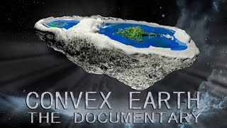
Korina Lymnioudi documents a seven-year investigation by Dakila and Ziggurats Technology Center using telescopes, lasers, and GPS across sites like Lake Titicaca and the Strait of Gibraltar. The researchers claim measurements showing water stays level and propose the Earth is convex, not spherical, driven by magnetism, density, pressure, and light rather than gravity.
Questions this video answers
Seven years.
2011.
Antennas positioned at 1 meter above water; separation distance 14 kilometers.
Distance reported 15,000 meters (15 km); receiver/whiteboard 1 meter from sea level.
Recorded images at 110 km; quoted curvature height (spherical model) 237 meters (equivalent to a 79‑floor building).
Chapters
SAM.
Throughout history, various civilizations have questioned the shape of our planet, creating hypotheses according to their level of knowledge. Even today, scientists around the world question the truthfulness of the sphericity of the Earth, because even though it's presented as a truth, there is no unquestionable scientific evidence in this reg on which science bases itself are only evidences, and evidences are not proofs. In order to bring the light of knowledge on the true shape of the Earth, researchers of Dakila and Ziggurat's Technology center joined with other scientists in an independent research that lasted seven years, seeking scientific and definitive proof to demonstrate that Earth is indeed round or has another shape. In 2011, researchers from Dakila and the Ziggurats Technological center with the objective of proving the real shape of our planet, it was needed to prepare and carry out different experiments and data collection at several locations around the planet.
Planet.
Likewise, several experts were consulted on the possibility of the Earth not being spherical.
As is known by all mankind. The Earth has a spherical shape. And as a geographer and cartographer, it is difficult for me to accept that the Earth is not a sphere. All this knowledge here, and the perception of man thinking and acting according to these rules here, he has fixed this model. It is an idea that totally contradicts the concepts we have today of the sphericity of the Earth. It's really difficult. I, as an engineer and I deal with the exact sciences. That's where we come from since childhood. With these concepts, it is difficult for us to have another vision of this reality that we have since childhood, because exclusively studying through this model, the struggle is very great. Because the amount of technological and scientific knowledge there is to ensure that these ideas are true is very great. The round Earth with mathematical formulas, all operative in aviation, aeronautics, astronautics and in satellites, all being placed with this formula. And this has been working. Water does not leave the Earth because it has a central force pulling it towards the center of the Earth, which is gravity. It makes us think that the Earth's gravity would not be the center of it. That's why I say it's a very shocking idea. So when we deal with abstract things from the past, historical things, so there are several theories with a concrete thing settled within scientific knowledge. It is difficult. And when you break break those pillars that sustain what sustains what sustains humanity are these pillars of knowledge that you have. So when you break one of such pillars, you dismantle a base that is considered to be true and scientific, where all knowledge of the Earth is based on that information. You break that paradig and it's really going to be a total unbalance for the people. I'm ready to be convinced that what I know is not worth more.
Urdan Dir and the researchers from Dakila and the Ziggurats Technological center evaluated all possibilities for the realization of the scientific experiments. In order to find proofs that determined the real shape of the Earth.
We did dozens of experiments. We will only present seven as it was enough to determine the real shape of the planet. We use the methodology of Lilarial science because the results are much more precise. Most of our research was done in the waters because it makes up 70% of the planet's surface.
The first chosen experiment was to determine the curvature of the horizon at water level.
Let's record one of the main tests on the sphericity of the Earth. And this test with the respect to the masts of the ships, the distance that it is away from the coast and the precisely to know if there is sphericity, if there is angulation in the earth, the lower the humidity in the air, the further we can see and the higher the humidity, the more distortions occur in our view. So the places to be chosen to do the tests have to be of very low humidity. The tests will prove that if the Earth is spherical, the waters will follow the curvature.
The first site chosen to start the experiments was La Goa dos Patos in Rio Grande do Sul.
We are in Lagoa dos Petos and there is a team. They are mounting a telescope with a great capacity of visualization and must follow the two boats that we will see in sequence. This image should also be registered by the cameras that are installed on the edge of the beach. We start from now on this new phase of the research. Intending to travel a distance of about 40 km over the lagoon. Trying to show people there is a straight in this lagoon. That is there is a flatness. And this is an objective today. One of the objectives that we will try to show this flatness of the waters that puts in question the issue of the curvature of the globe and the function of the ground crew is trying to perceive this displacement, to map and to generate a visual image of it.
The researchers mounted a Newtonian telescope specially designed for the experiment with a high definition camera attached to its eyepiece to register the entire process. The teams used high tech positioning equipment to ensure the accuracy of the results. This same experiment was carried out in other places. One of them was in the Strait of Gibraltar in France.
We are here in the south of France, a seaside town called Le Bagarre. We set out together with the French researchers, coordinators of an association called Project Energy Action here in France, trying to prove the veracity of this seemingly absurd theory. I had the opportunity to participate in the phase of the tests that were held in Europe. It would be the filming of a boat as far as possible from the coast. We find it very interesting, the chance to be able to touch on a controversial subject and to be part of these experiences. To demonstrate something that science does not accept today. It would be filmed through a telescope. We also used a camera attached to its lens so we could film the experiment effectively.
This experiment was also carried out in Brazil at the Tres Marias Dam in Minas Gerais. And another team carried out the same experiment on the beach of Santos on the coast of so Paulo.
There we divided the teams in two. One stayed on the shore and the other went on a boat out at sea.
We brought a Newtonian telescope. We were also using a total station. We are recording you here.
Is that so?
We're zooming in on you.
Another telescope experiment was realized at Lake Titicaca in Peru.
We are here on Amantani island on Lake Titicaca in Peru. We'll take target from this point to the Cordillera Blanca, which is the border with Peru and Bolivia. That is exactly 110km from here. If the Earth was spherical, we will.
Not be able to see at this distance. The curvature of the Earth would have a height of 237 meters, the equivalent of a building of 79 floors.
The cameras won't be able to get it, nor will we see at all with the naked eye. We will not see the other side, but with telescopes we do. One of the best points you could have in the world to really register the Earth's ferrisity is on this location.
Would the team be able to see the other shore of the lake through the telescope? Back in the experiment with the boats, the researchers observed that after some time following the boats with the naked eye, they began to disappear on the horizon. First, the hull. Soon after, the boat was no longer visible. And finally the mast goes down until it disappears completely. As the spherical Earth theory explains.
When.
The boats reached a certain distance, it was no longer possible to see them with the naked eye. So does this mean that the Earth is really spherical? Another experiment was carried out using radio waves. Teams were separated at a distance of 14 km on opposite sides of the lagoon.
Using the radio equipment. We use directional antennas at high frequency. Parabolic antennas that concentrate the radio frequency beam one directed to the other at different points.
The two antennas receive and transmit radio waves at the same time and any obstacle between them would block the communication. They were meticulously positioned and directed to establish communication. The antennas were positioned at 1 meter from the water level at a distance of 14 kilometers. At this distance, the curvature of the Earth in a spherical model would generate an obstacle with a height of 3.84 meters, the equivalent of a two story house, which would prevent the communication. Could researchers have established communication? Another performed experiment was to measure the flatness of the waters with the use of light. The researchers opted for the use of a laser beam because its beam of light propagates in a linear way and can reach long distances with minimal loss of potency. The laser experiment consisted of two teams positioned on opposite sides. One team emits a laser beam parallel to the wal toward another team in the spherical model of the Earth, it would be impossible for the laser beam to be seen on the other side, since the supposed curvature of the Earth would be an obstacle in its trajectory. However, if the Earth is not spherical and the waters don't follow its curvature, it would be possible to visualize the laser light on the other side, for there would be no obstacles in its path. For more efficient results, this experiment with a laser beam was performed at a great distance in the tens of kilometers. Because the greater the distance, the greater the curvature of the earth would be in the spherical model between the two points, which would prevent the laser beam from reaching the other side.
As we had some difficulty in getting high power equipment, we decided to design and build our own equipment with a great power that could achieve a far greater reach than the laser equipments found in the market.
The device emits several beams of light and is set to reach the programmed distance without expanding with the focus point on an object on the other side. Two points were chosen at the coast of Sao Paulo, One on the beach of Carawatatuba and another on the beach of Ilabela. The team prepared the the equipment during the afternoon to conduct the experiment at night. The devices are positioned at a height of 1 meter above the water level, directed towards the team on the opposite side.
The whiteboard or light receiver is 1 meter from sea level. The distance is 15,000 meters 15 kilometers.
With the equipment ready, it's time to start the experiment.
South 43 degrees.
This is the moment of truth. If the light is not visible on the opposite shore, it will be an indication of the sphericity of the Earth.
Down. Try to go down more. Alright. This position is good. Try to level it out for now.
There.
A little bit more. A little bit there.
Did the laser light hit the other side, which would question the theory of the spherical Earth? The team's next step was to repeat this same experiment over longer distances. To continue the research, Lake Titicaca was chosen on the border between Peru and Bolivia. One team was in the town of Juli in Peru and another on the beach in Copacabana, Bolivia.
Lake Titicaca has a width of 65 km and a length of 165 km. Other people say that the lake has spines, but it has not. It's a flat surface. It is a mirror. Lake Titicaca here in Peru. If you look, for example, 30-40km, the lake looks flat.
Will the researchers be able to prove the flatness of Lake Titicaca?
We got here on the site right on the side of the road. Down there. In the center of the display is the town of Copacabana. For me, from what we are seeing here, the theory of water flatness is very convincing. But we will seek more evidence. It needs more results. We are team two. Team number one is in a town called Huli, also on the beach of Lake Titicaca. So here we are on the same level as them there. Team number one is approximately two meters above the level of Lake Titicaca. We are here. 1 meter and 35 from the sand and about 40 centimeters from the water level. As you can see there.
The teams are in position. All equipment has been checked and the experiment begins.
That's good. Leave it there. We're pointing the laser.
The laser is then fired.
It hit it there. There, there. To our right. To our right. A little bit to the left. Right there. We will blink.
Could the laser be visible on the opposite sides, which would prove the flatness of the waters? An unprecedented experiment developed by the researchers was to measure the geodesic curvature between two buildings over a long distance. Using high precision gps.
Considering the round planet, you have to mark a point from one extreme to the other from a certain distance, precisely to prove mathematically whether the Earth is round or not. So we got two cities far away. We take two buildings, one in a city in the south and one in a city in the north. This one in the south and this one in the north. What happens if we measure this distance here at the base of the buildings? If the Earth is really spherical, when we measure buildings of the same height, when measuring the top, there has to be a difference because if the Earth is spherical, must have a superior length in the base.
To carry out the experiment of the geodesic curvature, two buildings were chosen of the same height and sea level, as far apart from each other as possible. High precision GPS measurements are done at the base and at the top of each building. According to the theory of the spherical Earth, the distance of the measurements of the bases must be different than the measurements of the top, even in a few meters. But if the measurements are equal, this would show that the Earth has no curvature. In order for the results to come out with the best possible precision, the CTZ researchers invited incra, the National Institute of Colonization and Agrarian Reform. This is one of the most respected organizations in Brazil and one of the best in the world in the area of topography. INCRA engineers and technicians met with the researchers from the CTZ and DAKILA to decide on the realization of the experiment, which would be evidence or not of the sphericity of the Earth.
Analytically, we will see if really this line here will be perpendicular in relation to this horizontal distance between the two points there. Probably in relation to the extension of this perpendicular line to that baseline, I believe it will be larger.
In the view of the INCRA technicians, the measures will be different. If this is true, it'll be one of the strongest evidences that the Earth is actually spherical. The first building chosen was at Torres beach in Rio Grande do Sul. The second building was chosen in Natal, in Rio Grande do Norte, at a distance of 3,050 km from each other, with the same altitude in relation to sea level.
This is a GPS L1 L2 signal receiver. We'll do a range reading from this point to chart the base. And from that base we'll do the vertical readings relating to our goal. And afterwards we will use another equipment, which is a total station, to make the readings of the vertical and horizontal angles.
To what conclusion did INCRA surveyors arrive in relation to the curvature of the Earth? To carry out the last experiments, the researchers invited the consulted specialists at the start of the research to accompany and participate in the tests. Paolo Cesar Parra, civil engineer and geotechnical engineer and a specialist in dam projects.
It's difficult as an engineer and I deal with the exact sciences. We carry this from childhood. With these concepts. It is difficult to have another insight of this reality that we have since childhood.
Mauro Dias, geographer and cartographer, specializing in aero photogrammetry.
As is known by all mankind, the Earth has a spherical shape. And for me, as a geographer and cartographer it is difficult to accept that the earth would not be a sphere.
In Minas Gerais, Brazil, the researchers performed the experiment of the geodesic curvature in the waters. Accompanied by the guests.
We are here in the reservoir of the Tray Marais hydroelectric plants. We have the complete team. We are going to start the verification of the horizontality of the water here in the reservoir. It is a large reservoir. We are in a stretch that will give us up to 18 km. The test aims, in other words, the following. The dam has a certain level. If the leveled GPS measures give the same, this means that there is no curvature of the element. If the measurements are different, then this means that there really exists an earth curvature in relation to sea level. We are with a geodetic GPS already installed here. The surveyor is now going to another point, taking another point to start a triangulation, thus verifying through this process, verifying the horizontality of the wall. This first point in the elevation in relation to the sea level is of 556 meters altitude. So we're going to hit more than three points. This equipment, the geodetic GPS, we have two devices, one installed here to get this point and the other goes to the other points. We get three points all at the water level and check the level of that point. The accuracy of this equipment for this distance, a distance of 10-20 km is around a few centimeters.
Engineer Paolo Cesar Parra supervised the entire experiment thoroughly.
Okay, we'll pass the coordinates now. We are now here at point B, seven and a half kilometers from the starting point. And there we had 556 meters altitude, altitude on the lagoon level.
What will be the results of the three points measured by the researchers? Will they prove the flatness of the waters or the sphericity of the Earth? The researchers returned to the Tres Marias dam together with the guests to carry out the experiment with a laser.
We are here at the Tre Marais dam, trying to explain various phenomena. Since we have an open mind, we have to do an investigation, a research with several experiences to explain these variables. We are going to point B, 18 kilometers from point A, where the first group is. We will perform the laser test at this distance, just to check the Earth's curvature. We are here in the night experiment at the reservoir of the Tremere Damp. You can see the boats that brought us here in the lake. We are on the shore of the lake. The positioning of the laser is here by the lake, a meter or so from the water level, Whereas the other sector that is also in the same Position exactly one and a half meters from the water level of the reservoir. We are in good climate. There is no wind, which greatly impairs water evaporation. That impairs visualization. So the weather is relatively cold, so there is little evaporation as well. So very favorable for our job.
Equipment position the experiment starts. All experiments performed. The moment of truth has come. To what conclusion did the researchers arrive in relation to the experiments with ships? The researchers realized that after some time looking at the boats with the naked eye, they began to disappear on the horizon. First the hull, then it was no longer possible to see the boat. And finally the mast lowered until it disappeared completely. As the spherical Earth theory explains lines.
Watching the boats with the naked eye. The initial impression is that they were disappearing as if descending behind the horizon line.
When the boats reached a certain distance, it was no longer possible to see them with the naked eye.
For a moment we were a little frustrated to be in the place to prove the sphericity of the air. As with a naked eye, we could easily come to that conclusion.
Does this mean that the Earth is even spherical? With the loss of eye contact, it's time for the team to use optical instruments. Instruments in an attempt to still see the boats. If the boats are still visible through the equipment, it's proof that they have not traveled below the horizon. And to everyone's surprise, the boats were still there visible. The researchers realized that the images of the equipment presented some optical phenomena.
During the experiments, we perceived the formation of optical phenomena that we initially attribute to the Fata Morgana effect, which is the refraction of light in the layers of the atmosphere.
This phenomenon is very common in deserts. There are the famous mirages. The mirage is the Faramorgana effect.
A formation of images occurs. Virtual images, images that are not real at specific points. Through the observations and the collected data during the experiment, we were able to determine that the optical phenomena had a certain pattern. After some distance, we began to have a visual loss, which increased to a distance where our direct vision was compromised.
When we lost the view with the naked eye, we used optical equipments. In this case the telescope and the boat was still there. Only we realized that it was an inverted image, a mirror image.
We realized that the real image was practically disappearing. And we had the formation of an inverted virtual image, an inverted mirror image, when the angle of incidence of light on the surface, in this case water, tended to zero. This occurs because of the mirroring effect, where the reflection of the image occurs.
This phenomenon we recorded for the first time In Lagos dos Batos in Rio Grande. During the research, we sensed that each state of experiments was complementing the other.
With the unfolding of the experiments, we perceived that the optical instruments amplified the visual phenomena.
In the case of the use of Newtonian telescopes, in which its optics, which is of extreme precision, amplifies thousands of times, the capacity of the human eye could see things that that we did not see.
This led to amplifying the visual phenomena we observed. During the execution of the experiments, we deepened the studies and we could determine that most optical phenomena, which are attributed to the refraction of light, called fatamugana effect, actually occurs by reflection. It is a reflective process of light on a surface with an angle tending to zero. With the observations we make, we have been able to promote a new physical theory that explains the fata morgana effect from a new optic, a new point of view. We call it the theory of optics applied to visual phenomena.
This conclusion helped us explain three phenomena that we know are illusions. Why the boat seems to disappear going down the horizon line. Why first fades the hull and then the boat. And why, when an observer is taller, can't see farther.
We conclude then that boats don't descend at the horizon and that we lose the ability to observe them, to see them in function of an optical phenomenon.
With this experiment, one of the main arguments of the spherical Earth theory, that boats disappear on the horizon due to the curvature, is totally refuted. This is the first proof of the flatness of the waters. Among the long distance viewing experiments performed with telescopes, the one with the greatest impact was at Lake Titicaca, where the team tried to record images at 110km. The site was chosen due to the low humidity of the air at certain times of the year, which is a prime factor for the result.
We are talking here with a boatman of the boat May3. He is an inhabitant of the island of the Uros. He is from the Aymara civilization. Is it possible to see the other side of the margin or is this not possible?
Yes, it is possible always. Because our lake, we think, is like a table.
How many kilometers do you see?
I can see almost 60 or 50 kilometers.
Normal.
No binoculars, nothing?
Yes, normal without binoculars.
With the telescope, the team was able to record images at a distance of more than 100km, which would be impossible in the theory of a spherical Earth, as the curvature would have a height of 237 meters equivalent, equivalent to a 79 story building. This experiment is yet another proof that the Earth cannot be a sphere and the Result of the experiment with radio waves, the researchers used directional parabolic antennas, where in the spherical Earth Earth model, communication would be impossible, as the minimum obstacle would preclude this, since at the distance of the experiment, the curvature of the Earth would generate an obstacle of 3.84 meters in height.
We have connected.
Got it. We're with connection here. It's responding. The machine is responding. Returning. I'm having connection to your computer there. We have a ping back here. The connection is established. The signal that we wanted, we could scan there and manage to find it. Here communication was established. It has been proven that at this distance we have been able to establish communication. We know that any interference in the way would mean not achieve communication. The test with radio waves was, let's say, unusual, because at the time we set our antennas and with the design of the spherical Earth, we started to work with almost complete obstruction of the Fresnel zone, which is the zone, the region where the propagation of radio waves occurs, which would make communication impossible between the two points. However, with the idea of leveled waters, we would already have approximately 50% of the Fresnel zone unobstructed, which could allow communication between the two points, even if precarious. And how it happened.
This is yet another proof of the flatness of the waters refuting the spherical model of the Earth. What about the geodetic curvature experiment performed on the buildings? Measurements were done of the bases and tops of two buildings, One in Torres, Rio Grande do Sul and another in Natal, Rio Grande do Norman. 3,050 km apart from each other. According to the theory of the spherical Earth, the distance of the measurements of the bases must be different than the measurements of the top, even in a few meters. But if the measurements are equal, this would show that the Earth has no curvature. Remembering the opinion of the INCRA engineers before the experiment.
Probably there will be in relation to the extension of this line perpendicular to the baseline. I believe it will be longer.
Thinking of the Earth as a globe, the initial expectation was that the measurements were different.
But when the results arrived, the base and the top measurements were the same, showing that the two buildings are leveled upright. And here, the opening angle, where we read the point here, the base of the building and its height. As we do this calculation Here, on this plane we will always find this distance. Here, on this plane we will always find this distance. Here.
The identical measurements of the distance between the bases and the tops prove that between the two buildings there is no curvature, proving that the Earth has no spherical shape. In the experiment of the Geodesic curvature in the water. Three points were obtained with a high precision GPS on the Tres Marias dam in Minas Gerais, whose extension exceeds 70,000 meters.
This first point, the elevation in relation to sea level is at 556 meters altitude.
The second point also presented the same result, 556 meters of altitude. If the third point were different, the water would be following the curvature of the Earth. If the measurements are the same, it will be proven that there is no curvature, but indeed exceed flatness in the waters. And the measure of the third point surprised the researchers.
Here we also obtained the same measure, 556 meters at the level of the lagoon. We analyze the data collected by the equipment and all points show the same result, the same altitude, thus showing that the water in the damage remains level. These data overthrow the theory of sphericity, because according to this theory, the waters should follow the curvature of the Earth only in a curve there is no level.
The three altitude measurements were identical, proving the level leveling of the water, proving that the Earth has no spherical shape. And what is the result of the laser experiments? Did the team see the laser light on the other side?
We are here in the nocturnal expansion in the Tre Marais reservoir. We are on the shore of the lake. The positioning of the laser is here by the lake, a meter or so from the water level where the second laser is. It is also in the same position, exactly one and a half meters from the water level of the reservoir. Sam, as you can see, the two devices are communicating at a distance of 18 kilometers. We have successfully done an experiment today and we are proving that the Earth does not have the format that science believes it has. So, as we are at 18km, there is no water level difference from here to the other crew that is 18 kilometers away. It's exactly, exactly level. On this distance there should be a visual obstruction by virtue of the curvature of approximately 6 meters. And we were able to get the signal from a laser cannon from the other shore. At 18 km on a little more than a meter from the level of the lagoon. This is the ultimate test. There is no curvature.
To guarantee the accuracy of the result, the researchers decided to conduct a surprise experiment. With the team still in place, a beam of light was lit that should be visible at 18 km on the side where the team of surveyors was, who used a total station. At that distance, the earth curvature would have risen 6.3 meters, equivalent to a three story building.
Do you see? Yes. Down. Can you see? Yes. Down. Can you see? Can you see? Yes. I am at water level. At water level. So. Okay, I will write down and you read the angles and the coordinates there. You take that height where it was blinking at the water level. It's on water level. But on how many meters high? Zero. It's blinking in the water, Right? It's in the water. 10 cm from the water. Okay, so I'm going to write down the angle here. Wait, we'll see. Listen.
During the experiment, laser was added without warning the topographers.
Do you see any other light? I see it. I did see. I saw a laser. Now. He did see. He saw the laser. It die off. Off. Lower the laser. All right. Wait a minute. Wilson. Now I saw the laser. Did you see the laser? Not now. I saw. I saw the laser there. Lower a little bit. Do you see the light still? I see the laser there. Do you see the light still? I see the laser there. That's good. Just a minute. Uran, dear, what's going on here? Dude, it's over. It's done at the water level. It was there at 2 meters and something. Well, now it's ruined now. So nothing. Anything else needs to be done. We can go, right? We are with a telescope. We have a precision level, an optical level with a topographer. We have a total station which is a topography equipment that is used for measurements and level determination. So we are here, 18 km marked with a GPS on an island on a point of Lagoa, 18 km from the topography equipment there with the crew. So we put a light beam and then the topography equipment can see the light at water level. The light placed on the water level can be visualized by the topography equipment that is positioned. 18 kilometers.
And the engineer remained perplexed by the outcome of the experiment.
We can go, right?
This is unquestionable proof that the Earth is not a sphere, for the waters are level. And the result of the laser experiment carried out at Lake Titicaca.
It is hitting the hill. On the hill. Look over there. It is hitting a tree above us. Here. Look at this. Look at this. Are you pointing yours too? We're seeing. We see yours. It's just too high. It's very high. Look there. You saw. You saw in this direction. It made it there. It appeared again. Go there. It made it again. That's it. Stop there. More to the left. Stop. Stop there. Stop. Through light. Here it is illuminating. Here it is moving there too. Here it is illuminating. We have already done the first tests and the laser of team number one has already appeared here in the treetops that are on our side. Then the trees here have about two meters, two and a half meters. So there we start directly discarding the hypothesis of the Earth being spherical, because we are 35km away from team number one in a straight line from end to end on the lake, on Lake Lavender. And according to the theory of spherical Earth, that 35 kilometers should give at least 23 meters and 98 centimeters of Earth's curvature. So a light communication would be impossible, as we just have had. The result was positive. Here we could see the laser on the other team there, and they could see us too, more than 30 kilometers. So there was no curvature. Total flatness. The research here was excellent. Here, with this laser visibility test, team two and team one, at 35km, there really was an unusual commutation at a distance of 35 kilometers and that there should be an arc of approximately 20, 24 meters. Neither group one or two should be seeing the lights.
But how could one project a laser beam from one shore to another 35km away, if, in the theory of the spherical Earth, there would be a curvature of 24 meters in height, and the laser equipment was positioned at 2 meters high, parallel to the water level.
Lake Titicaca has a width of 65 km and a length of 165 km. Other people say that the lake has spines, but it has not. It's a flat surface. It is a mirror. Lake Titicaca here in Peru, if you look, for example, 30 to 40 kilometers, the lake looks flat.
This is yet another unquestionable proof of the flatness of the waters, which definitively overturns the theory of the sphericity of the Earth. Gravity is the theory that science considers as the main factor to keep everything in harmony on a spherical planet.
Water does not come off the Earth because it has a central force pulling towards the center of the Earth, which is gravity. It does not exist. According to the experiments, gravity does not exist exist from the fundamentals of nature. Plum and level overthrow the theory of gravity.
The plum is an instrument used to gauge verticality. It is of fundamental use in civil construction to guarantee the verticality of the buildings.
This tool we use to get the wall in the right plumb, because it cannot be out of plumb, because the wall can fall. So this plum is used for this, to keep it right and steady on the plum. Neither there nor here. Right there in the plum.
The use of the plum is the only way to ensure that construction is being erected in vertical alignment. The level is an instrument used to measure inclinations and is fundamental to ensure horizontality. It's used extensively in the areas of civil construction, surveying, photography and astronomy, among others. The most common model is the bubble.
Any construction has to have level and plumb. Because if it gets out of plumb and level, it can fall. That house can fall. This equipment is a system of communicating vessels and is used in the laboratory to demonstrate the behavior of water level leveling. In whatever position we place the system, the water that is inside will always search its level. This behavior of the leveling can be proven not only in laboratory, but we can prove this in field experiments in ponds, lakes and the seas.
This is a micro version of what we find all over the planet level.
By verifying that the water remains level both in micro and macro environments. It's also verified that gravity does not exist. Because if this force existed, the waters would follow the curvature of the planet. But then what forces act to maintain harmony on a non spherical planet? Researchers from DOCUMENT and the Ziggurats Technology center have concluded that among the fundamentals of nature, the four main forces that acting together hold us firm to the ground are magnetism, density, pressure and light. The researchers called this set of forces mdpl. Among the four MDPL forces, magnetism, in contrast to what science considers is one of the strongest forces that act on Earth. It's the main force that keeps everything in balance, from the bonds of an atom to the Earth's magnetic field. One way to study the performance of the magnetic field of bodies is to perform a simple experiment where we transform into mechanical waves the kinetic energy produced by the magnetic field in an object. This can be reproduced by throwing an object into the water. Whatever the shape shape of the object, the waves produced will always be circular as they are modulated by the Earth's magnetic field. Note that regardless of the shape of the object, the waves produced in the water will always have circular patterns. This happens because the waves in the water are being modulated by the influence of the Earth's magnetic field.
It does not exist. According to these experiments, gravity does not exist. But going even further to prove or to sustain the sphericity of the Earth without people, falling buildings, animals, constructions, the water waters. Especially going off, flying out into space. To justify people stay fixed on the Earth's surface Without being thrown off by the spin of the planet. They created a magical force called gravity. But this magical force is torn down by the plumb and level. Because the physical behavior of water is to seek leveling. Or is physics wrong too? If the physical behavior of waters, according to our physics, is to seek leveling. How will it fix itself to a ball on a sphere without flying off space outside, without seeking its level? So these are two contradictory things. And even more to justify the seasons, they decided to tilt a ball 23 degrees. There is no way to tilt a ball. A sphere, Impossible. Let's see. How could a planet or a ball, a sphere, be tilted and waters not get off? But it has the imaginary axis, the imaginary axis. Even if there were a physical axis, what would be inclined is the axis axis and not the sphere. Any position that places the sphere, there is no way to tilt it. But the axis, an imaginary axis. That is an illusion. If it is imaginary, it is an illusion. So it's another contradiction. They created this axis that does not exist to justify the seasons in a sphere. In a globular model, that's not possible. Well, in a sphere we certainly do not live, because the physical behavior of the waters does not match the reality of the facts. And through the plumb and level, this theory is totally overthrown, extinct. What would Earth be like? The first sight, the Earth is absolutely flat. But this plane goes where? Is it square? Is it a circle?
Looking from above, the impression you have is that the Earth is flat.
Scientists of the past had only the eyes to observe and the reasoning to create possibilities. The older ancients used a model of the flat Earth, square Earth, triangular and geode. Later, other scientists defined the most suitable model would be spherical geoid, putting a stake at one point and another at 800km. But he did not take into account the altitude, had no gps, had nothing. So there is really no way how these ideas, with the technology of today, can be considered. Because everything we have today overthrows these theories. Any experiment today can prove that the globe doesn't exist. It's impossible.
But then how can we determine the real shape of the planet? The CTS researchers collected information on the movement of the sun, the Moon and the stars in different parts of the planet. In this research, which lasted several years, images were recorded by cameras installed in all these places during the day and at night.
We found several differences in the trajectory of the Sun. One of the most significant was between Australia and Argentina, which are in the same tropic.
While in Argentina the Sun moves at about 180 degrees, in Australia it moves almost 270 degrees, which would be impossible in a spherical Earth model. Another significant example was in the Canary Islands, where a time lapse of the stars showed a circular movement incompatible with the spherical model of the Earth.
This movement would only be justified if the place were near the poles in a spherical Earth, which is not the case.
We do not understand that with so many discrepancies we have found, and with the technology available today, no researcher, no scientist, no astronomer, no space agency in the world has perceived any of this.
The discrepancy in the comparison of the trajectory of the sun and the stars between the different points, when related to its geographical position in the current world map, allowed to generate a new geographical model of the continents. In this model, the continents present a size and position somewhat different from the current world map, having the North Pole to the center center and the other continents around it. This new model was called Convex Earth.
We call it Convex Earth because the continents have a convex relief starting at the sea level, rising to the highest point and returning to the sea level.
According to altimetric analyses, all the continents present a convexity in their relief. According to the investigations in the convex Earth, the magnetic field has the following layout, with the magnetic north pole located in approximately the middle of the planet. Due to the magnetic field, anywhere on the surface of the planet, a compass will always point to the north pole, as the south pole represents its entire border. Border. The magnetic field is also responsible for modeling the shape of our atmosphere, which takes the form of a plane convex lens. In this way, the atmosphere formed by several gases and water in gaseous state, takes on the characteristic of a gigantic magnifying glass with a high degree of refraction responsible for day and night. The following experiment simulates the behavior of day and night. We use a flat convex lens, a model of the continents, and an external light source simulating the sun. The result is a model of day and night in the corresponding time zones.
What helped us a lot in this research was the information we collected at at our own astronomical observatory of the Sigurat Technology Center.
In this manner, the researchers concluded that the Earth is neither spherical nor geoid, but rather convex on the continents and flat in the waters. In this concept, the Earth is like a huge misshapen asteroid floating in space, surrounded by a very high layer of ice all along its edge. And how do satellites work in the convex Earth?
The magnetic field of our planet is primarily responsible for keeping the satellites in orbit. Briefly, there are two types of satellites, the geostationary and the orbitals. The geostationary ones are apparently fixed in a position over the surface of the planet. I say apparently because its orbit has to be corrected periodically. Orbital satellites are in orbit over the surface of the planet. They have different routes and Altitudes according to each application.
And why do Earth photos taken from space show a curvature?
We launched several atmospheric probes and we noticed that the images recorded in the upper layers of the atmosphere begin to show a certain color curve after a certain height. This occurs in the high layers of the atmosphere above the stratosphere. That is, in an airplane window. You would not notice this curvature. We observed that this effect does not occur due to the supposed curvature of the planet, but due to two factors. The first, due to the large, flat convex lens of our atmosphere. And the second, according to the theory of curvature of light proposed by Albert Einstein, experimentally proven in 1919.
According to Albert Einstein's theory, the mass of a large object can create a curvature in space time around it, able to bend the path of a beam of light in its vicinity. This phenomenon was called a gravitational lens.
A proven physical law has to work in both macro and micro environments. In this way, the gravitational lenses were proved through astronomical observations of objects of great mass. Then we conclude that the curvature of light in the high layers of the atmosphere also occurs as a function of the mass of the planet itself and of its magnetic field. We fabricate in our laboratory a physical gravitational lens capable of correcting the curvature of light in the upper layers of the atmosphere. In the experiments, we reach the degree of 0.22 for the total correction. This can also be proved through computational simulation. This law also applies to other bodies, such as the moon and the planets we know from ourselves solar system. They apparently are spherical when viewed through telescopes. But we do not know their real format. That is not always what we see represents reality.
To facilitate the understanding and comprehending of the new model of the planet, the researchers built scale models of both the spherical and convex model models.
We made a scale model on geographic scale, just so that people have better clarity. A visualization that much more facilitates the understanding of what Earth really is. According to the report, according to all the research that has been carried out by our researchers, we have come to the conclusion of this format of the Earth.
We have been conditioned since childhood to accept that our planet has this round format. But if I say that there doesn't even exist a real image of our entire planet. To date, none of the space agencies of this institution have managed to register an entire image of our planet. With all the technology and advances of science, this image does not yet exist. So how are they made? All those beautiful photographs we see on the Internet, on posters, in films? This is very simple. Local images are taken, passed to a computer program. So they are Manipulated, forged into a format we know today. This beautiful image, this photograph of the blue planet that we know is nothing more than propaganda. Just like many others we see daily, according to the research done, the calculations and measurements taken from our planet. This is not its format. The real format of our world is this. It is convex in its continents and leveled in the waters.
I was hired to build a model of the globe and the convex Earth. I never thought that the Earth would have a different shape. I always believed that the Earth was a globe, an entire round sphere, all tidy, perfect. After the completion of the construction, I see the importance that you cannot live on a planet without level and without. Without plum. I can only conclude that our planet is convex.
Just as the image of our planet is manipulated. The size and shapes of the continents also go through the same type of problem. They are very different from what we have custom to see on the world maps. Countries like Brazil or Russia, they gain land extensions much larger than our informed. Which would explain so many miscalculations in land demarcations. Now, how do we come to this conclusion? It is very simple. If we take into account all the numerical data, all the measurements, the distances in the tropics, the meridians, the coasts, the extensions of land, and apply it on paper, taking all the details into consideration. All these continents suffer great distortions. Without exception, none of them stay out of it. Some, as I said, Brazil and Russia suffer an increase in land. And others, like the United States, suffer a reduction.
During the surveys, strong evidence emerged of the existence of a new continent.
And what about the new continent that is far beyond our borders? We call it the Greater North. For those who are here in South America, heading north. So we call it the Greater North. With the help of north Navy and Air Force officers, We were able to trace logistics towards the Greater north, towards Siberia, towards Russia. There were several factors that led us to perceive the existence of the new continent. With the launch of several atmospheric probes equipped with cameras and other equipment, we were able to identify a territorial mass, but is not included in our maps. It is not part of our current cartography. And analyzing the images mainly of the probes, we realized that it is part of a new continent behind an immense layer of ice. After seeing these images, we directed our expeditions to the limits where a human human being or the autonomy of a ship were able to get. And we collected many evidences of dust on the ice, pollen and other evidences that really brought us to the certainty of the evidence of this new continent. So there is no doubt that There really is a new continent of new lands, beyond the great mass of ice that impedes us to overcome. The research continues. We have not yet put our feet in this place. We only had observations from a distance. But we intend to get to this place as soon as possible.
A study performed by the CTZ on the Sun, Moon and stars brought many evidence regarding the positioning of the continents and the shape of the Earth. On the other hand, many questions have arisen.
Defining the real shape of the Earth was no easy task. But during research, we realized that the most difficult was yet to come. We realized that the sun brings forth many anomalies. Its trajectory, the sunrise and sunset. We installed equipment in several countries, in different parts of the planet. And all these equipments recorded different situations. Anomalies that made us think. We think about trajectory and about what we learned about the Sun. Its size, its distance to Earth does not match what we learn. It does not coincide the realities of the facts. It is an anomalous trajectory, totally different. It implies strong evidence that the sun is not a star. The way we learn, it seems that it is much closer to the Earth than we think. Moreover, its trajectory is totally different. In several points in several continents. The trajectory does not coincide with the reality. Mainly in Australia and the Canary Islands, for example. In Australia, it rises and sets almost in the same place. In Antarctica, it's totally different. Someone of the year, it stays at a fixed point, practically without moving to either side. By observing all these anomalies around the world, we realize that there is a possibility that the solar system is totally different from what we have learned. It might not even exist. During these observations on the sun, we noticed that the Moon has also a different behavior. Its trajectory is very similar to that of the Sun. And its size is also completely atypical. The impression we have of the Moon is that its size varies greatly.
Or.
Its distance from the Earth varies greatly. During its 28 day trajectory, there are days that it is closer, another, more distant. It is as if it's elliptic. We're totally within a different system of space out there, as if it were another reality. And because of the various anomalies observed in the sun, the Moon and the stars, we determined that the Earth doesn't spin. It does not have the spinning motion. We can consider a gentle wobble or a gentle tilt, but sure, the land does not spin. It is motionless. The mystery surrounding the sun is so complex that we will continue our studies. We will continue to research, because it is in our interest to unravel the mystery that surrounds the our star. And what changes in our lives. Knowing the real model of the Earth changes everything. Mainly in the academic system. Schools will have to redo all of their programming from their school curriculum. Geography, astronomy, mathematics, physics. Everything changes. Everything we learn the whole context, especially with regard to the model. Cartography, air navigation, maritime fuel economy, military strategies, meteorology, climate issues. All of that changes. Everything we learned was mistaken. Now this new reality brings us the light of knowledge. A new vision of our world, A new perception of all we have learned. And the transformation in our life, of our cultural affairs. The perception of the world of knowledge. All pillars of wisdom. There is an immense transformation for all people, without exception. So surely a change for the better. But what changes most is the search for the truth. That is what motivated us to carry out all this research. The thirst to know, the thirst for knowledge.
And what about the spirit specialists Mauro Diaz and Paolo Parra, who accompanied the experiments.
I have always worked with the concept that the Earth is spherical. And my colleagues and all cartography is based on the sparicity of the Earth. A problem even of reasoning. Because I worked so many years in a belief. And I will accept a new belief. Variables that had to be explained. As long as I did not have this explanation. I remained with a very big doubt that tormented me and even made me lose sleep at night. I kept thinking about it. But on this trip we did hear on the Tres Marais dam. We did a very important test. That is the projection of a laser at a distance of approximately 18 kilometers. And it is known in cartography and by the conception of the sphericity of the Earth. That we cannot see a thing beyond 10 kilometers. So we witnessed this experience with all success. It was done at night. The laser beam projected parallel to the water mirror. The test resulted perfect and satisfactory. And we made the greatest effort. Using as much as we had in our technology to take do this test. We bought a laser beam, we brought theodolites, we used communication, radios. So I declare concluded the basic part of this research. And I feel it is a moment of glory for us. So to finish. I know there will be a series of confrontations, doubts among other technicians. But we are convinced to get them also to do research. I think this is a very big paradigm shift for Earth science. I, as an engineer and all the studies I did to train me and specialize in me. I always considered the Earth as a spherical shape. So I had these preconceptions. But for us to start when we began doing the tests. And until so now I Deleted the prejudices that I had from my head, trying to imagine myself without any knowledge of the Earth, to verify whether it is spherical or not. It is clear without a doubt that the Earth in the Lakes region is flat. There was no difference of level at all. So I know it's difficult even for you to have the courage to talk about this issue here. Many professionals have refused to talk about it. Out of fear of having their career damaged, their image damaged, for contradicting a theory that has been there for 2000 years and which has never been proven in practice. In the case of the Earth's sphericity, they are thus only theories in relation to exact science. What advice would you give to the researchers, to the people who occupy the same chair as you? The important thing is to eliminate these preconceptions. Because those who understand these three forces well, magnetism, density and pressure, may have a very great technological advance. Develop other concepts of transport of energy. I think those who understand from this new knowledge try to deeply understand. They will have a very great gain in technology. We humans of the Earth, we will have a very great gain of technology. I have learned one thing. We have to have an open mind to discuss any theory, even if it seems absurd. At first I had this difficulty of understanding this revelation. I spent months working on this. We are coming to the end and all the report, all this will be archived, made available on the Internet. For anyone who wants to repeat the tests. We will include all the devices that were used, all technologies, all coordinates. We are here at the Tres Marais dam in Minas Gerais. And all this will be available to all of you. So that everyone can repeat the tests at home, if they want. With this, we hope that our contribution to science and to the people. So that goes government, to the Air Force, not only Brazilian, but to all countries, including so that all people can have a different vision from those 2,000 years that we had this spherical Earth theory. And now I hope you draw your own conclusions, Sam.
More from Korina







Κβαντική Ύπνωση & Ψυχολογία: Τι Αποκάλυψε το Υποσυνείδητο σε 3 Αληθινές Ιστορίες;