The video presents a 24‑hour regional weather forecast for western and central Canada, delivered by meteorologists Gary Ryan and Mark Frisky. It covers current and near‑term conditions across British Columbia, Alberta, Saskatchewan, Manitoba, Ontario, the Yukon and Whitehorse. The broadcast highlights severe thunderstorms and hail in the Edmonton, Saskatchewan and Alberta areas, issuing cautionary warnings. It notes a high‑pressure system bringing clear skies to southern British Columbia, while low‑pressure systems generate cloud cover and rain along the coast. Detailed temperature ranges are given for overnight lows and daytime highs across multiple cities, including Victoria, Vancouver, Prince Rupert, Prince George, Edmonton, Regina, Brandon, Winnipeg and Whitehorse. The segment also mentions fog in the Sioux State marine region and drizzle in North Bay Sudbury. The tone is informational with repeated emphasis on safety during severe weather events.
Chapters
Network a regional forecast for the next 24 hours, including satellite and radar.
Hello there. Gary Ryan with you and also Mark Frisky with me this evening. And we have been following a lot of weathers and watches across the nation. A lot of stuff showing up on the radar tonight.
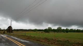
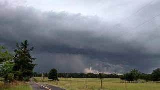
Most of it seems to be out into the Edmonton area in Saskatchewan and parts of Alberta. We do have some severe thunderstorms developing in those areas. We actually had some hail also in some of those storms down into the southern portion of Saskatchewan.
Yes, they could have gone golfing with many of those situations with golf balls rise hail into many, many regions and of course in severe thunderstorm activity that.
Is always a possibility of recurring.
Once again, we have some conditions for you this evening to pass along. We've got considerable an authority condition into the North Bay Sudbury area where they're also having some drizzle and the Sioux State marine region is having some foggy conditions into that area and some thunderstorms and rain showers in through Regina, Saskatchewan. And Mark will highlight that and others.
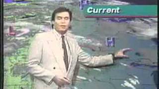
Near regional as well. Let's start out with what we have developing on the B.C. coast. We have a high which is quickly moving into the southern portion of British Columbia. That's keeping skies nice and clear. But we also have a couple of lows, one off the coast right about here and another one just moving into Alberta which has given some clouds at shavers in northern section. And you can see that there's some.
Clouds still in the 12th tonight.
Victoria and Vancouver partly cloudy. You will get partly cloudy conditions for Kamala George. Their overnight low dropping down to about 10 degrees. Some rain to Prince Rupert and an overnight low of 9 degrees. Now as far as tomorrow goes, daytime eyes a little bit on the cool side with cloudy conditions continuing in Victoria. Vancouver low size reaching 19 degrees. Thunder showers on the interior Kabaloosa colon of their daytime highs, 24 degrees. Prince George thunder showers, 18, Prince Rupert rain and 15 degrees. Now as far as your current situation goes for the prairie provinces, there is a high which is moving out of Manitoba. It's going to continue to move into the western part of Ontario which will start to clear out the skies. But here is where the Thunder cells are, 1, 2 big, huge thunder cells and some strong thunderstorm activity inside of those. And we also have some thunderstorms just around the Alberta area outside of Edmonton and some thunder showers. Right now in around the Edmonton area there's a thunderstorm. It's actually really probably a little bit closer to the St. Albert area. Saskatchewan, southeastern portion of Saskatchewan including the city of Regina, still continuing with a severe thunderstorm warning. There you can see that thunderstorm. Actually, it's a little bit too far south to be really in the St. Albert area, but it is moving into the Edmonton area and up into the northern portions. We do have some thunderstorms developing in those areas down into Regina, mainly rain at the moment, but south of that, you can see some thunderstorms developing in those areas. Once again, there are some severe thunderstorm warnings continuing for the southern portion of Saskatchewan. Do take caution. There has been hail besides the golf ball spotted in some of these areas and along with that, strong winds, intense lightning. It's very short time, but when it does happen, it can be quite violent. Later on, most of Saskatchewan, Alberta and moving into Manitoba will be clearing out those Summertime lows about 14 to 15 degrees. You still could get some ongoing thunder showers developing in Edmonton simply because of the low in the cold front moving through that area very slowly tomorrow. Clouds in Edmonton, daytime highs about 25 to 27 degrees. Thundershowers developing in Regina. And one more time for Brandon and Winnipeg, highs of 28 degrees.
Weather patterns should change little over the next few days. In central and northern Yukon, conditions will remain sunny and warm with highs well into the 20s. While further south, a weakening low pressure system will keep things cloudy with showers and the chance of thundershowers.
Forecast for Whitehorse Wednesday, cloudy, scattered showers.
And thundershowers in the afternoon. High 21, overnight low of 9 degrees.
And then on Thursday afternoon, clouds, scattered showers and thundershowers. High 21, low of 8.