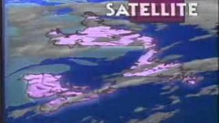
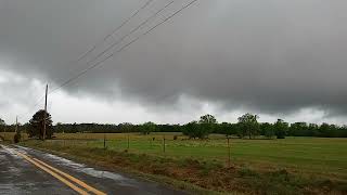
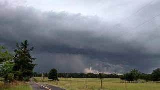
A 12-hour satellite forecast for Canada in July 1990 covering jet stream patterns, low-pressure systems, and regional conditions. Clear skies expected over Atlantic provinces, showers in Quebec and southern Ontario, scattered thunderstorms in Alberta, and mixed conditions in British Columbia.
Chapters
You're watching the Weather Network. Stay tuned for an exclusive satellite forecast covering the next 12 hours from Canada's Weather Network. On our satellite shot of the past six hours, we can see the skies will remain clear across the Atlantic region tonight. In Quebec, a low pressure system will bring cloudy skies and showers. Southern Ontario can expect similar conditions with a chance of a few thunder showers. The eastern prairies will remain mainly clear, while Alberta could see a few thunder showers. In British Columbia, expect showers in the coastal region, but clear skies in the southern interior. The jet stream flows through southern British Columbia, gradually climbing to the northeast through the Prairies and then curves back down through Ontario and Quebec out into the Atlantic over the Maritimes and Newfoundland as well. This will keep an unstable air mass in the extreme west and carry another storm system into southern Ontario and Quebec. After a day of sunshine across all of Atlantic Canada, the evening will bring clear skies and mild temperatures. Winds will breeze from the southwest over the area. St. John's clear tonight, a low of 10 degrees. Fredericton, clear, a low of 14. And Halifax skies will remain clear. A low of near 14 degrees in Charlottetown will also be enjoying some clear skies. The low in Charlottetown will be near 15 degrees. A low pressure system moving in from northern Ontario will bring clouds and showers to most of the southern half of Quebec by tonight. Temperatures will stay mild with warm southwesterly winds across the area. In Montreal, cloudy, some scattered showers, a low near 15. Quebec City, cloudy, scattered showers and a low of 14. The Chicoutimie region looking at showers, clouds, chance of a thunderstorm and the temperature tonight will be around 11 degrees. A frontal system in northern Ontario will be moving into Quebec tonight, clearing the sky. A trailing front will drag through southern Ontario tonight, producing showers and a few thunderstorms. In Toronto, clouds, some scattered showers, possibly some thunderstorms, a low of 16 degrees. Ottawa, Cloudy with scattered showers, a low of 15. In Sudbury, skies will be clearing. Look for a low of around 8 degrees. Thunder Bay, look for a low of about 8 as well. An area of high pressure sits over the eastern sections of the prairies, keeping them mainly clear tonight. But to the west, the storm system in southern Alberta will be producing clouds, showers and some thunderstorm activity as well. Winnipeg, variable cloudiness, chance of some thunder showers, a low of 14. Regina and Saskatoon, a few clouds below around the 15 degree mark for Calgary, a few clouds below near 12. Edmonton, thunder showers then clearing out. Look for a low of 14. A storm system to the north of British Columbia will produce some clouds and some showers in northern sections of the Province and another storm system in the Pacific is spreading clouds to most of the coastal region, but southern inland sections will remain generally clear and mild. Vancouver and Victoria cloudy with clear periods. The low will be near 12 degrees.