A severe weather system moved from Lake Erie inland across western New York on August 29, 1990, producing tornado-like damage. Families in Springville, Orchard Park, and Hamburg reported funnel clouds, barns torn from foundations, and livestock loss. Thousands lost power across Chautauqua and Erie counties.
Chapters
Foreign you're watching WGRZ TV 2, Buffalo, New York. Now from your 24 hour news station.
This is Channel 2 News.
Nightside.
You could see a trouble brewing over Lake Erie and it was moving this way. And once it hit the shoreline and moved inland, a terrible storm leaving destruction in its path. Good evening. I'm Lori Lasowski. John Postles is on special assignments as Channel 2 News has been reporting all evening. Some severe weather has rumbled through most of our area. Channel 2 News meteorologist Don Paul is keeping a close eye on the situation and joins us now with the latest. Don?
Laurie, as we told everybody at six o', clock, this was in my judgment the most potent severe weather threat we faced around here in a couple of years and it has really borne itself out. The tornado watch for western New York has now ended and there are no warnings immediately in effect. But we are watching a new cluster of fairly strong but not yet severe thunderstorms from Long Point and just southeast of London across Lake Erie. These are moving east at about 45 miles an hour. So although the threat of truly violent storms has been reduced, there is still some threat for severe weather to reoccur in parts of Chautauqua and perhaps southern Erie county during the next two hours. I'm going to be coming back with a complete new forecast for you and the latest on any severe weather potential. And in just a few minutes in first weather. Laurie.
Okay, Don, we'll see you then. The National Weather Service reports tonight summer clouds were spotted near the Chautauqua Institute, near the Jamestown Airport in Killabuck, New York and in Carrollton in Cattaraugus County. There are many reports of damage throughout parts of our area tonight, the heaviest to the south of Buffalo, California News Night 5 reporter Steve Keeley has more on the damage there tonight.
There's no question it was a funnel.
Head for cover. I can't believe this is happening.
When Michelle Zampona and her family did realize what was happening, they didn't hesitate deciding what to do next.
When we were sitting down here eating dinner, my dad rang the phone. We answered real quick. He said, you better look out your back window. It looks like we have a heck of a storm coming. And I run over to the back window and I could see a funnel cloud coming across the field there. So I grabbed the wife and kids and we run down cellar. We were down cellar about 10 minutes. We came back upstairs and we looked out the window and noticed that all the pine trees were gone and the neighbor lost his barn.
I saw it storming and then I just wanted to get down saw as fast as possible.
What were you thinking when we were down there?
I hope it doesn't blow the house away. We were nervous, the kids trying to keep the kids calm. Cause it was kind of nerve wracking. They were scared. You kind of think you're still. Nobody wanted supper after that.
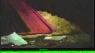
Across the street from the zambronas farm, parts of jack henderson's barn were tossed about a half a mile away from its foundation. This was all that was left. Two horses inside the barn's basement were killed. Fortunately for henderson and his family, they weren't home at the time the tornado hit, tearing apart huge trees in their yard and tossing his trailer.
We lost two horses and we put most of our farm equipment in today because of the bad weather. So that all went down. Where were the horses? They were in the basement of the barn. They had come in just a second before it hit.
And the barn. Wouldn't the barn just get picked up and tossed?
Part of it's out in the field. A major portion of it just completely just dropped. And the back wall is out in the back field somewhere.
Steve keeley reporting from chautauqua county. The punch from the storm is not quite as powerful in erie county. Still, many communities watched as lightning down trees and power lines, creating one big. This was the damage done in the village of springville. Trees knocked down, power lines snapped, leaving residents with nothing but candlelight and workplace. With the job of repairing the mess. Some neighbors stood and watched as the thunderstorm ripped through.
Sparks flying every which way and rain coming down every way. And it seemed for a minute almost like there was going to be a tornado.
No tornadoes were confirmed, but the scene was similar north into orchard park. Live wires left smoldering. Crews working to restore that lost power. And this is what hamburg resident Joe claywon found in his front yard.
Right here. We heard the lightning come down and it hit the tree up there, which just ripped. It sounded like a cannon going off and the whole house shook.
Authorities say many residents are still without power in several communities tonight. And it could be a while before it's back on. Here's a late update on those power outages in erie county. Power is out in portions of Holland, east aurora county, Concord, Lancaster and west seneca. The juice should be back on again soon. In chautauqua county, several thousand are without power. Some may be without electricity there for at least 24 hours. The storm causing other problems across the state. There are unconfirmed reports that a tornado hit the state fair in Syracuse. The roofs of some horse barns were torn right off. No reports of serious injury there. Plus, severe damage is being reported in Allegheny State Park. Severe weather tonight in other parts of the country as well. At least eight people are known dead and 50 homes destroyed. In northern Illinois tonight, a series of tornadoes whipping through the area. 165 people are being treated for injuries at hospitals there. And meteorologist Don Paul is joining us now with more on tonight's weather. It seems like everyone in the Northeast and the Great Lakes getting hit in some way.
Yeah. In fact, we have an update from the National Weather Service that the death toll in Illinois is up to 10 now and that's minimal to and while we are through, I believe with the threat of the tornadic thunderstorms that we had earlier, which sounds like a high pollutant term, but it's fairly common what I do for a living, we still do have to contend with the threat of more severe weather without any official watches up for areas primarily south of Buffalo. And I'll show you again on radar where that threat still exists. The tornado watch has expired for western New York and for northern Pennsylvania as well. Our statistics for today are high reading occurring late in the afternoon and that heating adding to the instability that is the tendency of this atmospheric humidity to rise into towering thunderstorms. That high temperature reached Lake 81. The low 66,45ths of an inch of rain. We lose a couple of minutes. In fact, three minutes of daylight for tomorrow. There are the lake water temperatures. Lake Erie up to today 74 at 11 o' clock, cloudy skies at the airport, 72 degrees, 81%. The humidity is high. We still have southwest winds. The cool front which will bring us relief and tranquility is not anywhere near through yet. 15 miles an hour gusting at 22. The barometer is rising 29.74. And here it is right behind my jacket I should have gotten out of way in advance. This is a system of complexes of thunderstorms which we study in atmospheric science papers. But this is just one of the.
Most down the barricades will begin. Diane Buckner, CTV News Shadow Gang.