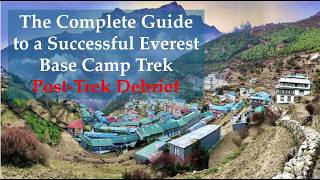
The Complete Guide to a Successful Everest Base Camp Trek – Post-Trek Debrief
Dr. Chris Stout recounts his Everest Base Camp trek with Rugged Luxury and CTSS, covering the full route from Lukla to EBC across 7 moving days. The trek was roughly 40 miles with nearly 11,000 feet of ascent, he lost 11 pounds, and he shot over 600 photos. He shares what gear mattered, how to train, and why flexibility beats rigid planning.
Chapters
Hi everybody, welcome back. I'm Chris Stout and this is another episode in the series of The Complete Guide to a Successful Everest Base Camp Trek. Now everything is over and past This is probably going to be my last video on this because it's basically a post-trek debrief. I'll give you a little bit of background and I'm going to go actually over the map and what our day-by-day schedule was like doing this with Rugged Luxury and climbing the Seven Summits. So a little bit of background real quick. I founded Summits for Others, which is a part of the nonprofit that I founded, Center for Global Initiatives. I'll talk about that in just a second. But every time I go for a climb or anything along these lines. I do it as a fundraiser and awareness raiser for various charities these days, primarily for the Center for Global Initiatives. My background: I've done 3 of the 7 summits, the easy ones. I've done a variety of other kinds of climbs in a variety of places throughout the United States. I've done Whitney, tallest in the lower 48. I've done Rainier. I've done Adam's Peak in Sri Lanka. I've done Half Dome. My daughter and I did Pikes Peak, etc., etc. A lot of stair climb races in Chicago in the winters, whatnot. In the process of doing that for charities, it was nice. I I got a lot of publicity and notoriety for it. I'm also a LinkedIn Top Voice, and I like to write in these kinds of areas as well too. So I've got a variety of articles there too. So just head over to LinkedIn and put in Chris Stout, and chances are you'll find a lot of them. So this is the 501(c)(3) nonprofit that I talked about that I started basically by virtue of a 1992 climb of Kilimanjaro. That really kind of set things into motion with an in-country partner. We've done things around malaria treatments. We've done things, we've been able to get an ambulance. We work with two hospitals there on treatment and education and medication access, things like that. We also got approval from the Ministry of Education to establish a kindergarten for the orphans that we work with that have been lost. They've lost their parents to HIV/AIDS. So that's Alois Aru, our partner, Father Alois Aru, and he's our in-country colleague and partner and just does an amazing yeoman's job there. Very, very proud to be able to call him my friend. Back to climbing, these are the Seven Summits. Like I said, I've done 3 of the easy ones, maybe I've done now 3.5 since I've made it to 17,000-some-odd feet at Everest Base Camp and really had an enjoyable time doing that. So Kili, in terms of context, is around 19,000. Elbrus, much colder for longer but about 1,000 feet shorter. Kosciuszko is basically a walk in the park. You can make it hard if you want to go like during really bad weather. I was there just sort of shortly after a catastrophic mudslide, which was very sad, but very easy, hardly even need to train for, for Kosciuszko. And then in context, Everest Base Camp is around 17,598 meters. I'll get into all the details of how many feet of elevation and whatnot in just a second. But to just also let you know, also in this series we've got a variety of other kinds of topics. We've got an overview We've got what the gear that— this is a part of the debrief of what I needed and the stuff that I brought that I really didn't need. Looking at guide services, like I said, I've used Climbing the Seven Summits, great, great folks with the luggage, luxury, luxury with that. Training, I did nutrition and fueling. I'm a vegan athlete, so it's not specifically to that or exclusively that, but if you are vegan, you'll probably really appreciate it. Otherwise, I think you'll still find it helpful. All the gear, which is a nice contrast to the gear that we thought we were going to be taking and did take, and stuff that we thought we would need and wound up didn't. Medical kit— thankfully I did not need much of it whatsoever, especially the blister stuff. That was a big relief. All the different kinds of insurances, which might come as somewhat of a surprise of the things that you might need. And then just really all the summary of kind of everything all kind of taken together. So that's kind of a quick snapshot, bite-sized view of kind of what's what with the background for this. And next up, I'm going to walk you through a map and then through a day-by-day calendar of what it was actually like. That's coming up next.
Okay, so as mentioned, I thought I would start off with kind of contextualizing this in a map, via the map that we got. So this is all of basically the trail. This is looking at the I'm probably going to mispronounce this, the Sagarmatha— Sagarmatha National Park. Sorry for the mispronunciation, but this just kind of steps things through. I'm going to start at the top. So this is basically the China-Tibet line. So this is Nepal and this is China-Tibet over here. So this is kind of the more southeasterly, if you will, side of it. And this is Everest Base Camp. Where we spent 3 days. That was where we wound up. But if you sort of follow these little tabs here that I put in, those are sort of the highlighted cities, either where towns or villages that we stayed at by virtue of tea houses or sleeping bags and tents. So we actually flew into Lukla, which everyone does, and it was sort of strange. They said, well, the weather's kind of bad, so we're not going to be able to fly a plane in. We'll take a helicopter. We're sort of like, wow, that's actually safer than a plane. So, um, but anyway, we thought that was a little strange, but that worked out just fine. 5 of us were able to fly with our bags for about 45 minutes from Kathmandu, the regular airport there, the helicopter area. There's pictures that I have of that in Flickr and on Facebook. And we flew in there, it was really quite a beautiful ride. It was a little foggy, we didn't get see everything super great in terms of distance, but we certainly got to see below us. And then basically, uh, this is kind of the trail. So you go on here. I'm going to break into the cities because I can't read them this far anyway in just a second, but these are all either notable little— I keep saying cities— villages. And then, um, and/or they were where we stayed in tea houses up until there were no more tea houses which was in Lobuche, which was a tented low camp, and then we did a hike to high camp. So here we go, and then that is at Gorkashep. Yeah, Gorkashep, that's kind of like the last way station, um, and then on to Everest proper. So we actually went from Lobuche— we're supposed to go from Lobuche to Gorkashep, which is about 5 or 6 hours, and then it's about 2 or 3 hours from Gorkashep Gorkhashep to Everest Base Camp. We had bad weather coming our way, so to avoid snow— which I'm so thankful that we did avoid the snow, we got in before the snow— we just made it a big push of about 9 hours, 10 hours for some others, of being able to get there. Once— I should also say too, a lot of people say they went to Everest Base Camp because they got a picture of themselves with this goofy looking spray-painted rock that is not Everest Base Camp. That's sort of like the, the entry to Everest Base Camp. You can only get into Everest Base Camp if you're part of a group that actually has summiteers, actually has climbers in it. And that's the situation with us, with CTSS, Climbing the Seven Summits, that that's part of the licensing and permitting and stuff that we had. So once we got past that rock, then it was about another 45 minutes and very difficult to navigate even with trekking poles. Scree and moraine and rocks and, you know, thawing ice and what a mess. But once we were there, we got to our camp, which was very, very far at the farthest end and kind of by ourselves, which was nice once we got there, but really kind of a pain to get there. But also beautiful to see all the stuff that we were seeing on the way to it, the glaciated ice and everything. Some of us got to go on a stramp on the crampons and go for some hiking and stuff too, which you can see in the Facebook and Flickr pages. So as a kind of a whole vista, you can see way down here with Lukla, basically following all this path, is just a scooch over 40 miles. So now let's, um, kind of break this down into some of the specifics. So we've started with that overview. I took a lot of notes And I had a, um, a watch that, you know, kept track. I had one day that I had a malfunction, but most of the times I got pretty good accurate data in terms of altitude gain and how many miles and how much time and things along those lines. So this is just sort of how I kept track of stuff by virtue of what the date was and what day of the trek it was. And, um, sort of, um, what day of the week it was. It was all disoriented. So it's, uh, kind of goes through this way: March 26th, 27th, 28th. So that was a Friday, Saturday, Sunday, Monday, etc. And then where we were. So this was Lukla to, um, I hate to even try and pronounce this, Phredang, something like that. So it's 5.1 miles, etc. So just We'll break this down in just a second. I add all this stuff together, I came up with that we had 7 days of actual climbing, of actual forward progress, um, 3— so it's 10 days kind of there. The 3 that weren't part of the 7 were acclimatization days where we took extra acclimatization hikes, went to high camp at Lobuche and whatnot at other places. So the total elevation gain By my calculations, and again, this is all just kind of rough, close to back of the napkin, was almost 11,000 feet. So we've got 10,987 feet, and this was by my adding the data from my watch with one hiccup bit of data in it, as well as some of the information that you'll see in just a second that CTSS gave us. So by virtue of my calculations, total hours— this would include breaks and like stops for lunch or stops for water or toilets It took 43 hours and, uh, 55 minutes, so call it 44 hours to do those 7 days. Um, total miles, uh, by their count was 40.5, and that was, um, 3 days of— with the 3 days of climbing. So it's 7 plus those 3 days is 10 days. For me, my total weight loss, I lost about 11 pounds, which is kind of crazy. You can probably dehydration and poor appetite. And I took, last count, and this is probably increased significantly, but I had over 600 photos and 44 videos. All of these appear in my Flickr account. So if you go to Flickr and type in Chris Stout and type in EBC or Everest Base Camp or Nepal or Kathmandu 2026, you will find it. So this again is just sort of my close to back of the napkin kind of tally. So this is the date, so 4th of April, kind of a countdown, 3rd, 12th, etc. And then this is mileage, uh, 6.91, 2.10, etc. Some of these might have included some, um, uh, day hikes and acclimatization hikes, uh, what time it took to do those. So even like a short hike might take a while because maybe we had lunch during that. I found if I would stop my watch during lunch, I would remember it about 2 miles after to turn it back on. So I just let it run after that so I it. So there's some squishiness in some of those numbers. So by my tally, we were around 39.7 miles. By their tally, about 40.5 miles. So let's call it 40. And then, uh, this is a vertical, uh, ascent on different days. Some days I think maybe even one of them somewhere even lower. Uh, this is like, I think, a boo-boo day that I had with a glitch. But basically, you know, some days were lower, and then sometimes it undulated. Sometimes you were you started off higher and you went down lower, and then quite a few days, at least 3, the worst was like mile, 2 miles at the tail end of the day had the most vertical ascent. If you go to my Flickr account and look at the animated version of our treks from my watch, you'll see that, you know, very apparently. And then I— these are not public, but these are the notes that I took that I just kind of keep personal logs and journals for trips like this for myself. So to kind of wrap up or summarize, this is the pre-trip booklet that Rugged Luxury gives. I believe I have this— you can probably get it from their website, but I also— and it's probably going to be a more up-to-date one— but I also have it in the show notes if you look under the issues. So I've got a lot of stuff that's reprinted there that you can take a look at. I'm not going to go through every single page, but I wanted to specifically get to, um, the— this page, the daily route information. So, pardon me. So days 1 and 2 are spent in Kathmandu. It gives people coming from different places in the world— we've got the, you know, there were canceled flights because of the war, all sorts of craziness going on. So we had 2 days to get into Kathmandu. This is great. Because then you can catch your breath, you can, um, start to get your biological clock synced. Um, you can rest, you can go for walks, you can kind of do whatever, sort out your kit if there's something you need. You can, chances are, find anything you need that you don't have in Kathmandu. Then day 1, or pardon me, so that's 1 and 2. I kind of call this day 1 because it's really the first day in earnest of getting going. But then you go to the airport and you fly to Lukla. In our case, we took a 45-minute helicopter ride. And then again, I'm going to mispronounce this, but I'm guessing it's, uh, Phakding, F-P-H-A-K-D-I-N-G, uh, Phakding. Um, not a real big thing. We had an elevation change of actually negative, uh, like I mentioned, you know, sometimes because we actually went down lower. So it was 5.1 miles and we flew in and trekked. We stayed then at a tea house. Then that next day, we just had one night there, we went to Namche, kind of the famous Namche Bazaar. That was an elevation gain of 20— I'm just going to round stuff off— 2,700 meters. We went about 7 miles, and then we wound up at a lodge, a tea house, while we were there. That was very nice. So, um, then we spent two nights there. So this shows zero meters in terms of elevation change, but we went for a hike. We looked at the Tenzing Norgay monument in the museum there, which was just very lovely. And we were already at the tea house we stayed at, it was still quite a hike once we got into Namche. We were all kind of disappointed with how much further and more vertical that was, but we went just a scooch higher to go, you know, see that. And then we kicked around in the city. I bought that umbrella that I talked about in another video and a La Sportiva raincoat since my other one was kind of worthless. So that was nice, very nice day that day. Then from Namche, we went to Deboche, Um, which had the elevation gain of about 1,400 feet. We went about 6 miles and then we stayed there. Um, and I can't— let's see, I think— okay, so that's Deboche. Then we had again an acclimatization day. I'm trying to remember, there was a, um, a Tibetan, uh, Buddhist— or not Tibetan, a Buddhist, um, uh, monastery. I'm trying to remember if that was around here that day or not. It's probably clearer in my photos. But anyway, that might have been a day hike that we did that day. I apologize that I'm foggy and hypoxic still with all this. Then Deboche to Pariche, that was about 1,700 square— or square feet— 1,700 feet of elevation, about 7.5 miles trekking, stayed at a tea house there. Then same thing, we then went for a hike That next day we did a training with some of the doctors there on high altitude medicine and rescue, things like that. That was very, very interesting. Then from there we went to, uh, Labuche. This was our first base camp. This was our first tented camp. That was about 1,600 feet of elevation gain over about 4.5 miles. A very nice setup there, very nice tents, but now really starting to get weather and the coldness. So that was kind of a drag. And then I was also sick. So we did a hike, a day camp, pardon me, high camp hike that next day, about 1,700 more feet. I got to the top, did pictures, and man, did I get sick. I threw up probably about 8 times. I think I got like a little bug of some sort, maybe from some soup that I had, is my suspicion. Took an antidiarrheal so I wouldn't get dehydrated, took an anti-nausea. The anti-nausea didn't work that great, which is probably just as well to get this stuff out of my system. But my— our guide said basically if I wasn't doing better, then I would have to stay behind and have another rest day, which I did not want to do because snow was coming in. So next day, got my appetite back, got my energy back, got my strength back. That was great. Felt much more comfortable. So then from there, the plan had been— and this was even changed though Some of my colleagues on the trip had a different situation with this, but it was going to be, pardon me, 2 or 3 nights in, um, uh, Labuche, uh, base camp, and then it was going to be either going to Awi Peak or it was going to be going to, um, Gorkashep. And then people didn't really want to stay in Gorkashep. So long story short, with the weather, not staying in Gorkashep, not doing Awi Peak. We basically skipped a night. We, instead of 3 nights in Labuche camp, base camp, we did 2 nights, avoided the weather, did a real haul to go from Labuche past Gorkhe Shep to Everest Base Camp proper. That was a big day. That was about 9-ish hours. You can kind of figure out whatever the ascent was for that, but that was great. We were very glad to then be able to get there. Camp unfortunately was not set up super well. They had had some weather, they had had some issues, so that was problematic. And it was just really cold, so a lot of the heating systems and things like that that we had hoped for really weren't, weren't there. So nevertheless, I had a chance— some folks had a chance to get on crampons and get out on the ice, get out on the glaciers, which was just really beautiful. Again, this is just kind of a more detailed itinerary of kind of what's what with these camps. And again, when you're dealing at altitude, when you're dealing with weather, when you're dealing with freaking Mount Everest, a lot of things have to be changed because of those, you know, weather and conditions and people. So you have to go in with an attitude of flexibility. It's nice to have a structure, but to also then expect we need to vary from the structure if it's going to add to safety, if it's going to avoid foul weather, et cetera. So we wound up staying there for that, those numbers of nights, and then we're able to take a helicopter back from that the next day, which again avoided a lot of bad weather for us. So that was really beneficial. So then we got back to Kathmandu, got a very necessary shower. I washed my hair like 5 times. It was really kind of a, you know, great experience to be able to then be back and enjoy some city tours there of Everest. So it was quite an arduous time towards the tail end because of the scree and the moraine and the terrain, plus combined with being fatigued and the altitude, people are having some issues, a few GI issues and some sleeping issues, things like that. But overall, for these kinds of conditions in this kind of situation, it really wasn't anything that you could sincerely complain about. So really quite a wonderful experience. If you've done this, you know, please make your comments known in the notes below. If there's questions or anything like that that I might be able to answer, please feel free to add those and I'll see them. And I try to respond to all the questions that I see as well too. So if you're thinking about this, I would highly encourage you to do it, but do, do it with a lot of preparation and appropriate training. Go in with an attitude of flexibility and that it's going to be a a wonderful experience that with proper preparation that you'll really be able to enjoy, and it turns out to be really kind of a, a lifelong bucket list kind of thing. So thanks for watching. If you enjoyed this episode, please do like it, please do subscribe. We've got quite a variety of other kinds of series within the channel. Check those out too if you have an interest. And again, I wish you all the best if you do go on this expedition, and be safe. And enjoy the ride.
Take care.
More from Dr.

2025 Mercedes-Benz CLE 450 4Matic Cabrio – Owner’s Views After a Year-and-a-Half as a Daily Driver
The Complete Guide to a Successful EBC Trek – Post-Trek Debrief: What I Needed (and What I Didn’t)

What Went Wrong Customizing My New 2026 Porsche Carrera T …and what I did about it!

Coming May 1 At the Intersection of High Performance and Fulfillment: A Conversation with Alisa Cohn

From High Performance to Fulfillment: Lessons in Inner Mastery with Jim Murphy
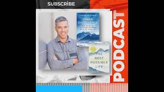
Coming March 19: From High Performance to Fulfillment: Lessons in Inner Mastery with Jim Murphy
The New Humanitarians Volumes I - III:- Inspiration, Innovation, and Blueprints for Visionaries

The New Humanitarians Volumes I - III:- Inspiration, Innovation, and Blueprints for Visionaries
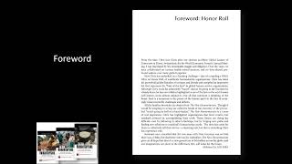
The New Humanitarians Vol I - III: Inspiration, Innovation, and Blueprints for Visionaries - Forward