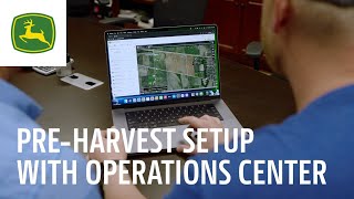
John Deere walks through setting up the 2025 combines with predictive groundspeed automation. You'll need specific hardware and licensing, plus satellite data sent through Operations Center to optimize your harvest operations.
Introduced for model year 2025 combines is the new predictive groundspeed automation which utilizes both satellite views and forward cameras to make ground speed adjustments predictively with crop variability. To utilize satellite views, advanced planning and preparation are required. Ordering a combine with the Ultimate Technology package equips all necessary hardware needed for predictive ground speed automation from the factory. To enable this all new functionality, a one year ultimate S7 or X9 combine license will need to be purchased and activated onto the Combine in CAB display. Because it is a time based license, the more you use the more value will be realized in harvest. The first step of planning is to plan what fields the operator will be harvesting. Are the boundaries for these fields in their account. If there is a field without a boundary, either driving the boundary or hand drawing a boundary or will suffice for this functionality. Once a boundary is in an org along with a machine with an Ultimate Combine Technology license, the process kicks off in the background. Operations center will go procure existing satellite images in a one way process with no information going back to the satellite image provider. To get a file ready to prepare for sending to a machine, a user simply needs to create a workplace for a given boundary with correct crop type. This can be done with as much or as little detail as the user would like. Once inside Work Planner, you will notice a new column labeled Satellite Views which shares the readiness of the file for each prospective field. When a new field is created, Not Ready will appear in this column which indicates the file is still being generated and not ready to be sent to the combine. Upon creating or adding a new field boundary. Typically it is advised that a minimum of 24 hours is needed for the systems to prepare the Satellite Views file until signifying that it is ready to send to the combine. When a check mark is shown, the file is ready to be sent. By hovering the mouse over the check mark symbol, you can view the date stamp of the last update automatically. The system updates this file every two weeks within Operations Center. It is not expected, but for any errors encountered during the file generation you can hover your mouse over to get a further text description for the error cause. The Sent Status column gives a deeper understanding of the field file status. Once the work plan has been completed, choose the file and select Send to Equipment. A pop up window appears to select the Combine or combines from. Note that there is a checkbox for Include Satellite Views for Predictive Yield. This is on by default but permits the system to transfer these files outbound. Finally, select Send in the bottom right hand corner. Now that satellite views has been sent to the combine, you are one step closer to beginning harvest. We know that duty around the farm consistently calls and therefore farmers are regularly on the go. The good news is that satellite views can also be transferred using Operations Center Mobile from their smartphones anytime, anywhere. This prevents accidentally forgetting to send the files and adds the ability for quick adjustments from field.