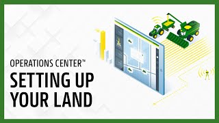
Learn how to set up fields, boundaries, guidance, tracks, and flags in the John Deere Operations Center Web platform. The tutorial walks through creating new fields, drawing boundaries, and organizing location data to improve field work precision.
Land is your place to manage your fields, boundaries, guidance, tracks and flags. Setting up your location data in Operations Center Web before your operators get to the field saves your team time and increases field work precision from pass to pass. In this video we will learn how to create new fields, boundaries, guidance, tracks and flags. Navigate to Land by going to the Setup menu in Operations Center Web. When you first open Land, you will be greeted with the map view. Here you can see all of your clients farms and fields. Each field on the map is color coded to indicate what type of work was done in the field. Most recently, on the Client and Farms tab you can expand the client name to view the associated farms and fields. This helps organize your data and you can select a field name to locate it on the map. Switching over to the table view allows you to review your land data row by row with greater detail. Land makes it easy to narrow your search down to the work that is most critical. The Filter buttons and search feature can save you time when you need to find a particular item. Let's say we're going to do some work out at a specific farm. We can use the Farm filter to show all the fields and other items related to the farm. Next, let's review how to create a new field. Select the Add button. This button will allow you to create many different items including boundaries and flags. We need to make sure our field is associated to a client and farm and in this case we will create new ones. Be sure to give your field a unique name. If the field is associated with a base station, we can specify that here. Now we will create a boundary for the field. You have several options for creating boundaries. For best accuracy, you should record your field boundaries using a GPS system, but you can also draw a boundary by hand in land or create a boundary based on a previous operation such as last year's Harvest Map. For this example, we will draw a new boundary for our field. Use the drawing tools to create your boundary shape. Here we will use the Polygon tool to outline the field, connect the dots to complete the shape, then move the dots to make any adjustments. You can use the show all Active Boundaries button to turn nearby boundaries on and off. For more precise drawing. Be sure to give the boundary a name and mark as Active Land lets you layer shapes. If you need to create interior boundaries, then you can specify if these boundaries are irrigated or non irrigated. Let's create a straight track for our field based on an implement with a 30 foot working width. Name the track and use the drawing tools again marking the A point and B point for your guidance line. Edit your heading and track spacing if needed. Next we will add a flag. Remember you can use flags to mark points of interest in the field. Here we will create a point flag to mark a large rock in the field. Simply drop the flag anywhere on the map and categorize the flag. There are several predefined categories but you can add others if you'd like. Flags appear in Operations Center Mobile and can be included in setup files so they are visible to operators on the display in the cab. If an item such as a field or flag is no longer active and you want to remove it from land, simply mark the checkbox and select the Archive filter. There are many informational articles to help you as you use the Land tool. Navigate to the Assistance menu and select Help Documentation. In this video you've learned a few things to get you started with your land. Thanks for watching.