WALKING ACROSS AN ENTIRE STATE (putting Google Maps to the test)
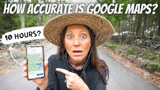
This is a first-person YouTube vlog by Nate Buchanan (with Kara) documenting an experiment to follow Google Maps walking directions across the smallest US state (Rhode Island). They start at 9:00 AM and attempt a Google Maps route that Google estimates at roughly 10 hours and 15 minutes for ~30 miles. They use a stopwatch to track non-walking stops (2 hours 39 minutes by their count) and encounter heat, hunger, aching feet, and darkness on a mostly greenway route. They reach the state border at about 10:58 PM (≈14 hours elapsed); subtracting stops gives ~11 hours 21 minutes of walking time — about 1 hour 5 minutes longer than Google’s estimate. The video concludes the route is reasonably close to Google Maps’s walking estimate.
Questions this video answers
9:00 AM
About 10 hours and 15 minutes (also referenced as 10 hours 16 minutes).
6:14 PM
They arrive at about 10:58 PM (≈14 hours after the 9:00 AM start).
2 hours and 39 minutes (stopped time, per their stopwatch).
Chapters
Okay, I have a question for you. Have you ever accidentally searched for walking directions in Google Maps when you meant to search for driving directions? And then seeing that a one hour drive would take somewhere around 10 hours to walk. As Kara and I travel to new cities, I'm constantly switching back and forth between driving and walking directions. And this happens to me all the time. And I've always been super curious what would happen if I just started walking. How accurate would those directions really be? So tomorrow I've convinced Kara to help me conduct an experiment. And we're going to walk across the smallest state in the US and put Google Maps walking directions to the test.
So according to Google Maps, if we walked without stopping to the eastern border of the state, it would take 10 hours and 15 minutes, which would put us there at 7:15 tonight. Hey Siri, what time is the sunset?
Sunset will be at 6:14pm today, so.
We'Re gonna be walking in the dark. We are starting at exactly 9:00'. Clock.
And we're off.
I don't love just walking on the side of the road like this. So I did a little research before we started and I think I found a greenway, like a walking path that'll take us most of the way across the state. But I think the first five miles and the last few are gonna be on the side of a road like this. This could be the most dangerous video we've ever made.
Half a mile in. Already sweating. What are you doing?
Burning up. Literally that entire backpack is full of electronics and warm clothes.
Should we go back?
Pretty sure I could be in shorts and short sleeves all day. So yeah, we're on pace in the first mile.
Sweet. Go out.
29 more to go. I think we're finishing at midnight.
Oh, gosh. I don't know. Walking just doesn't sound that hard.
Probably the furthest our legs have ever carried us in a single day is like a half marathon. 13 miles, maybe a little bit more. We're going 30 today. When you're walking, you're just seeing the world at a very different pace. Just noticing a lot of little things that even if you were on a bike, you would just fly by. I. I meant that in a positive way, but one of the things that we are noticing is the trash clean and dry inside.
You want to cool it, put trash in it as we walk.
All right, we're already a tenth of the way. So far this has been nothing but an enjoyable walk. And the weather could not be better for what we're doing.
It's Perfect. Got this.
We got this. Going this way.
I've never loved a big shoulder so much.
So much room. Check this one out.
What? Going east.
Sidewalk.
Hey, look.
Begin walk. That's us.
Got a honk. Wait. Now it says end sidewalk.
Starts started there and it ends here. Fun while it lasted.
I love you guys. Thank you.
We love you too. No way.
That's us. We're walking across the state. Are you serious? Yeah. Take you about 10 minutes.
What are the chances? Three people on one roundabout told us that they watched our video. That was great.
Open dawn to death. What happens if it's dusk and we're not there yet?
We are about six miles in. Taking our first little break. Boom.
Good.
If we make it to the end of the day without getting attacked by a dog, we'll be doing good.
Canadians took our pepper spray.
So. So in order to uphold the integrity of this experiment, I'm carrying this stopwatch. And every time we stop. I'm sorry, starting it. And this is how much time we are not walking. Up to this point, we've spent 43 minutes either snacking or mainly filming stuff. So at the end of all this, we'll subtract what's on the stopwatch from our total time and that's what we'll match up with. Google Maps.
Yay, Greenway. No more cars for a really long time.
That's what happens when you spend too much time together. You start walking the same.
We're seven miles in. Means we're a little less than a third of the way. I'm much hungrier than I thought I would be at this point. Think we'll pass any restaurants on the greenway?
I think this is our view for the next 15 miles.
Here's what I found. Lunch is a meal eaten around midday.
This greenway is surrounded by forest. There are fall trees everywhere. It's nice.
Wait, were you just being positive on the camera?
Yeah.
I feel like this video is only seeing one side of your emotions at the moment.
Okay, fine. My hip muscles are really hurting. My feet are starting to hurt. Hungry. And I'm sick of protein bars. Happy? I'm trying to be positive to lighten my mood.
I appreciate it.
9 miles. Average pay so far is 2340.
Is this an illusion? Pizza? Do you think it's real?
This is the craziest thing ever. I've been talking about how good pizza would be pretty much since we started walking this morning, and we have seen nothing on the entire greenway. I didn't think we were going to eat for so long.
This is a miracle. Unless this is all a mirage civilization. Oh, no. I knew it was too good to be true.
They also have pumpkin pie martinis.
I don't know if I can go on.
Oh, my gosh. Oh, I need it. I mean, pizza would have been better, but this is pretty good.
Mmm. Amazing. Wow.
Does everybody else know what hash is? The lady looked at me crazy. I was like, hash browns, like potatoes. And she was like, no. It's like.
20 more miles to go.
And we're back. I still can't believe how perfect that timing was.
Kara was getting hangry and less and less fun to be around every minute she didn't have food in her stomach. Yeah, we still have a long way to walk.
We have a positive mindset. And go. We get to go. Yeah. 20 more miles across Rhode Island.
Yeah, bro. I'm so cold.
This is conveniently located.
I drank too much water for lunch.
Yeah.
Feels good to stretch.
Just hold it. Take it.
All right.
Well, riveting content on the channel today.
Filming our bathroom break at the Porta Potty. We're five and a half hours into this, and I'm wondering if this is the most boring video we've ever made.
And I live in a van down by the river.
That's us.
Kara had never seen this before.
We just met a guy and we told him we lived in a van. He was like, down by the river. And I was like, what?
Perspective is such a funny thing. We have walked 13 miles today, which is probably the most I've ever walked in a day, I think, because we're not even halfway yet. My brain just won't even let me tell myself that I'm tired. It's like I have to keep going. Just working on my mental toughness over here.
I'm slowing down. I need a coffee.
Oh, wow. We're doing it.
We've only gone five miles since lunch.
According to my watch, this bench is pretty much the exact halfway point of the entire trip. So we are 15 miles in, and it is 3. 44. The good news is our body's feeling really good. The bad news is it took us six hours and 44 minutes to go halfway. The sun sets in three hours.
So I was talking about perspective earlier, and something just happened that made this walk feel really small. We walked past a guy who was biking with all these bags, and we could tell he was on a big journey. So we asked him where he was going, and he said California. He had already biked over 3,000 miles. Plus, he's on a $10 a day budget, and it just made what we're doing not seem like that big of a deal. Okay, I know this is so random, but this guy was so sweet and joyful that he just gave me the energy boost that I needed in this moment. But I was so disappointed in myself because I didn't think to offer to buy him dinner or something since his budgets only $10 a day. However, I've done some digging and I've managed to find his blog and he's got this little coffee cup at the bottom where you can buy him a coffee. He has no idea who Nate and I are. He definitely doesn't know that we're doing this, but we've bought him a few coffees and I thought I would share because I think it'd be really cool if he could get get enough copies for like the rest of the year, maybe even the rest of his trip. I don't know. He just seemed like such a special guy doing a really cool thing. And how neat would it be if he checked his inbox one day to the surprise? So I'll leave the link in the description below. Back to the vlog.
So we just met up with our guardian angels for today, Caitlyn and Aaron.
They're going to go get our van and take it to the end, so when we finish, we can just go to sleep for sure.
Wow.
Wow. I've never seen someone do that. Whoa.
All right. We've walked halfway across the state and that's the coolest thing we've seen today.
That hurt.
I'm hurting. I'm hurting really bad. I don't want to say it out loud because I don't want to bring Nate down too. My feet like, my feet bones.
Kind.
Of feels good to write. What just like uses different muscles.
All right.
It's kind of nice to be back on the sidewalk, back by the road, back by some action. The greenway was great, but after 10 or so miles it starts to get pretty boring.
I really, really, really, really, really have to pee.
There's your mile 18. Update.
3:59 4:99.
I've never been so happy to see a CVS. They had a great bathroom and and.
Cold coffee.
We are almost 2/3 of the way. According to Syria official sunset is in 30 minutes, which means we're going to be walking at least 10 miles in the dark, which is fine.
Wow. Coffee nut M&Ms.
I feel like walking everywhere just simplifies life and you appreciate little things so much more. And I'm going to feel less bad about eating this entire bag of M&M's.
Back on our beloved Greenway. I think it's gonna get a little scary once it gets dark. Haven't mentioned that my feet are hurting. They still hurt. I live in sandals. The only time I put on tennis shoes or any shoe that covers my toes is when I'm working out, which is for like 30 minutes to an hour. And just to like be in tennis shoes on my feet for this long, they're not happy at all.
Oh, that was so hard. So if you're wondering what necessities we chose to lug around on our back the entire day, we just show you what we packed in this giant backpack that's crushing our back.
Trash bag. New M&M's added to the bag. Power bank. Bag of snacks and rain ponchos. Drone battery number one drone controller.
Drone GoPro.
Extra light protection.
More SD cards.
Hydration. Caffeine tablets.
Spare pair of socks. Beanies. Another lens. Another layer.
Extra socks. Kara's puffy jackets.
Toilet paper just in case. This is like a CBD pain relief roll on that. I need.
Oh, and most importantly, we had two headlamps in the van housing. No, I don't think we'll need them.
Should have brought them.
Whoa, baby.
I've never put this on my feet before, but I think this is brilliant. Take a bath in it. I feel like they're swollen already.
Don't start licking your wounds now.
Not only do I never wear tennis shoes, but these are two years old. That's probably not helping either.
If I just act like it's not happening, I bottle it up and then I explode.
Stiffening up.
This is our average pace. This driver. 25 minutes and 9 seconds per mile. That's a pretty good pace to us.
Walking under super dark bridge. I don't like this at all. Gosh, I forgot we were under a brain. Gosh, I hate this.
So I really enjoyed. What?
Don't talk so loud.
Why?
Cuz it's scary. I don't want people to know. Here.
I hate this. I really enjoyed walking on the Greenway earlier today. But tonight it's the creepiest place we could be. Something to be jumping out at any moment.
Wait, I'm just gonna pretend like I've never seen Dateline before. I don't like it.
It's not really the conversation to be having as we're walking through here.
So dark.
This flashlight's pretty incredible.
Scary, No. I don't even know where the camera is. I'm too blank. Look how giant my shadow is.
I feel like the adrenaline from the darkness has worn off and I'm feeling all my pain again. Had a pretty good backache going on.
Nothing really like hurts, hurts. Everything's just pretty achy.
It's been 10 hours and 15 minutes since we left this morning, which is approximately when Google maps told us we would reach the other side. But we've made lots of stops to eat, go to the bathroom to rest. So what we've learned is Google maps definitely doesn't account for taking breaks. Can you drop me a beat?
We are walking across Rhode Island, 30 miles. It's really cold, but we're doing it in style. My feet are really hurting, probably because my shoes are old, but I got good socks so my feet aren't cold.
In effect. Taught me how to rap, but I'm not very good at it. Give me something to rap about. The van. Ooh, the van. Yeah, it's waiting on us. It's on the other side in a spot that's B plus. Yeah, it's at a Walmart. A go to home because it's for free and nobody knows why. We don't get in trouble even though the sign says so. I can't think of words. This is a bad time to wrap. That's all for tonight. Feeling alright? No people in sight. Wish I had another light. Peace.
Losing it.
You must not be in nearly as much pain as I am. Oh, work it.
All right, we have officially said goodbye to the greenway. Hopefully from here it's all sidewalks and street lights the rest of the way.
I honestly have a second wind just being on this street that has movement and life.
What I would do for a pizza right now.
Maybe you're manifesting it like last time. Pizza, pizza, pizza. I think a place on the bottom of my foot just like split open. All of a sudden it feels like I have this open wound. It's making me limp a little bit.
We've made it to the big city. Those skyscrapers over there, Providence. Which means we're getting close. I can't tell myself we're close though, because then my body's gonna start getting tired. I have to tell myself we still have a really long ways to go. We're only halfway.
Okay. I think that's the last time I can muster the energy to walk back.
And get the camera.
Slowing down. I feel like if somebody tried to rob me right now, I'd be like, hold on, you don't have to rob me. You drive me to the Massachusetts border. And I will give you everything that's on my person. We won't call it a robbery. You can just have it.
Oh, my gosh. We've just turned onto our last road. I know you can't tell. That just gave me a big old boost. I could smell Massachusetts.
I give up all hope that this is actually happening.
Literally salivating right now.
Thank you.
Is it real?
It feels like a dream. Oh, my gosh.
Oh.
It was the best piece I've ever had in my life.
One piece. Number three.
I don't care how far we have left.
Honestly, when we set out to do this, I was like, walking 30 miles cannot be that hard.
I'm done for. For who knows how long.
So close. Last steps.
We're so close.
Where is this town? Is this Rhode island or Massachusetts? Are we there? Oh, wait, what? According to Google Maps, we were dangerously.
That's just.
Hey.
Oh, my gosh. I'm gonna stand in both at the same time.
We walked an extra 10 steps.
I'm in Rhode island and Massachusetts at the same time.
We did it. Good work.
I'm so proud of us.
Rhode island state border.
Okay, ready for some stats? It is 10:58. We started walking at 9am which means it took us almost exactly 14 hours. Google Maps said it would take 10 hours and 15 minutes. And according to my stopwatch, we stopped for 2 hours and 39 minutes. I'm not sure I did this stopwatch perfectly.
I believe my cow's going into a cramp.
So instead of walking for 10 hours and 16 minutes like Google Maps said, it took us 11 hours and 21 minutes. So an extra one hour and five.
Minutes, which is probably us stopping to stretch and film at PE and forgetting.
To stop the thing, and for that long of a distance to only be off by an hour. I also want to know if they just default to 20 minute miles. Does anyone here work at Google?
There you have it, folks. Wonder no more. Google Maps is close to being accurate.
You're welcome for all this research you've done. Oh, wow. This hurts.
I can't believe we just did that.
I hope you enjoyed what could end up being the most boring video we've ever made.
We did not finish the pizza.
Oh, I think the blister popped between your toes. Yeah, look, it's white. Gross.