William Marshall: Entrepreneurship Takes Flight [Entire Talk]
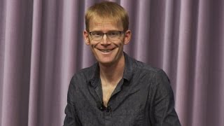
This content was created by GHION.AI . This content was uploaded by GHION.AI . This is a YouTube video titled "William Marshall: Entrepreneurship Takes Flight [Entire Talk]" which contains a talk given by William Marshall on May 22, 2015, discussing entrepreneurship and its challenges and opportunities.
Chapters
Thanks, guys. Can everyone hear me? Okay, great. So I want to. What. What I wanted to talk to you guys about today was a little bit about what we do at Planet Labs and why, and a little bit of some of the lessons I've learned on this entrepreneurial journey, if you like. For others that are interested in taking similar journeys, I hope it will be useful. Much of it will be from my personal perspective. So take it with that grain of salt. I want to start us here. This is called the Earth. You may have seen it before. You may have seen it before. In particular because of this rather iconic image that the Apollo 17 astronauts took when they were hurtling around the Moon in 1972. It was the first full frame image of the entire planet when it was fully sunlit. And it's credited with having started the green movement. Not so much because we didn't know we were living on a planet before then, or at least most people thought we did. It is the case, though, that it hadn't really gone into the public consciousness. And this changed a lot of people's thinking, this particular photograph, because they saw the thin shadow of the atmosphere, they saw the Earth in the vastness of space and made people realize that we've got to take care of this beautiful planet that we're on. But beautiful as this picture is, it's a little bit lacking. It's lacking because it's static and the Earth is constantly changing as we in particular affect the planet as human beings. And what one would ideally like is much more high cadence imagery, high frequency imagery of the planet. So satellite imagery today is typically old. The image you find online is typically several years old. So we did a thought experiment. What would it be like if we could take a high resolution image of every single point on the Earth's surface every single day? What could we do with that data? We were thinking, well, we could track deforestation. We could see that as it happens. Rather than waking up at the end of the year and realizing there's a bloody great hole in the Amazon again. We could catch people in the act as the logging takes place over many weeks. We could do the same for fisheries. We could see disasters like the situation happening in Nepal right now and help people quickly get the imagery they need to figure out how to respond to those situations. Same with floods, fires, earthquakes, well, that is an earthquake. Other disasters as well. We'd also be able to help people improve agricultural yield, because with satellite data you can tell biomass in every single pixel. And so we can help people improve agriculture around the world. And then there are a lot of commercial applications. For example, having up to date imagery is something that people want on their consumer mapping products. And so everyone wants that on their phone instead of an image several years old, they want the image from recently. And there's lots of financial applications as well. And so me and my co founders who were at NASA at the time, left NASA to start a company to try and tackle that problem of trying to get to daily imaging of the planet. And so that was the mission we set out. Image the whole earth every single day and provide universal access to that imagery. And so roughly what does that take? It takes a system like this. We need about 150 satellites orbiting the Earth in a particular orbit. We need a system of 30 ground stations around the world to receive the information down from those satellites. We need of course, large numbers of processors in order to digest and make that information calibrated and geo rectified onto the Earth's surface. So it's useful for consumers. And then we thought about two ways of sort of provisioning that out to customers. One, via sort of feed hoses to large enterprise users, say those consumer mapping clients that I was talking about. But also we wanted to get it out on a platform so that everyone could have access to it. So we have an open API where anyone can come and hack their own apps on our imagery on our servers. So that's roughly what we set out to do. This little video is going to show you how it would work. So we put 150 satellites into a sun synchronous plane. They're all in the same plane and they actually stay fixed. That plane stays fixed with respect to the sun and the earth rotates underneath it. Each one is pointing down and taking a strip of imagery along the ground. And then by the time the next one comes along, the Earth is rotated just the width of the image so that it stripes. The part just next to ends up being like a line scanner for the planet. So basically the Earth does the legwork and we just stay put and let the Earth rotate underneath it and slowly scan it. A line scanner for the planet. This is two of our satellites being deployed from the International Space Station. It gives you a bit of a sense of scale of how small our satellites are versus the solar arrays of the space station. And what I'm going to tell you a little bit about what it took to get there and some of the journey first. So we started this in our garage as Silicon Valley startups are wont to do. But I think we were the first space startup to do that. We literally built our first satellite in our garage. And that wasn't the only lesson we learned from Silicon Valley. We took an approach of rapid iteration we call Agile Aerospace. I'll tell you a little bit more about that in a minute. We tried to just take things out into the field and test them. We would take our satellites out, we'd fire them in planes over our ground stations to check they work, have, have the radio tests along across the valley from here to basically the Lick Observatory would send somebody up there and try and do a link and make sure everything worked. So we took this sort of more hands on and testing approach, which is quite different from the aerospace sector, which takes a very hardcore analytical approach to finding problems and risks to the satellite design. So we started in our garage and that was just over three years ago, three and a half years ago. And we actually, the founders of our company, we all met at the United nations at a conference that was looking at how to use satellites to help humanity, how can we bring them to help people in developing countries, help stop disasters, things like that. And so this in many ways has been the uniting theme throughout our career. So we've known each other for about 15 years before starting this company. And so we were long term friends and cared about this overarching mission. So what was standing in our way? The first thing that was standing in our way was that satellites looked like this. You see these people, they're rather big, the satellites, either that or the people are very small. So these satellites weigh about 6 tons. This is a Landsat satellite. It was launched last year by NASA. This is what a traditional earth imaging satellite looks like. So it weighs 6 tons. It's 4 by 4 by 6 meters. It cost $855 million. It was launched on a single rocket. And satellites like this have done a tremendous service in helping us to understand the planet. So far this sort of satellite has given us reliable data over the last 40 years. But if you want to put up 150 satellites, this model doesn't really work because, well, at least not unless you have a gigantic budget. But that doesn't really represent the forefront of satellite technology. At least small satellite technology, which really was represented prior to us, at least by these folks at Surrey Satellites who are actually from the uk. And these are some of their satellites that they build. A Rapid Eye is the constellation of satellites that they built here shown. And these sellers are about 100kg and commensurately less money. Only say 30 million or $40 million. But even that for us was not going to work. We needed to put up 150 of these guys. And even by that standards, it was going to be billions of dollars and not something we could get venture capital funded, let alone try and start out of our own pockets, which is what we wanted to do. So what we did was make satellites much smaller. And this is actually one of our satellites under construction by one of our engineers, to give you a bit of a sense of scale. So our satellites, this is actually one of them. What it looks like, one of the dominant features you can see is actually we have an artist in residence who paints all of our satellites. And this is actually the. The top side of the solar array. So you can't see the main solar array, obviously that has to have the solar cells on it, but the artist gets to paint the other parts, which is kind of cool, but what's inside that? So we've miniaturized a massive amount of technology into this little volume. These satellites are 10 by 10 by 30 centimeters. They use what's called the cubesat form factor, which actually Stanford engineers were involved with pioneering in the late 90s. It's basically a standard form factor of size of a satellite. And launch providers got used to this form factor to give more, which enabled us to get more access to space, basically. But inside there is first and foremost the largest telescope we could possibly fit into that volume. So, you know, the front 2/3 of the satellite is essentially the telescope, which is the optics that you need to get reasonable resolution. Imagery of the ground from 4 or 500 km up, which is where we're orbiting. Then we have a camera system at the back which that telescope feeds to. And on our latest generation is a 29 megapixel camera. But in addition to that, that's only really just the beginning. What one has to have is obviously the power system, so the batteries and the solar power to keep them charged. We have to have an attitude determination system. So that's the system that figures out where the satellite is and where it's pointing. So we have a GPS antenna that picks up that. And actually GPS works in space. You might question whether it would or not, but it does. We're that much lower than the GPS satellites, so it still works. And we have a star camera which looks out up whilst the main camera is looking down and takes pictures of the star field and then automatically recognizes constellations and then adds metadata to our main image to say, you were pointed this way when you took that image. So we Have a timestamp. The GPS stamp says where it's at in the orbit. And then this star camera stamp, if you like, says, which way are we pointing at the time? There's a lot of other sensors in here. There's a 3 axis accelerometer, 3 axis rate gyro, 3 axis magnetometer. These will feed into a Kalman filter to spit out the satellite position and attitude state. Then we have a system of attitude control. So that's what then says, well, we now know where we're pointing. Now we need to point somewhere else, the ground, say if we're pointing up or what have you. And so we have two systems of attitude control. One is a system of reaction wheels. So these are little brushless DC motors essentially, that were put in all three axes. And if you spin them one way, then the satellite has to spin the other way to conserve momentum. And so we can turn the satellite round just by turning on these motors. We have an independent other system of attitude control which is using magnetorque coils. So these are little, just literally a system of copper wire that we put through a little current, which creates a little B field which reacts against the Earth's really small magnetic field and gives just enough torque to turn our satellites around as well. So we have two independent means of turning our satellites around. One is completely simple, that magnetorque coil, and very robust, but it's a little bit slower. And so when we're turning, for example, to point at our ground station, to maximize the gain of our radio antenna, we use our reaction wheels. But for most of the time we can use our Magnetoga coils. Also in there we have a processor. We actually have three processors. We have an FPGA which does the initial compression of the imagery. We have a full up x86 processor running Ubuntu. And then we've also got an ARM processor that does a lot of the light work scheduling of the satellite operations. And so actually, despite being some of the smallest satellites ever, they are some of the most capable satellites ever in terms of the compute power on board. We've got more memory and processing power than a lot of other satellites, if not all of them, just because we use the latest technology and stuff it in and we take a slightly higher risk approach, which I'll be talking more about. Then we have radio systems to send down the data. So we have three radios on board, all of which we developed in house because the cheapest radio we could find that would do the job was larger than our satellite and cost About a million dollars. So it was out of scope on two axes. So we build our own radio in house. It has three channels, UHF channel which does the command and control of the satellite, an S band which is where we send the data up, and an X band which is 8.3 GHz to send the data down. We can send our data down at about 40 megabits a second down to our ground stations that are around the world. And I'll show you a little bit what the ground stations look like in a minute as well. So that's what the satellite looks like. And as I mentioned, we take this sort of agile approach. And what I mean by that is we constantly put in the latest technology. So in between the last two, one we just launched about a month ago today, where we launched 14 satellites. And we always put a tech demo satellite on, testing our next generation technology. And then we put a fleet of ones that we know work right, and then if that one works, then we'll just produce loads of those for the next batch. So the tech demo one that we had on this one, for example, had double the field of view on the telescope. We had gone up 3x in the number of pixels on the camera. We had doubled the hard drive space on that satellite. We'd increased the radio speed, we had put new sensors in that helped us to do better attitude control, sun sensors, basically. And so we keep on iterating the technology. We call this strapping space to Moore's Law. We're basically trying to leverage the billions of dollars that have gone into consumer electronics and stuff them into our satellites. And although that seems pretty obvious, that's not really what the space industry has been doing until now. It might be obvious to you and I, but it's not what's been going on. So basically there's. Traditionally you can only put something into space if it has already been tested in space, which leads to this sort of chicken and an egg, then everything is antiquated. And there's very long design life cycles for these things. So they want them to last a long time, so they want reliable technology and they design them over many, many years. So what ends up happening is you end up launching antiquated technology. So the processors on the latest mission on Mars has a 33 MHz processor and a 2 megapixel camera, because 20 years ago that was really hot shit. But unfortunately, I mean, you can't Even find a 33 MHz processor to go and stick in a satellite. They have to keep their Own lines of processors going to keep that stuff going. So we strap our satellites to Moore's Law. And then we really also do another thing that's quite equally important, I think, to keep our satellite agile. We keep on uploading new code. Again, pretty obvious to computer programmers down here on Terraforma, but in the aerospace sector there's always hesitation because you could put up new code and it could send the satellite into a spin and there goes a billion dollars, right? So people are scared about doing that. And at NASA we would typically take about a year for us to get new code uploaded to our satellites. So we just upload new code to our satellites all the time. Normally we've got a couple going that we are more experimental with, and if it works, we just copy it across the whole fleet. So we take an agile approach to our software development as well. So that's that really. So we take agile aerospace. Then we had to figure out how to manufacture them at scale. And I don't mean scale like iPhones or whatever, but. But hundreds is the sort of scale that we need to build satellites in. And we figured out how to do that. And that meant redesigning the satellite for manufacturability so that everything was plugged together like ribbon cables, rather than us wiring it all together and three axis milled parts rather than five axis milled parts so that we could have a shorter timeline to get the iterations in and things like that. So we redesigned them to be able to build them in large numbers. So in, in the aerospace sector, typically it takes the fastest people develop a satellite is a year or so, and we can do it orders of magnitude better than that. I'm not going to tell you the specifics now. Then of course we had to get rides into space. In fact, when we were in our garage, we put our first deposit on a launch vehicle with our pocket money, so to speak. But when we were getting towards the bigger payments, that wasn't going to work. And that's when we went and asked Steve Jurvetson, who I guess helps to sponsor this series or DFJ does, to give us some more serious dollars. Because in particular we needed more serious dollars for these things. Rockets are expensive, it turns out, and we needed to get our satellites up. So we've actually had nine launches to date, eight of which were successful. I'll tell you about the one that wasn't in a bit, and these were over the last two years. So we've roughly had a quarterly cadence of launches to test our technology and keep on iterating it. And so every time we have that new generation of satellite, we put it up. But we've also been launching these fleets of satellites. So We've now launched 87 successfully into space on rockets like this. This is a Falcon 9 rocket that launched a month ago. But we launch on anyone's rockets. We stick our satellites in any nook and cranny that is available. And we've launched on Russian rockets, Soyuz Nepa, we're launching this year, also on a Japanese rocket, on an Indian rocket. Wherever there's space we'll go, excuse the pun. So, and this is just to show you a little video. This is of course, this is one of the advantages of going via the International Space Station. You can get the astronauts to take these nice videos out the window. I guess they got nothing better to do. And so we like seeing this. There's a sort of flash at the end which is kind of fun when it glints in the sun. I thought we could have planned that, you know. Here's some of the latest ones that just came out. I put these out animated gif of them coming out of the space station, just for shits and giggles here. Okay, so then we have to get the data down. So we have a system of ground stations around the world. We've got about a dozen of these. So inside that is a 5 meter parabolic dish antenna which points at the satellite as it goes ahead and gets the data down. And the satellite at the same time points at the ground station to maximize gain on the little antenna that we have on the front flap that perhaps you saw. The artists in residence evidently got to these guys as well. As you can see, he goes around the world. This one just gave birth. We've got another one next to it. Now. We actually need three ground stations in each site, roughly speaking, because there's so many satellites in the sky as they pass across. There's actually three or four satellites in the sky. So we need three at each location picking up the data. So that's obviously how we get the data down. So then what? Well, then we get things like this. This is one of the first images from the wider field of view telescope that I was just mentioning. We just launched a month ago. So this Image is about 20 by 15 kilometers in size. The pixel size is about 3 meters on the the ground. So we can see objects that are about 5 meters across. You can see a canopy. If we zoom in, you will see a canopy of trees. You see just about. You can see large vehicles on Roads, but you can't see people. And in fact, we think that's a strategic advantage. We don't want to get into privacy areas, and it's quite difficult to be able to detect a person's face from space, it turns out. But. But we wouldn't want to do that even if we could. And so we get images like this. I'll show you a few more. This is Beijing Airport. This is some area in Tibet, I guess. This is when we zoom in. This is an area also in China, in Yunnan. Again, when we zoom in, you can just about see the vehicles on that road there. This is an area in Texas. Again, we can zoom in. The other day, I was looking out for to see where Elon's building his Tesla Gigafactory, just to see if we got any pictures of there, just for shits and giggles. I'm trying to tease him or something. And we did indeed get that his over a month or so interval, him build this building, if you see that. So I sent that to him and he said, well, there's lots more coming anyway. So even billionaires can't hide from their secret facilities, from our steely eyes. Okay, so what I wanted to do is just show a few more pictures on the Web here, if I can do that. Did you say? It's great. So the real key thing that matters here is change, because what does daily imaging of the whole planet do? It means you can see changes as they happen around the planet. And so here, two images taken 24 hours apart. And as I slide this back and forth, you can obviously see the changes. The most obvious thing being that fire right in the top, right there. But actually, if you look at this field here, you can see my mouse there. And this field down here, you can see that they've been harvested or tilled or something in that. In that period, every single picture we get down when we put it on the Earth's surface to the latest imagery that has been taken, we see changes. People have built a building, people have removed a tree, people have harvested a field. The Earth is changing. It's constantly changing. We think of it as this static thing because that's what we've had access to, static imagery that's old. When we have more higher cadence imagery, we see these changes. This is one that we showed people that might be interested in the more sort of monetary aspect of this is that of course, we can see changes in mines, in this case, a gold mine in China. And we could therefore estimate the volumetric output of these mines. And, of course, we can do that for every single mine around the whole world every single day. That's useful for people betting on markets, say, in this case, the gold market. But we can also tell the output from every single crop field around the world every day, like every soy field around the. Around the world every day. That's useful for the farmers. Of course, it's also useful for people in New York trying to make bets on markets. So there's lots of people interested in our data. From that sort of reason, we can see construction projects. Obviously, this is a Landsat image on the left and our image on the right. Landsat is that satellite I showed you earlier. Ours is slightly higher resolution, even though they're much, much smaller satellites for various reasons. So the drought in California, we can see these reservoir levels again, the thing to think about is the fact that we can see this around the whole world every day. So every single reservoir, we can see the levels every day. Every single farmers field, we can see the. The crop yield here. I've just. Maybe I need to sign in. Don't try and guess my password. It's going to be tricky. So, yeah, we can see these changes. So this, what we do here is this is our image. And if you look at this bridge down here and the previous most recent image taken of this area somewhere in Texas, I don't know if it's Dallas or something. Again, the bridge appearing, disappearing, appearing, disappearing. And of course, we can just put an automated mask over that that finds these changes and figures out where the things are that have changed. In this case, obviously pulls out that bridge, but lots of other things that have changed. Somebody painted a roof over there. Some people built some buildings over there. And we can do this around the whole world. In fact, in China, it's like a bloody, one giant construction site. So here, maybe I should make this a bit bigger for you guys. So here again, that's the most recent other satellite image taken of that area. Our image. Bang, bang, bang, bang, bang. You can see the massive amount of construction that's taken place there. Again, whoa, Loads of changes. And as we zoom around China, this is just rendered on the fly in the browser. This particular. There's just more and more construction all over the place. There's evidently another area where the Chinese have built another town overnight. That's just what goes on in China. And this is so. And as we zoom out, you just get the sense for if this is all loading. So these are now all of our images in strips, and we're slowly striking covering the earth as we go around. And again, if I turn back on the change change detection, you'll just start seeing all these changes, whether it's because of agriculture or whether it's because of people have done something for that field. These are these circular crop fields all around the world and we see these changes as they're taking place. Obviously, there's a lot of utility to that for a lot of different people. And again, our goal is to put this data out there so that people can build their own apps on top of that. And maybe this says you want your fire detection app while you find red pixels and then alert fire departments of the lat long of that fire. Or if you're somebody doing news, you find the floods and fires and earthquakes or whatever in Pakistan, if that's your area of interest, or missing planes, you see these things and you could maybe set up alerts to pull out the information to get the information that you need for whatever you're trying to do in the world. So with that, I'm just going to talk about some of the challenges with. Of building and launching satellites. Here's one of them. It's called Rockets Can Explode. This is actually an amateur video of the one rocket that didn't work that we have put our satellites on. It's a little bit shaky, but I think it captures some of the fascination with this particular launch. So it gets up a little bit and then doesn't do so well about delaying the sound at this point. It's not going so well. Oh, God. Oh, God. Hold on. It's gonna be loud. It's gonna be loud. It's gonna be loud. Oh, my God. Buzz. Wait a few seconds. Holy. Oh, my God. Jeez. Now, Alex. So that's one of the challenges we face. Let me come back to the. That's one of the challenges satellite launches can. Is that going to come back up? Excellent. Yeah. Launches can be delayed quite often and sometimes explode like that, which we had 26 satellites on that particular launch vehicle that exploded into smithereens that day. We put a lot of effort into it. That was annoying. But luckily we had had quite a few launches. We'd already had four launches that year. We were doing pretty well. We'd already launched more satellites in one year than anyone else in history. We were doing pretty well. And our strategy is put our satellites on lots of different launch vehicles and if one blows up, it's not the end of the world. So that's part of the advantage of having our satellites be smaller and put on more regular launches is that we don't have one big $1 billion satellite. And if it explodes, that really is the end of the world. So that happens. And I just wanted to talk about some of the challenges only because I thought it might be useful. One of the key risk areas we weren't sure about as we started the company was where are we going to be able to get the regulatory approval to launch these satellites and operate these satellites in space? One thing, if you're Boeing and building this billion dollar satellite and you can pay tens of millions of dollars to some lawyers in D.C. or whatever to lobby to get some approvals or whatever that goes on, and we weren't sure as a small startup how we were going to be treated and how it was going to work. But luckily the good news there is that we really did manage to get all the licenses and approvals. We have to get three kinds of licenses for our satellites. The NOAA licenses to take images of the earth, we have to get FCC licenses and ITU licenses to broadcast in these particular radio channels to ensure we don't interfere with other satellites in terms of the RF frequencies. And we also have to get State Department approval to send the satellites abroad for launch when we're sending them abroad for launch. Because State Department considers the munitions. If you think about that rocket, maybe that's true. Although we call our satellites doves, so we don't think of them as munitions at all. We think of them as having a peaceful mission. But there we go. Actually, there's a fun story about the doves that was named by one of our engineers. And what he was thinking about there was the fact that in aerospace there's a lot of people call their satellites after birds, but normally birds are prey. So he eagle eye or Kestrel swoop, kill this, whatever, I spy that. And we had a humanitarian mission for our satellite, so we thought we would take the piss out of the military and call them doves. So a bit of fun anecdote there. One of the other challenges, perhaps this is the most important one really is the sheer engineering, systems, engineering complexity of what we've tried to undertake. This is not a YO app. Turns out there's quite some differences. In fact, I find the YO app a mockery on humanity and I think the founder of that company does too. So we're probably in sync there. But we have probably 1000 features of our inventory and satellite building shop control system that is more complicated than that yo app and probably 10,000 features of our mission control system system that Schedules and deploys and manages all the satellite operations than that freaking YO app. So it is a mockery of humanity. But anyway, there is a complex system engineering thing. We have the satellites, all those components that I mentioned that go in have to all work together and have to work together without any human interference, right? Directly we can't go up there and press the reset button. We're really. Once they're launched, they're launched. And so we have to have all these watchdog circuits and all of those components have to work together harmoniously. Then those satellites have to work with each other. Those satellites then all have to communicate with a system of ground stations around the world. Then it has to be a mission control architecture that schedules all those satellites to take pictures or turn to the ground station to coordinate all of that and all the bespoke interfaces to all the different ground stations. And then that's just when we get the data down to the ground. And then we have to have this fairly sophisticated set of programs to turn the data into something useful. We have to stitch it to the earth's surface. So this image comes down with the metadata of here's where I was when I took the picture and here's roughly where I was pointing, but it still doesn't give it accurately enough. So then that's sort of plus or minus a tenth of a picture or something. And then what we do is we scour the earth for ground control points, sharp peaks of mountains, buildings, roads, things like that, and then find the same thing in each image and then rectify them automatically to the earth's surface. And doing that whole process, color calibration, atmospheric correction, orthorectification, that means taking account the topography, the geo rectification, that's what I was just talking about. Cross calibration between all these satellites, we have this complicated data pipeline. So just the sheer complexity was really, I think the thing that was the biggest challenge and still is the biggest challenge for us as an organization. And that's sort of tightly related to the goal we took on. But it is pretty hard, I think, finding the right investors. We lucked out in many ways, I think, but I think finding the right investors, really key people that really take the long haul view was really key. And yeah, not too prescriptive. I mean each, each startup needs its own way to go and of course, which we're disrupting a big sector and there's worries about how they react. So this again was that end to end system. I just want to emphasize the complexity there. So I wanted to Say a few things about some of the other aspects of this not related to our progress, but just that I think contextual things that we've learned that I thought might be interesting to share. Firstly, the question we often thought of at the beginning was why hasn't anyone done this? And I think it's useful to reflect on that just because it helps you think of what might be good, other ideas to pursue. And we think that there are sort of three major reasons. One was the technology readiness. So I mean, we leveraged a lot of technology that people have been spending billions of dollars compressing sensor systems into these devices, and we leverage a lot of that. We don't have phones in our satellites, although we did when we were at NASA, put some phones in space. That's another story. We leveraged a lot of the sensor systems though, the accelerometers, the rate gyros, the magnetometers, all of that stuff that's been stuffed in here, the little GPS sensors, the little and low power processing arm chips and so forth. So we leveraged a lot of that and simply it wouldn't have been possible to do a lot of that technology that stuffed into that little box five or ten years ago. So that technology maturity was one part that also applies on the cloud compute aspect of this, all the processing of the imagery. Ten years ago we would have had to stand up our huge own server system to deal with all of the imagery, but now we don't. We can just sign up on Amazon Web Services. The other thing was the stage in our career. So for our particular problem of the systems engineering complexity that I just mentioned, it was very useful that we had spent a number of years at NASA learning how to build satellites and learning how to get launches and the regulatory stuff and operations and da, da, da, da. But we weren't too far along such that we had bought into all of it. And so we questioned a lot of it when we left. In fact, we tore up most of the, what's called the NASA Gold rules for satellite manufacturing. We don't use clean rooms, we don't use a lot of the processes that NASA uses because we didn't think it was relevant. But we did know enough about them to be able to apply the ones that were needed. And so, at least for our particular project, our stage in our careers was kind of about right, which is about 30 years old, FYI. And then there was a need for this product. I think that was a genuine need for what we were delivering at this time. I think everyone has an Acute awareness of our need to become better at stewarding this planet in a sustainable way. And so there was a strong need when we went out to the marketplace. So Tina asked me to touch on my entrepreneurial story. There isn't really much of one, but it could be summarized roughly like this. Physics, Planetary Science planet. So I studied physics, did a master's in physics and space Science Technology at Leicester university. Did a PhD in quantum physics actually at Oxford and then finishing up that stuff at ucsb, which is how I ended up in the States. Then I ended up working at NASA for six years on various planetary missions, lunar missions and astrophysics missions. Sent a couple of probes to the moon, one that was looking for water. We slammed a small probe into the south pole of the moon. I was on the science team for that mission and we did in fact find lots of water on the moon, which was kind of cool because people thought it was dry. It turns out there's a boatload of water and that's pretty cool for ultimate human exploration because the moon's the obvious place to settle. But having extra volatiles there like water and CO2 and methane and the other things we found is very useful for putting up a self sustainable settlement there. It makes it much easier. But honestly we wanted to have more practical applications that's very nice for science and long term settlement and backing up the species if you like. But we wanted to have more practical applications. So we wanted to turn our attention to something a little bit more focused on the earth. And as I mentioned, the founders of the company, we all met at the um. So as a little bit about career, we did put these phones into space when we turned to leave NASA. NASA was very supportive of that. We hired back some of the people that were into positions that we were going to vacate and left and they were very supportive because it's kind of part of NASA's mandate to spin out technology. So in this case that was relatively easy. Bit like leaving Stanford. I'm sure you supported in that sort of thing. So there's not really much to say about my entrepreneurial journey, so to speak. But let me. But I have sketched a few pieces of advice that I thought may be applicable. If you guys want to go into doing something entrepreneurial yourselves, the first thing is to do something meaningful to help the world. I know everyone says that at some level, but I really, really mean it. Like it's so pointless just going out there to make cash or some other thing. And so many people have ideas, but you've really got to think about whether or not it's a really good idea and something that's going to be differentiating over what everyone else is doing. And I would really encourage you to wait until you have a very compelling idea. Don't just do an idea. As soon as you have an idea, wait until it is one that you think is not a question of whether I might want to do this, I have to do this. The timing is right, everything is right. Unless that is in your mind. If you think, ah, it's probably pretty good, it's probably, probably pretty fun. That's not the idea. I think you should go away, take a year off, travel around the world, get some inspiration, do something else. Don't start a stop. Because once you start a startup, you're in there for five years, ten years, who knows? And you don't want to wake up five or 10 years later and find you're doing something completely pointless like a YO app. And so do something meaningful to help the world. Don't, don't at all budge on that constraint is my advice. I've got some other things. Don't do an mba. I don't see any advantage to that. In physics, some of the best physicists studied mathematics. My old supervisor at Oxford had studied mathematics and a lot of the best physics people had studied mathematics. They're the best philosophers. I study philosophy. A lot of, a lot of the best philosophers didn't study philosophy. They studied history or they studied neuroscience or they studied something but they didn't study philosophy. And I think the same is true in business. The best business people didn't study business. They were entrepreneurs in some other technical discipline and then they applied themselves. And you can and should bring in the business experience that you need, but that's not what you need to get a company going. You need a great idea. And that's not related to business skills. Yeah, I think laterally, I think there's a lot of Kool Aid around Stanford, in particular around go do a startup. You know, like that's the solution to any problem that you might come up with. You know, I need some popcorn. Do a startup. Okay, right. Well there's lots of other mechanisms, you know, and I think it's worth thinking laterally about what one is appropriate. If it really is a company, is it a B Corp or a, a C Corp? Is it Flexible Purpose Corporation or what if it's not, Is it a non profit? Is it academia where if you have an idea, where's the best and optimal place to affect that problem. Not just default to a startup. So hire people smarter than yourselves. That's really good advice that I was given. Do something you love. That sort of relates to number one, I think. Get ready for a wipeout. I liken doing a startup to having children. Not that I've had any, but it seems like that, like the first few years is a wipeout. And that seems like everyone's experience of having kids. Have humility. What I mean by that is I think it's good to wait until you've done something before announcing it. Don't say, I'm going to do this, this and this and it's going to change the world. How about instead do it and then show people how it's useful and then they'll appreciate it so much more. I think so don't set yourself up for failure. That's the other reason not to do that. But I think generally having humility is a good thing. So I have a slide which relates to raising money. I don't know if any of you guys are interested in raising money, but I call it the 12 D's of raising dough. Mainly because everyone always asks me about raising money. So I just put it up here, rattle through it. Only talk to the people that are making the decisions, that is the partners in venture firms. No point talking to anyone else. Just don't even take the meeting if it's not the partners that can make the decision. Get the right amount of money. Change the direction. Just quickly. If your razor mount is wrong. Change direction. You've got to be adaptable. Test it with someone. That's kind of obvious, a dry run. Be different. Don't turn up with a slide deck. Totally boring. Do something else. Whatever it is. Go for a hike with them. We just turn up and put a satellite on their desk and then discussed it. That was it. And we thought that turned out to be very compelling. Not every startup maybe has satellites and that's kind of fun. But there must be something else you can do other than just doing a normal slide deck. Avoid the details, be dynamic. Adapt to what their interests are. If you're talking to billionaires, they find out what they're interested in in real time and adapt it. Oh, you're interested in climate change. Our satellites can help with that. Use two people. Don't go on their own. It looks weak. Use deadlines, random deadlines that work. It's so surprising. You're like literally one of our founders said to one of the investors, I'm going on holiday on Tuesday. Sorry, we Gotta have a term sheet by then. And they bought it and they just gave us a term sheet by then. And we were like, that was totally random. But you just have to issue these things. People work the deadlines. So you just have to issue deadlines. Not quite, you know, I'm doing my hair, but like, you know, not far off. Yeah, you've got to do it fast. From the moment you first meet this person, the probability of the transaction having goes down 10% a day. You've got to seal it within days. Either it works like that or not at all. You've got to be confident and you've got to turn the tables a little bit. You've got to say, what are you guys going to do for us? And that immediately puts them in a different reference frame, which is starting to think, oh, well, don't worry, we can help you connect with people and we can help you. And that puts them in the psychological mindset of they're already in. And don't ever talk to the investors about other investors you're speaking to, because they will talk to each other. Okay. So I wanted to end by coming back to this beautiful Spaceship Earth. That's what Buckminster Fuller called this. And it's funny, sometimes you need to go up to understand what's going down and what I mean by going down, what's going down on the planet. It kind of took us getting off the planet to realize that we are on a spacecraft. It took us putting spacecraft outside the atmosphere to realize that we're already on a spacecraft and it's called the Earth and it's orbiting the sun, you know, 40 kilometers a second or so. And that spacecraft, just like any spacecraft, you have to take care of it. If you're in a spacecraft in orbit around the Earth, you have to take care of the CO2, otherwise if it gets away, you're fucked. You need to take care of your food systems, You've got to take care of your closed loop life support systems. Well, recently, I mean like 1970, recently on geological timescales at least, or evolutionary time scales, we realized that we are on a spaceship ourselves, it's called the Earth, and we've all got to take care of it. And this is where I think that we fit in now, which is really just my second to last slide, which is, I think there's a set now of Global Sensing companies that are standard arrivals. And that's what I think of ourselves as a company that helps out the sensor systems around the whole Earth so that we can take data of it regularly enough to do something about it. Most of you guys are engineers and you probably know that in order to affect a system you have to take data about it on faster than the timescale of change of that system. So if you're tumbling, you need to take data on how you're tumbling on faster than the time scale of the tumbling. Kind of obvious. Well, with our Spaceship Earth, we're not taking data on a fast enough timescale of all the things that we're affecting the planet with. And so if you take imagery say once a year of the planet, but deforestation is happening on days and weeks, that's not very useful. By trying to get us data that happens on a daily basis, we hope to get inside that decision making loop such that we can help us to steer and steward the planet better. But I think we'll be one of many companies doing that kind of thing. So I put us in that sort of perspective. And I also put this in the perspective of the last point about this is the macroscopic challenge of our times. Sustainable upkeep of our environment. You know, we've already wiped out a massive fraction of the species on this planet. That's why it's called the sixth major extinction event that we've done in the last sort of hundred years. And we need to do something about that. And this is the macroscopic challenge of our time. And I really hope that we as a company fit into that by helping us to get us the data that we need. And just to give a very concrete example in Nepal, we actually donated all of our imagery of Nepal to the ABE efforts that were going on over there. And actually just a couple of days ago we heard back that we had found two. Basically there was a crowdsourced campaign to look through our imagery and find where problems had happened, where mudslides had gone on and so forth. And there were two villages that were found or towns that were found that weren't on the maps of all the aid agencies. And now again, relief help effort because of our data. And that's just one example. But that's something that I think is nice and really the whole reason why we started the company. In case you guys have any interest in working at Planet, we do have lots of jobs. And just to tell you just a tiny bit about ourselves, we have a very open collaborative culture. About 150 people from top universities. Stanford does currently have the most. We just checked, I just checked before this talk. But MIT is very close, so be warned that you might be Being beaten out by MIT soon. Anyway, so we have a lot of talks like today, Phil Rosedale, who started Second Life, came around last week. Al Gore came around and talked to us. We have interesting speakers come by and tell us about what they're interested in and how it relates to our data and so forth. And we do cool projects. Like the that Nepal thing was just a few people getting together and going, ok, what can we do to help the situation in Nepal? We must be able to do something. And did. So if you have any interest in joining us, we do have internships this summer and in general and permanent jobs. And just email peoplelanet.com if you're interested in a job with that. I'll open it up for any questions. Time for five minutes. Yes. In the yellow. So I think it's really cool how you've kind of gotten away from the large scale, like big, expensive satellites. You're kind of getting that rapid prototyping iteration going. Yeah, but it seems like that would have ramifications for like the lifetime of satellites as well. But maybe you could replace it a lot faster. So what you see is like the lifetime, especially with electronics law, you mentioned that this is something that you can keep getting better. Great question. So essentially, what happens in the lifetime of the satellite if we take this rapid approach? So we put our satellites in, most of our satellite lifetime is dictated by orbit altitude. And depending on the orbit altitude, they last sort of one to three years. And our optimal orbit is around three years because actually by that point Moore's Law has gone on and the satellites become obsolete. And other than that, we want to keep them as low as possible to get a good resolution per unit satellite. So that would be our aim. And so that's different from the sort of traditional model of trying to get your satellite lasting 10 or 20 years. Next question. Yeah, in the back. Yes. I hate to say the satellite, but I worked on your radio years ago. Oh yeah? Yeah. It's so refreshing to see. But what about all these other new technology other than just the satellites? Like balloons with Google, drones with Facebook. It would be nice to just see all more different technologies come out other than just that. Because the balloons are really huge, but yours are really, really small. I'm so excited for you. You're having so much fun. Thank you. And what was the question? The question is what other technologies are you guys going to dish out other than just the satellites? Got it. Well, the satellites is quite enough for now, it turns out. But surely I think we would love to collaborate with people doing drones and other sorts of satellite systems to integrate the data sets. I think that there's a lot of utility in merging these data sets from different. I mean, obviously drones can do much higher resolution imagery, for example, but much, much smaller area. Agriculture is 26% of the world's land area. You can't very well cover that with drones. You need a ridiculous number of them. Right. But if you have a building site and something's changed, you might want to send a drone in to see it because you want to know brick by brick how many bricks have changed, you know, so it depends on your use case. But I think they can be very complementary and they should be sort of on the same sort of place. Yes. I have to think that at some point, proactively or reactively, the military knocks at your door. Can you comment at all on the dialogue on that, pluses and minuses and how you go about that? I can. The complete answer is no. No. Yeah, of course some branches of the government, the military and intelligence communities are very interested in our data and from lots of different countries. And the way we talk to those guys is they can have our data the same as anyone else on the same sort of terms. And, and that's. But yes, a lot of those guys have approached us, but our main aim is to serve the humanitarian and commercial side. But we do want to be equal, give our data to everyone that comes to us. They didn't try to restrict. No, they have not tried to restrict the data. No, no, not per se. Yes, over there. Modifying on the question earlier. Now, if miniaturization continues like you've done, what other applications could you imagine for miniaturized space satellites? Oh, well, so we could go into communication satellites. We could do GPS satellites, we could do radar satellites. There's lots of different things. I think we might be interested in doing that in the long haul. But right now we're sort of laser focused on this Earth imaging mission. Yes, at the bank. Yes. You so very great mission of doing good to the planet. But have you ever thought about like your data can be used by terrorists kind of to compromise? Yes. Oh, sorry, I forget to repeat the question. The question was, could our data be used in a bad way, for example, by terrorists? Absolutely. We thought a great deal about this. We started this company from a do good position and as with any technology, there's good and bad uses of it. The vast majority of the use cases of our imagery are positive, in my opinion. Having thought through the long list that I could come up with and if that were not the case, I wouldn't be pursuing the technology at all. I think it's really important that we, we all take responsibility for deciding what technologies to focus on based on their use and whether it's really a net positive. However, yes, there are bad uses of satellite imagery that I'm sure will come about. And all I can say is that we will do our best to try and restrict those negative uses as best we can. Other questions? Yes, you brushed over the fact that you can't right now see people, but you also said that more laws relate to you guys. So I can clearly see that in 10 years you guys will be seeing who's going bald before they know. Actually, probably not. Let me give you a bit of a reason, right? I mean, fundamentally our resolution is dictated by the optic size. And even the largest satellites that ever gets launched, which are bus sized satellites costing billions of dollars like the one you saw, the limit of the size of the optic is limited by the size of the rocket that's carrying them. And that's normally 4 to 5 meters wide. And even if you take that, you can only get down to sort of 10 centimeter resolutions or 10 centimeter pixels. Well, with 10 centimeter pixels you can't see someone. So even with those biggest satellites, you can't really see or identify people. That doesn't mean you can't do some things like track vehicles. Right. So it's not like there's zero implications for privacy. But I think it's extraordinarily difficult to get to that sort of level that would be necessary to actually identify people. Yes. I was mentioning earlier on that you had previously worked on getting rid of space debris. And I was wondering, after the life cycle of these from one to three years, have you thought of a way to break? Yeah, absolutely. So. Well, I thought after contributing to getting rid of space debris, I would contribute some more space debris. So that was why we began the company. No. Yeah. So what happens is that space debris is a real problem. And there's about 30 million pieces of orbital space debris orbiting the Earth today, man made debris of which most of which we can't track even it's too small to track. So it's a real problem. And in particular above about 800 km, between 8 and 1200 km, where the main density is where most people put their satellites over some of histories, it's got so dense that now there's a runaway cascade where the collisions between debris and satellites and debris and debris are creating more debris because every time they collide, they create lots of little bits, then the debris is coming down such that we're in a runaway cascade in that thing. It's called the Kessler Syndrome. We keep our satellites way below that, like 4 to 500 kilometers, where there's enough atmospheric drag that it just pulls the satellites down. So the simple answer is that they just come down really quickly and they can't possibly contribute to this long term challenge. But we would love eventually to try and mitigate that problem that's up higher altitude, because if we don't, we'll have a serious dilemma on our hands about utilizing space in the long haul. A bit like climate change, the sooner you nip it in the bud, the better. And so when I was at NASA, I was working on schemes to try and do the nipping in the bud, if you like. You mean our satellites? Well, they decay in a fairly predictable way based on the altitude. And it's sort of the atmospheric has an exponential density with altitude. And, and so depending on the altitude we put them at, we know pretty well how long they're going to last. It also depends, of course, which way we're pointed. And I assume they burn up and they burn up in the upper atmosphere. Right. They don't fall to Earth? No, they do not fall on people's heads. I don't have to worry about one hitting me on the head. I am going to guess that all of you found this absolutely inspiring. Please join me in welcoming Bill Gates.
More from GHION.AI


O processo de reconhecer limites, mesmo quando a vida parece exigir sempre mais.




Depois de tantas histórias, aprendizados e pausas necessárias, o @interior_iza está de volta