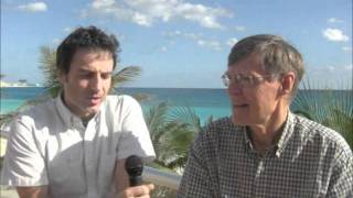
This is a short transcript excerpt from a 2011 YouTube discussion about a new medium-resolution, spatially-consistent tropical above-ground carbon stock dataset derived from satellite data and field samples. The speakers note that while the biomass map now provides spatially-consistent carbon-stock estimates over the tropics, it still needs to be combined with high-resolution land-cover/deforestation maps to assign carbon losses to specific cleared stands. The new dataset yields substantially higher total above-ground carbon than prior FAO-based estimates (about 41% higher versus FAO FRA 2005), and FAO's 2010 revisions also increased many country estimates—raising methodological questions and promising improvements for MRV and global carbon-cycle constraints.
Chapters
I've been thinking of this as the first time we've put together the spatial detail on deforestation rates with the spatial detail biomass. But you make the point that we're not quite there yet. So tell me again how you see it. We've put together the final spatial detail for biomass now, but we still have not really integrated it with a spatially highly defined rates of forest change, let's say. So we haven't made the final step, but at least we're ready in terms of the biomass map. Is that way to put it, is that the way you would?
Yes, I think that for, for the first time we had the possibility to generate a sort of medium resolution carbon stock data set that provide information on how much carbon is stored in the vegetation all over the tropics. The new aspect of this data set is that actually for the first time is consistent over space and over. Over time. This is different from previous estimates that they usually are based on existing forest inventories. And one of the limitations of existing forest inventories for the tropics is that unfortunately, quite often they are obsolete because tropical countries, they don't have enough resources to implement new forest inventories. And quite often they were mainly trying to estimate the commercial value of the timber. So they were not really providing a comprehensive sample of what the carbon stock was on the ground by using a combination of specifically designed field data collection and a series of satellite data. Well, we solved this problem because satellite data, thanks to the fact that it's continuous in space, is providing a very comprehensive estimate of how much carbon is on the vegetation. Of course, this is only one aspect, one data set that we need in order to improve and better understand the carbon cycle, as you mentioned. Yes, the next step is really try to combine this data set with high resolution information on land cover change. So that will allow us to properly assign a value of carbon stock to the forest that is lost. And this is different from what it is possible to do until now, because until now what we use is only an average value of carbon stock stored in the vegetation. We are not really able to assign the specific value of that specific stand of forest that has been removed. And so by having a spatial data set of carbon stock and being able to combine with the deforestation map, well, you are able to assign the appropriate value of carbon to the forest that has been lost. And I hope that this is going to help your work, that is focusing more on the, on the fluxes of.
How are your results? How do your results compare with what's come before? Besides, higher spatial resolution in terms of actual numbers, are you higher or lower or just the same? Right.
It is interesting to see that as a result of the study, we see that the result indicates that the total amount of above ground carbon stored in the woody vegetation in the tropics is actually much higher than we previously knew. If we compare our result with probably the most comprehensive data set existing so far on carbon stock, that is a data set published by the Food and Agriculture Organization of UN under their Forest Resource and Assessment project, we see that we report a 41% more carbon stored in the vegetation. This is compared with the Forest Resource and Assessment 2005. And just to give you a sense of the uncertainties that are out there in the estimate of carbon stock until now, if only recently, FAO published the new estimate based on the forest Resource Assessment 2010. And it is interesting to note that for many, many countries they revised the numbers and all the estimates are much higher than the Forest resource assessment in 2005. So Tizi is really pointing out a big question. What is the methodology? How reliable is the methodology that we have been using until now? And so with this new work with the data set that is based on consistent remote sensing options, we are really hoping to reduce the uncertainties on the.
Estimate for mrv, which is monitoring, reporting and verification of carbon fluxes. It's vital everyone will understand how a better estimate of emissions contributes to better MRV for such things as redd. It's also from a more scientific point of view, having better estimates of carbon emissions from tropical lands will put a tighter constraint on the understanding of the whole global carbon cycle. For example, are the natural sinks continuing to increase as in proportion to emissions or are they beginning to saturate and maybe lose their strength? Which is vital to understand whether the carbon cycles can continuing to work sort of in a favorable way to the human enterprise, or whether it's going to get tougher to manage carbon.