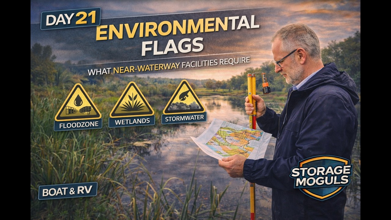
This content was created by Joe Downs. This content was uploaded by Joe Downs. This is a YouTube video titled "Day 21: Environmental Flags — What Near Waterway Facilities Require" (created 2026-04-09) featuring Joe Downs of Storage Moguls. It is a solo instructional episode in the Boat & RV 100 series that walks investors/operators through environmental risks for near-waterway boat and RV storage deals and a practical, two-hour desktop screening protocol. Topics covered include FEMA FIRM/flood zone checks, the National Wetlands Inventory and formal wetland delineations/Section 404 permitting, county GIS shoreline buffers, EPA ECHO and county assessor history for prior industrial/marina use, stormwater management triggers, and guidance on Phase I ($1,500–$3,000) and Phase II ($5,000–$20,000) environmental assessments and walkaway criteria. The host emphasizes making Phase I a due-diligence contingency in LOIs, gives tool links and time/cost estimates, and teases the next episode (day 22) with a complete due-diligence checklist.
Chapters
And welcome to day 21 of the Boat and RV 100 series. I'm Joe Downs with Storage Moguls, and today I'm showing you the environmental issues that can turn a beautiful near-waterway parcel into a deal you wish you'd walked away from, and how to find them before you spend real money on due diligence. These aren't edge cases. Near-waterway land is exactly where the boat and RV demand is, and it's exactly where environmental complexity concentrates. If you want everything we cover in this series backed up by a community of people actually doing it, come find us at storagemoguls.ai where operators share what actually happens in the field, not what the textbooks say. Folks, a mogul isn't just someone who holds a deed. The definition of a mogul is a sophisticated operator of inanimate assets, someone who's mastered the full arc from finding a deal to running one. That's what we teach because that's what we do. We don't buy storage. We acquire and optimize. There's a difference, and that difference is worth tens to hundreds of thousands of dollars per deal. We're made up of real people, couplepreneurs, solopreneurs, entrepreneurs just like you. Nobody here is selling you a fantasy from a stage they stepped off years ago. We actively evaluate real deals, acquisitions between $400 grand and $2 million. They're financeable and digestible, and we'll show you how. And we're about real results. Members in our community are becoming storage moguls, not someday but every day. And you can start for free and advance at your own pace. So let's get into today's episode, because skipping environmental review on a near waterway deal is one of the most expensive mistakes in this vertical. The land cost to water, I've The land closest to water is where the demand is, and it's also the most heavily regulated. Boats need water nearby. RV parks cluster near lakes and rivers. That proximity is what drives boat and RV storage demand in the first place. It's also where floodplains concentrate, where wetlands are most common, where shoreline buffers apply, and where prior industrial or marina use may have left contamination behind. A Phase 1 environmental assessment costs between $1,500 and $3,000. Missing an issue costs anywhere from $50,000 to well over $500,000 in remediation, permit delays, or deal collapse. The math isn't subtle. Phase 1 is not optional on any near waterway deal. Here's 5 flags, all of them screenable in under an hour from your desktop. Before you spend money on professionals. For FEMA floodplains, go to msc.fema.gov, pull the FIRM map for the parcel. Any portion in a special flood hazard area is a flag. Doesn't necessarily kill the deal, but it changes your site design requirements, your insurance costs, and potentially your financing terms. For wetlands, the National Wetlands Inventory Mapper shows delineated wetlands nationally. Presence on or adjacent to the parcel signals Army Corps of Engineers jurisdiction. Development near wetlands may require Section 404 permit, a process that can add 6 to 18 months and a significant cost. For the shoreline buffer, county GIS overlays show riparian buffer zones. Most states require a minimum setback from the water's edge, typically 50 to 200 feet, and this can significantly reduce your usable footprint on a parcel that looks adequate from a satellite view. To check prior industrial use, check the county assessor's property history and EPA ECHO database. Cover that in a minute. Prior marina use, gas station, or underground storage tanks on the site are the most common contamination sources. Phase 1 will catch these. But the desktop screen tells you before you order it. And for stormwater management, large impervious surfaces near water trigger stormwater review in most jurisdictions. A gravel lot may need engineered drainage and retention, so check the county stormwater map. You'll need a Phase 1 on every near waterway deal, full stop. It reviews the historical record for the site. Identifies prior uses that could have left contamination and produces a list of recognized environmental conditions, or RECs, R-E-C-S, RECs, that warrant further investigation. Phase 2 is physical sampling. You order it only when Phase 1 finds a REC that you can't dismiss. A Phase 2 is soil samples, water samples, testing of structures for asbestos or other materials. It costs $5,000 to $20,000. It really depends on the scope. Your walkaway criteria is if phase 2 finds contamination with remediation costs that materially change the deal economics, either the cost to clean it up, the timeline involved, or the liability exposure, that's your signal to walk. Not every contamination finding is a deal breaker though. The ones where remediation costs exceed what the deal can absorb They are. Most common contamination sources on near-waterway boat and RV sites, typically underground storage tanks from prior marina or gas station use, hydraulic fluid from vehicle maintenance, and stormwater discharge issues. A Phase I should suffice any prior— sorry, a Phase I should surface any prior uses that flag these. Wetlands are the most common environmental delay in your waterway boat and RV development, though, and the one most operators underestimate. The National Wetlands Inventory Mapper gives you a desktop read on delineated wetlands, but NWI's called maps are not definitive. If NWI shows wetlands on or adjacent to your parcel, order a formal delineation by a qualified wetlands consultant. Cost should be between, again, $1,500 to $3,500. That delineation establishes exactly where the wetland boundary falls and how much usable land you have. If your development plan involves filling or disturbing any wetland, you need a Section 404 permit from the Army Corps of Engineers. The process takes 6 to 18 months minimum, and it's not optional. You cannot build around it. The most practical advice? Design your site around the wetland boundary rather than through it. A setback and a buffer zone are far cheaper than a 404 permit process, and the buffer actually improves the site aesthetically for boat and RV facility near waterway. So here's the screening sequence. First, NWI mapper. It's free, takes 15 minutes. Then formal delineation if NWI shows anything. Then site design that respects the boundary. And then 404 permit only as a last resort when avoidance isn't possible. For FEMA flood zones, pull the FEMA firm map at again mse.fema.gov before you do anything else on a near waterway parcel. It's free, it takes 5 minutes. If you see Zone X unshaded, that's minimal flood risk, no action required beyond noting it for your insurance package. If Zone X is shaded, moderate risk. You're in the 500-year floodplain. Check local ordinance requirements. It may affect lender terms depending on the institution. Zone AE, this is the 100-year floodplain. Flood insurance is required by any federally backed lender here. Structures on the site may need to be elevated above the base flood elevation. You're going to want to discuss this with your lender early. Some are more comfortable with AE zone deals than others. Zone VE, that's Coastal High Velocity Zone. That's the most restrictive FEMA designation. Construction requirements are significant. If the parcel is primarily in Zone VE, you're going to want to reassess the deal economics before you go any further. Insurance costs and construction requirements can materially change the return profile. Here's an important note, though. Boat and RV storage with gravel surfaces and no permanent structure is often treated differently in the floodplain review than buildings. So clarify this with your engineer and local floodplain administrator. Open-air gravel storage may be permissible in AE zones where structures would require elevation. These are the 5 free tools and about 2 hours of desktop research. Do this before you spend a dollar on professionals and before you sign an LOI. Before you sign an LOI. FEMA MSC MSC dot FEMA dot gov. We discussed this already. Enter the parcel address and pull the firm map. You'll know the flood zone designation in under five minutes. The NWI mapper, Fish and Wildlife Services wetlands mapper at fws.gov/wetlands. This shows the delineated wetlands nationally. Not a substitute for formal delineation, but a Fast desktop indicator. Your county GIS— most counties post their GIS data publicly. Look for the shoreline buffer overlays, special environmental protection zones, and stormwater management areas. 20 minutes of GIS review often surfaces issues that would otherwise wait until Phase 1. And then EPA ECHO, which is the Enforcement and Compliance History Online database at echo.epa.gov. Search by address. Prior enforcement actions, underground storage tank registrations, and Superfund site proximity should all show here. County assessor history is where you can look at the property's use history. Prior marina, gas station, or industrial use on or adjacent to the site is the most common contamination pathway. A 5-minute records search can tell you whether the prior use warrants specific Phase 1 attention, folks. If any of these screens surface a flag, order the Phase 1 before you sign the LOI. Make it a due diligence contingency in the agreement. All right, let's review. Near waterway land is where boat and RV demand concentrates. It's also where environmental complexity concentrates. 2 things are inseparable. The screening protocol is free and takes 2 hours. 5 tools, all publicly available, all searchable by address. Do this before you sign an LOI or really contract. On any near waterway deal. Phase 1, not negotiable. $1,500 to $3,000. Make it a due diligence contingency in your LOI and your contract. We cover the exact language on day 24. Phase 2, only when phase 1 finds something. Know your walkaway criteria before you order it. What remediation cost makes this deal not work? If phase 2 finds contamination above that threshold, you walk. Have the number in advance. All right, next up, day 22, your due diligence checklist. What self-storage investors forget to check. We'll build the complete due diligence checklist tomorrow, everything in one document, including all boat and RV specific terms that self-storage investors often miss. All right, please like, subscribe, and share so you can show your network you're doing the work. Plus, ring the subscribe bell. You won't miss day 22, one document, every due diligence item in that order. And remember, environmental issues don't care when you find them. Finding them early is a negotiating tool. Finding them at closing, well, that's a disaster. Screen early, order phase one, know your walkaway criteria. That's the protocol. Build it into every near waterway deal you evaluate. And of course, storagemuggles.ai has the full framework. You can start for free and level up at your own pace. So join us at storagemuggles.ai. We build operators. Not spectators. Tomorrow, complete due diligence checklist. Every item, right order, nothing left out. See you tomorrow.