Mapping the Arctic, Charting the Future
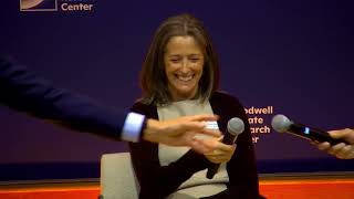
Woodwell scientists Sue Natali and Greg Fisk discuss mapping permafrost thaw across the Arctic. The Permafrost Pathways project models how thawing could eat up much of the remaining carbon budget, and works with Indigenous communities on adaptation. They explain why maps matter for policy and the logistical puzzle of collecting data in remote regions.
Questions this video answers
Around 2005 (he said he's been here 20 years).
2012 (she said she came here in 2012).
About 160 people, ~90 scientists (≈50 PhD scientists), and an annual budget of roughly $36 million per year (as stated by Max Holmes).
Permafrost contains about three times more carbon than all of the world's forests (statement by Sue Natali).
Permafrost thaw could take up to ~22% of the remaining carbon budget (statement by Sue Natali).
Chapters
Sam.
Welcome, everyone. Welcome everyone. I don't know if this is working or me, but welcome. It's wonderful as always to see a bunch of people that I know really well and to see a bunch more people I don't know at all. We like both groups to show up here. Certainly one of the goals of this series, Woodwell Climate Conversations, which we started in January. So I think this is our eighth in this monthly series. Well, it's to get people in our door again. We did this pre Covid. We love it when people come here. We're proud of this building, we're proud of the people that work here. We're proud of our scientists and the work that they do. And we're proud of all of you who help us do this stuff. So thanks to all of you who have been with us for a long time and thanks to the brand new people who are here for the first time who will be with us for a long time. Let me see a couple of things I want to bring up. As I said, this is our monthly series, Woodwell Climate Conversations. And they're pretty informal conversations where I. Did I say who I am? No. Max Holmes. So I'm the president and the CEO and I have the really easy job here where I'll ask some really open ended questions and then the really interesting people will, we'll take it from there and we'll see where it goes. And there'll also be the opportunity for all of you. We'll save, I don't know, a bunch of time at the end for audience participation, you to ask questions, make comments and we'll just kind of see where the conversation goes. We have really incredible people that have participated in the first seven of these monthly things. And that certainly holds for who we have up here tonight. Sometimes they're external speakers, sometimes they're staff. Tonight we have two of our staff members and I'll say a little, you'll learn a lot more about them in a minute. But I'll just, you know, just as examples of the kinds of people that we have here. Our last speaker was Gina McCarthy. I suspect a bunch of you were here to hear that. And those of you who weren't, you probably know of her and she, you know, that was a fantastic, I don't even know how to describe that conversation, but it was, it was a good one and a unique one. Max Holmes. Yeah, I am Max Holmes and the president and the CEO. Yeah. And I've been here for 20 years. I've been in Woods Hole for 30 years. I first went to the Ecosystem Center. John Hobby's here somewhere. John was my running the Ecosystem center when I was there. And many of you will know that George Woodwell, who founded this place was the founding director of of the Ecosystem Center. Anyways, I could talk forever, but that's not the point tonight. Let me get to some of the points. John Holdren spoke before Gina McCarthy. John Holdren, most of you know John. John had been the president of this location of this organization. He was also Obama's science and technology advisor. Spent all eight years in the Obama administration. So just examples of the amazing kinds of people that, that we get to participate in these conversations tonight we have Sue Natali and Greg Fisk, two of our scientists here. And one of my goals when we certainly when we have. Well, let me mention our next one. Sorry, September 18th again we'll have two more of our scientists, Jen Francis and Christopher Schwam. September 18th, I think that. Is that a Wednesday? I don't know what it is. Be here Thursday. Somebody says a Thursday. Another will be a fantastic conversation. But today it's sue and Greg. And one of the goals of all these things, whether it's internal or external speakers, is to get to know the people a little bit. And for Woodwell Climate Research center, what I want you to know, and most of you already know that what I want the world to know is we have amazing people doing amazing things in amazing places. People, things, places. And so we're going to learn a little bit. We're going to get to know the people today and then learn about some of the work that they do and some of the places they do that work. So yeah, my first question to each of you and maybe sue can start off but people who accomplish incredible things and each of you are in that category. I'm always curious what they were like as a 10 year old. You know, how did they. It was about 10 year old sue and you know, would your elementary school classmates be surprised to see what you're doing now?
I had a have. Of these things. I had no. So I guess those are kind of maybe some ways where I think people would be surprised. But then at the same time I think people who are quiet sometimes you're always like observing and taking it in and you're watching how people are responding and you're seeing what people's needs are. And so that's always really important to me. I have a big team now and I think I hope I still. My mom. Yes. Okay. So my mom had a very bend to Her I can go over even closer. Yeah, how about that? Everything she, you know, she was having meetings in our living room about, you know, writing letters for, you know, changing policy about hunger. And so that was just always a thing that I thought was normal because that just always happened. And then both my mom and my dad were very much like really, really hard workers and go getters. And so I think I kind of got that sense of, yeah, you should do the thing that's right for your people and your family, but also like the not just do for yourself. So I think I just got that mission driven way of functioning. I just thought that's just what you do. And so I went into the sciences partly because I thought it was the easiest thing to do in college. I just. So I was like, I'll do that. That's kind of an easy subject. It really wasn't like I didn't know what it meant to be a scientist and then was very fortunate to have a mentor who saw things in me and realized like what my interests were. I mean, I didn't even have any outdoor experience, you know, so it was really like very, very, very much value, a mentor. It took a while for me to get there, but I don't think it was totally disconnected from the places I was in as a kid and the people I was around and who I was. I'm a little bit louder now sometimes.
Yeah. As the president and CEO, I was thinking, God, I wish sue was still quiet sometimes. Only sometimes. Yeah. Greg, same question to you. Let's talk about 10 year old Greg.
Okay, just 10 year old Greg. Let's see. 10 year old Greg lived on a farm in New Hampshire, a family farm that was owned by the family since the 1700s and is still owned today by the same family. 10 year old Greg was probably running around the farmyard with no shoes on or getting into trouble somehow. This farm was adjacent to many hundreds of acres, maybe thousands of acres of conservation land, open space. So I think about now as current Greg, focusing on geospatial data, thinking about geography, thinking about maps and the stuff that I do was clearly influenced by that. I have clear memories from that age, maybe not 10, but somewhere around then, of intentionally going into the forest, saying, I'm going to get lost today, I'm going to get lost today. And of course I'm here. I didn't get lost. I found my way back. But I don't know, I like to think that wandering around the forest built that geospatial portion of my mind and it helped to develop that. And I'll stop there. But you have more questions as we move on?
Yeah, we'll have more. And I'll maybe ask each of you how you got to Woodwell. But first, this is part of the audience participation part. This is raise your hand if in the last three weeks, you spent more than eight hours on a horse in Mongolia. Okay, so we'll get to that later. Sue, how'd you get to Woodwell?
Can you hear me? Oh, yeah, just keep it off. I came across you in Russia. Siberia definitely convinced me to come here, but I had my eye on Woodwell because I was like. When I got out of college, I was like, do I want to do science or do I want to have impact? So that goes back to just this thinking that everything you do should have impact. I thought that's just how all humans functioned, but I thought these were two separate things. And then I found out about this place called Woodville Climate Research Center. I was like, wow, science for impact. What is that? That was really surprising to me. Also, this team of people who were here also at the mbl, all of the Arctic research that was happening, I was just, this is the right place for me. And so then I was in Russia with a colleague. Max was in Russia with the Polaris project. And it just was. Really had a huge impact on me, working with students, seeing, like, scientists working together and collaborating. I was like, wow, this is like the vision of science that I had, that I didn't even think this was real, but it really was. Like, it was a special. It was a really special time and a really special place. And so, you know, on the way back from that. I think we got back from that trip, we got me on a plane, Everybody was delayed. But I had to come here to do my interview. Went right from Russia to here to do my interview, and here I am.
Greg. Well, first, all of you, if you haven't already seen it, when you leave, walk out these doors, look right to the left. And so this organization was founded in 1985, and on our 20th anniversary, so 2005, which is when I came here, but for that 20th anniversary anniversary, somebody put together a graphic that shows all the employees with the earliest employee at the top. So George would have been there. Ski Houghton, who's here somewhere, is, I don't know, probably number two, one of the very earliest. I was at the very bottom of that list. Greg, you are above me. So you are maybe the second longest serving staff member here. So the question how'd you get Here. And why are you still here?
Good question, Max. Well, a large part of it is a man sitting back. Tom Stone. Let's see, late 2001, I got an email from Tom Stone saying there's an open position here at then called Woods Hole Research Center. And you remember 2001, what happened in September that year? It was hard to find jobs due to that. And I was in New Hampshire. I had actually just left the Lawrence Livermore National Laboratories doing geospatial work there. So I had a good amount of background science and geospatial stuff. And I said, what the heck, I'll come down to Cape Cod and see what this job is about. I came down to Cape Cod and met Tom, hit it off with him. But then I also met George. And a lot of folks here in the room know George. George was a daunting man. And I remember Tom dropped me off at his office and he said, you're going to talk to the director for a while. I go in. George's got a big pile of papers on big desk that was made out of a door that he fabricated himself. And on the top of the pile of papers was a map. I'm like, well, here we go. George and I talked for a long time. The rest is basically history. But we talked about maps. George said, I want to have a map of the world's forest, and, you know, I want to have a map of this. And he had a whole list of maps he wanted to have at that time. And I was like, I can help you out with that, George. But we also talked about farms. He had a farm in Maine. I have a farm in New Hampshire. We talked about that. And we also hit off there as well. But it was supposed to be a temporary job for me. I wanted to be a temporary job. I wanted to move on in science. But I really found quickly that I filled a niche here. There was a niche. There was a need for coding, geospatial analytics, working with geospatial software, and, of course, maps. I fell into that black hole, and then it never came out.
Can I say something with the niece that he feels? I think the other place that you feel, though, is that you can communicate with scientists and you can communicate in those maps. And so when I. I think now I can talk your language a little bit better. But when I first came, there's a lot of back and forth of like, I want this thing. I don't know how to communicate it. And you can do that. So that ability to take in information and understand who your audience is. And that's really, really critical. Like, that's, that's the, I think the core thing of like having those maps.
Why they're so special, and that goes back to this initial conversation I had with ge, is that he had the urge to communicate the science that was happening at the center. If you get a chance to go upstairs and see the map table, I have a diagram on there where cartography lives in between science and art, which we all know. It's kind of combining science and art, but also within the realm of science. You have on the top, I put another circle of the cartogram that says wonder. So you have a hypothesis in science, you are curious about something and you can work your way through those maps and get to comprehension. So we have a conclusion. And that's an iterative process that we've worked with the scientists, I work with the scientists, we take data, we turn it into a map, we go back to the scientists, we go back to the research group, we talk about that and we iterate again.
There's absolutely no doubt that Greg is one of the very best makers of maps, synthesizers of data, communicators about scientists science that there is in the world. There's also no doubt that sue is one of the absolute greatest, I'll say Arctic scientists, but I could even drop the Arctic. Just an amazing science. And we haven't spoken about the work that sue does yet, but I want to do that. And I'll say, well, sue came here in 2012. A few years ago, sue became the leader of the biggest project we've ever had, the Permafrost Pathways project. Sue, if you could tell us a little bit about that and what that project's about, what you're accomplishing, what remains to be accomplished. Take it wherever you want to take it.
Yeah, thanks, Max. So, yeah, so Permafrost Pathways is a project that was funded through Ted Audacious. Through that, a lot of donors come together and fund large scale projects. And also gave me the opportunity to give a TED Talk, which was a really nice opportunity to get the word out about the work we're doing. The project looks at what are the climate impacts that are happening in the Arctic, what are the local to global impacts of that. So it's really looking at, and then what are the solutions? So really looking at how is climate impacting us in one region and how is the world connected? And so some of the work that we do is really all of the work we do is state of the art science looking Mapping permafrost thaw across the Arctic, mapping disturbances across the Arctic. What are the carbon consequences of that? How much carbon dioxide is being taken up because plants are growing more, because it's warmer. But how much is being lost and how much methane is being lost? And being able to do that, the way we've done science before this was you get a small grant and you kind of do this opportunistic projects and you try to put them together. And this was an opportunity. How do we look at this big problem of this huge place, this diverse place, this beautiful place, how do we really get a handle on this whole place at once? And so that's really what we set out to do. Like, is the Arctic source of carbon dioxide and methane? Is it a sink? So that's one aspect of it. And then modeling what's going to happen in the future. Like, how does the Arctic change impact our global.
Come to me and say your maps are awesome. And in my perspective, it's, in a way, it's cheating because I'm using some of the best data possible.
I don't think reflections or I think it's the amplification, not reflection. Right?
Yeah. And so a lot of folks who do what I do work with pipelines and fire hydrants and roads, things, and that's cool stuff. But when you start mapping all the stuff that came out of that's coming out of the project that sue mentioned, it builds fabulous maps, and these fabulous maps inspire people, and they bring people to the table. And these maps cover common ground, and they bring us to common ground. So that's a very important thing. And the one portion of the project that sue just mentioned is the adaptation portion, where we're working with folks on the ground throughout the Arctic. There's 10 communities we collaborate with directly in Alaska, and we work with them to help them tell the stories they want to tell through the format of maps. Maps are this common language that everybody understands. So it's a really good way for us to communicate both what's going on in their community and how our science can help that. So coming back to Mongolia, I had six days notice to work with some folks at icr, which is the International center for Reindeer Husbandry, who we've collaborated before with before, to go there and to meet with some Duha reindeer herders, folks who have been reindeer herding in that area for thousands of years and are now facing quick, drastic changes to their way of life due to political changes, changes in conservation lands driven by the government, and of course Climate driven changes as well. And what we want to come out of that is to learn from them, to build beautiful maps. This is part of the permafrost zone, so we can go there and we can do some of the permafrost stuff that sue mentioned before. It's not Russia, but it's just over the border from Russia and do stuff like the map you're seeing here on the side. I don't know if you had a chance to see this on the way in, but do take a chance to check it out on the way out. This is an example of a map that we exchanging.
There's a lot of knowledge exchange. We have a steering committee. We have Russian scientists on that through the Arctic Monitoring and Assessment Program. It's sort of a research program that's like multiple nations get together. We are through that can publish some papers with Russian scientists. So we're working to do what we can. We're working, you know, to continue our collaborations. But there definitely has been a pause. And that said, we have shifted a little bit. You know, we're doing a lot more work with Canadian colleagues. The Canadian High Arctic. But Russian ecosystems are unique. You can't just think you can measure something in Canada and it's going to be like a Russian large forest.
Very different, but we can get pretty close and maybe. Let's hear about what Greg was doing a few weeks ago. What got you to Mongolia? Why were you there? What were you doing? What is Woodwell doing in Mongolia? It's a place we've never done any work before.
Yeah, let's see. So Mongolia, that was a surprise. About a month ago today, I had six days notice for a trip to Mongolia, so I had to prayer quickly.
My wife is in the background here and I'm just trying to imagine how that would go in my home.
It didn't go over very well. Yeah, entirely. But let me step back before I get to Mongolia. Sue just said a lot of things. And prior to that, Max said, I make awesome maps. And there's some maps that you can judge for yourself throughout the building. But building on the stuff that sue said, I think my maps are a reflection of just the good science that's happening here. A lot of times people come to me and say your maps are awesome. And in my perspective it's, in a way it's cheating because I'm using some of the best data possible.
I don't think reflections or. I think it's amplification, not reflection.
Right, Amplification. Yeah. And so a lot of folks who do what I do work with pipelines and fire hydrants and roads, things, and that's cool stuff. But when you start mapping all the stuff that's coming out of the project that sue mentioned, it builds fabulous maps. And these fabulous maps inspire people, and they bring people to the table. And these maps cover common ground, and they bring us to common ground. So that's a very important thing. And the one portion of the project that sue just mentioned is the adaptation portion, where we're working with folks on the ground throughout the Arctic.
Knowledge systems, indigenous knowledge systems, our technical expertise, which includes our mapping, but our modeling and our, you know, different ways that we measure things, and how do we bring that together to both observe change, but also to provide information in a new way to respond to that change, to order, you know, in order to see what's happening in the near future. Another big component of this project is we want to have impact. And so that's policy work that we do with our. Our partners, John Holdren and his team at the Arctic Initiative at Harvard. But really taking this science and taking it from the start, like having walking hand in hand with policy experts at the start, not just doing our science and then crossing our fingers and hoping that it has impact. And so we've done a lot of work strategizing at all levels of policy, and I recognize we've had to pivot a little bit recently because things have changed, but we haven't halted. There's a lot of work that still continues. So that's a big part of what we do. And also communicating this to people and thinking about how do we communicate what we're doing, the impacts people are having, and then how do we respond to it?
So in case anyone's wondering, what is permafrost? What is permafrost and why should we care about it?
Yeah, so permafrost is frozen ground, perennially frozen ground. It's underneath most of the Arctic. It's underneath some mountain areas, Tibetan plateau, and it contains a lot of carbon. So. So you should care about it, even if you don't have a house on permafrost, because it contains three times more carbon than is in all of the world's forests. So we all get a handle on, yes, we should care about the world's forests because we know that they control our climate. They take up carbon dioxide, they store it. It's good for us. Right? Permafrost has a lot of carbon that's in it. It's frozen. When that carbon thaws, it can be released into the atmosphere as carbon dioxide and methane. Sorry, I should have started with that. And so that's why we all should care about. The other reason we should care about it is for folks living on it and for those of us who care about people and maybe not just the place where we are. It contains a lot of ice. And so when the permafrost, when it gets warmer and it thaws, the ground actually collapses. And so that means people's houses are collapsing, roads are collapsing, infrastructure is collapsing, plants are changing, you know, all sorts of things. Lakes are disappearing, reappearing. So there's a lot of impacts that are happening, happening on the ground across the Arctic.
You mentioned we met in the Russian Arctic. We've spent a lot of time there in permafrost pathway. And Russia is half the Arctic, or two, depending on how you categorize it and talk about how what's happening geopolitically has influenced the permafrost pathways project, how we're able to try to kind of think about the whole Arctic, but maybe how you've had to shift where we do some of the work because of what's going on with Russia.
Yeah, so so many. I mean, that's the wars. Like, our science is. Yeah, the war is terrible for, like, all the reasons that we. That we know. It's also had a big impact on the science that we do. And we have a lot of Russian collaborators. We're prepared. You know, we're setting up monitoring equipment across the Arctic. You know, just signed an agreement and the war broke out, and then that's the end of that. And so one of the things maps.
Are this common language that everybody understands. So it's a really good way for us to communicate both what's going on in their community and how our science can help that. So coming back to Mongolia, I had six days notice to work with some folks at icr, which is the International center for Reindeer Husbandry, who we've collaborated before.
We're trying to do is look spatially at where are we taking measurements and where are the biggest gaps. And the biggest gaps are in certain areas, Siberian Arctic. So when we set out to instrument the Arctic to measure permafrost thaw and carbon emissions, you know, a big priority was going to be in Russia, and that had a change. There is still some work we can do. There are some, you know, work you can do with satellite data to map some of the changes, but for the carbon consequences, it's a little bit tricky. We do still work with our Russian colleagues. But we, for the most part, you can't take data and then publish it because it puts people at risk, even if they are sharing it. We are trying to provide technical support so that we can keep measurements going so that data will eventually be available. We are.
It was co directed or co produced by my colleague Christina Shintani and some Sami reindeer herders, Ravna, Barre, Moore Maja in Norway. And it tells the story about how their traditional way of reindeer herding has been changed by climate and other obstacles in that region. So we're trying to replicate that in Mongolia. And it's a fabulous place. I got to spend three days on what was called the West Taiga, so with a group of nomadic reindeer herders who own four teepees. And we spent time in a spare teepee with them at about 10,000ft and it was snowing there. It was beautiful. We also went to a place called the East Taiga where there's about 20 families or a larger group of people. And what I wasn't told on the way there is that the only way to get there is on horseback. And fortunately, going back to that farm, I've had plenty of experience on a horse, but that was a long time ago and it seems like those saddles are getting small. So it was a good trip. And now I'm back. I was just going to add one more thing. I get to be trained on riding reindeer at the time, in milking reindeer. The folks in this part of the world, they don't slaughter their reindeer or eat their reindeer. They use them for work animals and they use them for milk and cheese and tea and stuff like that. So we get to learn that as well. And so it's a fabulous trip. We actually just got funded by the internal FCS grant Fund for Climate Solution to go back next summer and hopefully produce some maps similar to what you see here and to work more with the folks in that region.
In a minute, we'll open it up.
To questions because I do want to just point out. So you got a call six days before you left, but it actually started at the Arctic Initiative with John's team, who introduced us to the International center for Reindeer Husbandry. And that's really where, like, the science and the policy holding hands together from the start allows these things to happen. And I think some people are like, what does mapping have to do with policy? But, like, policy is all about space and borders and who's using whose land. And so it's really the core of what we do. And so the objective, like, Greg can now ride a reindeer and milk and have these new skill sets, which is awesome, and that's really important to us, and make beautiful maps that are art, but also there is a purpose because there are people whose voices aren't being heard. And maps are a great way of communicating that. And people can now take these maps and bring these maps to their decision makers and make, hopefully make sure that people are more at the table. And that's really where all of the work that we do, that's what centers it, and that's what kind of really motivates us and propels us forward.
So in a minute, we'll open it up for questions from the audience and we'll kind of go back and forth. But, sue, if you could talk a little bit more about what permafrost pathways will be doing over the next few years and sort of. Or the next year sort of plans in the field or synthesis or.
That's where we left off. So we've had a. It's been really, you know, this project's been quite unique because it gave us a lot of money and a lot of time to do science in a very different way, to sit and listen. And so what we thought we would do going into it and what we're doing now aren't necessarily the same things, which is really nice. And so there's been a very strong interest from our indigenous partners in Alaska and elsewhere in learning GIS and learning mapping. And so we did a workshop for people. Some people had never used a computer, and it was unbelievable because they're all using GIS now.
Geographic Information System.
It's a software to make maps. Right. And to analyze geospatial data. And what that allows them to do is, you know, they. Whereas you. I might go, you know, if I'm. Someone from a village may go to a consultant. They make a map on flooding in their community. It's often not right. Right. I mean, it's based on data. There's not a lot of satellite data. The people on the ground know what's happening. They can now make their own maps. People are making maps with indigenous people place names so that they can share with the communities. Like, it's been incredible what has happened over one year. Like, I have never, like the learning curve. I'm like, wow, this is amazing. I never thought this would happen. People now are recognizing the community members are also really interested in drones. And in the. It's so cloudy in many of the areas of the north that you don't have satellite data. So the data you see on Google Maps, like you can't get it. You make, if you lucky, you get an image a year. And so expanding a drone program is a huge priority for us because people want to map how rivers are changing, where the flooding is happening, what's happening with their dump. Like all there's all sorts of things, search and rescue. And so in a very short period of time, two of our liaisons and the tribes have just gotten their drone licenses. One now has a drone. And so our goal really is to expand this drone program so that people, people are going from like measuring to mapping. Like, and like, I would love to move us out of the equation a little bit. You know, Greg still makes the most beautiful maps, but we don't have to be the ones doing it. And that sort of capacity sharing is, we're going to continue that. It's really, really like hot. People are just taking, it's taking off. It's really nice. So I think that's a big priority for us on the policy end. You know, there federally, like we've had to pivot obviously, but we are still, you know, we have a fly in to D.C. see, and our goal is, continues to be, as it always has been, to be a resource for policymakers. You know, the science that we do, we want that to inform decision making. I mean, obviously that's a little bit more challenging now, but we are still having face to face meetings with decision makers, with policymakers. And so we will continue to do that and we are continuing to do that on the science like mapping like these ground collapses that happen across the panarctic, making data available in real near time. That's also another priority. That, that's a little bit longer time frame. Yeah, continuing the work that we're doing.
Yeah. One, just to emphasize one thing, you mentioned the DC fly in. And so just what that is, we do this every year. Actually. The three of us, I think will be there this year as well as several others, staff members, board members, we'll be on Capitol Hill, we'll be meeting with members of Congress. Obviously there are challenges with the federal government, but we're still there. We're still, still talking to people on both sides of the aisle because times will change. We're making, we're helping progress to be made now, but we're also setting the stage for when there are more opportunities for progress. So yeah, I mean it'll be a different vibe down there this year than last year, I'm sure, but we're still at it.
Yeah. And it is important for people to know that, like, we are still here, we're still providing data, and also for us to be strategically looking. Where are the levers? And sometimes those levers are in places that support for mapping, like, oh, this senator is really interested in mapping. And so we have a very good and strategic team here and with our partners who help guide that. So it's not just we're not disappearing.
Go ahead, Greg. But we'll also kind of go to questions after.
Just quickly. So I'm just thinking that how many jobs where you go from lying on the frozen tundra in the teepee to wearing your map tie in a senator's office within a month?
Yeah.
That's cartography. Tell your kids and grandkids to pick up cartography.
Yeah. And I'd say that is a really special thing about this place. And I mentioned, like, we don't have this yet, but I want a series of photos of our staff. And certainly everybody sitting up here could do it, but a whole bunch more where it's exactly as Greg described. You're waking up in a tent or you're covered in mud digging permafrost, or you're in the tropics with bug butt, whatever may be the case. And then you're on Capitol Hill speaking to a senator or at the climate conferences talking with national leaders. And that is a really unique thing about this place. And I think sue did a wonderful job of describing it. Like, what brought her here and what. What keeps her here is science for impact. That's it. And that's what's special about this place to all of us, I think.
Super strange.
So, yeah. Questions, comments from the audience. Wait for the microphone, please.
What's a map that doesn't exist that you wish existed? So I expected a tough question from Andrew. Andrew, if you don't know, is the owner of the map store in Pawtucket, Rhode Island.
While Greg's thinking about that one, unless you have an answer right now, I'll kill a little bit of time, but I'll say, well, before I came to. I love maps and I love Greg, but before I came here, I never had. I can't make a map. Like, I can't make a good map. And I didn't know people who could make good maps. And so one of the huge things for me when I came here 20 years ago as a scientist was getting to know Tom Stone and Greg and having the ability to have somebody who'd kind of translate ideas or questions. I had to make a map and put that down. And then one thing that Greg will always say, and I think everyone recognizes, like once you're staring at a map, there's nothing better than a bunch of people looking at a map. And it's an answer to some questions, but it's the stimulus for many, many more questions.
So I'll give you a general answer and then a specific answer. A general answer is always my next map. That's, you know, and what I didn't say in my introduction of why I'm still here is that some days I find myself, I pull into the driveway and I literally run up the ramp, up the stairways to get to my desk because I'm so inspired by a map that I thought about while I was sleeping or something like that. And I want to get to it and sometimes I'm embarrassed to realize I'm running up the steps. But yeah. So the general answer is that my next map is the map that's not made that I'm eager to make. But our specific answer is we also have Jenny and Brendan are two of our scientists back here and we're working on a panarctic map of retrogressive thaws on. So these are abrupt thaw feature where the ground is sinking. And in that particular case I'm really intrigued because we're going to couple with esri, which is a large geospatial company in California, multi billion dollar corporation and use some of their horsepower to do this mapping at a very high resolution across the Arctic. And for me that's really exciting because it has the data side as the software, but also it's going to yield some really cool maps that will go on the permafrost pathways website. Have you done a map of loss of animal habitat which is the underpinning? Well, animal and fish, which are the underpinnings of the far northern diets.
No, I mean, but I don't know if you want it. You haven't. But I mean this map probably is the one closest to animals and land use change that we've worked on. This map here looks at land use, a reindeer migration herd and how it moves across the landscape and what are the pressures on that reindeer herds lands and those pressures range from wind turbines being put in to climate change. And so that is probably, I think the only animal one that we have. Yeah, I mean it comes from the data that we do. And yeah, a few years ago you apparently had a tiny talk with Obama and told him about permafrost and it suddenly convinced him to get really interested in permafrost and what was going on. And I wonder if you've had the same experience with a few people recently who had no idea what was going on with and why it was so important. So I would have loved to have any conversation, a tiny conversation with Obama probably was my colleague John Holdren here who had the conversation and got him talking about permafrost. And he did mention permafrost. There was a congressional briefing where there were senators who said they had never heard of permafrost. And this they didn't realize when they thought about the Arctic, they had thought about ice and all of a sudden they think about permafrost. I think, you know, it's funny because I forgot here to mention what permafrost was and that's a sign of I haven't done enough public talks in a while. But also, I'm just with my team so much and I'm surprised that everybody doesn't know about permafrost and we're still in that place and maybe it means we need to take a few steps back and really be doing some work there. And we are, and trying to get, you know, we have a great comms team trying to get out that out more broadly. But.
One person that does know about permafrost and also loves maps is Senator Lisa Murkowski from Alaska. Some of you will know her and we work closely with her and she shows some of our maps, Greg's maps, and is an advocate, surprisingly as much as she can be for some of the things that we care about. So that's an example of how we kind of work across the aisle where we can. To make differences where we can.
Yeah. And I will say Senator Mercad, like, she knows that she knew about permafrost, but she's been, she's really into maps and she also is very into the carbon consequences of permafrost thaw and interested. She's very like, very intelligent person and knows a lot about Alaska, knows a lot about the Arctic and has been and really engaging and as Max said, showed one of the maps that Greg and Brendan and the team produced at a conference. Very, very, very large map at an Arctic conference. And so she's definitely an ally in understanding and wanting to use science for decision making. I don't mean to change the subject, but I so associate Max and Sue with the Polaris program. Is that program still going on?
And do you want to talk a.
Little bit about what it did for Bringing young people into the profession. Yeah. So right now, Polaris project is a program where we brought undergraduate students to the Arctic. So Max started this in 2008 and brought students to Russia. We moved to Alaska in 2015, working in a really remote location in, in Southwest Alaska, Yukon, Kuskokwam Delta. A number of Polaris students are staff, current staff at Woodwell right now. I don't know how many, but I feel like I can think of four pretty quickly and there's probably more. When I go to major international science conferences, I see a lot of Polaris students there. So they're having a huge impact on Arctic sciences and also a huge impact on the way that we do science and making sure that science is inclusive. Because priority for us in that program was to make sure that Arctic science was available to all students who wanted for it to be available. And so it's currently on pause because we don't have funding for it right now. There is a grant that's submitted. A 2014 Polaris student, Nigel golden, who currently is staff at Woodwell led, is leading that proposal. We are not necessarily in a great environment for NSF funded science, so I don't know what the fate of it is, but that project, it really propelled amazing scientists and young early career scientists, but it also brought the three of us together in the field. I mean, one of the things that's really special about that is when you put a bunch of people in a remote location, students and faculty, and you're brushing your teeth together, you talk a lot of science 20, 24 hours a day, and you're thinking about and you're waking up to it. And so a lot of ideas are generated. You have, you know, no Internet, no other distractions, no nonsense of the world. And so you're thinking science 24 hours with people who are seeing a lot of things for the very first time. And that sparks excitement in us, it generates ideas and it has moved our science forward even in places where we may not see those specific studies students involved. But it has pushed us a new direction. So hopefully it will continue in the future.
Thanks so much. So you've made a number of references, vague or not, to the current political environment. And I think of maps as fundamentally a way to tell stories and to convince people of things that they might not otherwise believe. And so I am wondering if you could speak to, you know, has that served you recently? Have you had to change your tactics in how you make maps and what stories they tell and how that, how you envision that Moving forward, are you referring to as it served me or us in D.C. or. Yeah, just in general. In general. And, you know, I'm in climate science myself and thinking about how to talk about climate science with people who don't even believe in it. And maps often come to me as one of the answers. Yeah, I mean, just generally speaking, it's always going to serve us. I mean, as you say, maps are really good at this. Maps are like campfires. You put a map and people gather around, they'll stop the talk, they start to grease the wheels of communications, you start to interact, and people are emotionally connected to maps. You put a map out, people will find a portion of the map that they know about, and they start to reflect on their memories of that place. And then once they do that, you can start to connect to the data really easily because they've already connected to that map. So anytime we go to D.C. or we work with policymakers or any of that type of scenario, maps are going to be very helpful. More specifically, I'm thinking about when sue was talking about our Alaska Native partners and how they're inspired to do GIS and make maps and stuff like that. We didn't go into those communities and say, you have to use maps. They came to us, we were there, and they were like, I want to make a map of this, I want to see this on a map. And we would do things like bring in satellite imagery and just put it on the table. And they would start to point and tell stories, and then they would tell us about how they have to work with FEMA or Alaska DNR or any of these government agencies and how those agencies are using geospatial data and they need the answers in a certain geospatial format. So they came to us with these questions of how do I do this with gis, or how do I do that? How do I get to that map? And so they're doing the same thing, and we're enabling or trying to enable it.
And one other thing about, like, when we're in the communities with a map and just thinking about conversations, and maybe this isn't the political landscape that you're thinking of, but even when you put the map down and people come around it, and they're coming around it to tell you that your map is wrong, Right? Like the people are still talking. Right. So then you're having a conversation and you've created that common space and they're correcting you because your satellite image is old and the home is no longer there. The river's changed, but that's already brought people together. So I think that goes for many different, many different spaces where if people are talking, that's a good thing, even if they're telling you you're wrong. So maps are a great translator and they do tell a lot of stories. How do you balance data gone awry? Because these maps take a lot of data and in this landscape, that AI can ruin things and kind of be a deflector of what your purpose is. Just, can you talk maybe positive and negative of how data has helped you or hindered you?
Yeah. So there's something where you learned when you studied cartography is that early on you have to read a book called how to Lie with Maps. And the basis of that book is that maps are an agreed upon set of lies. And what that means is that math is an abstraction of reality. So you can't take real spatial data and make it real on an abstraction or else it'll be too big. So you have to abstract it somehow. But having said all that, the most powerful map is a map that's based in science. And I was saying earlier that my maps are good because the science is really good. And so if we have rigorous science that's producing really good data, we're going to have the best product, the best thing to show to the senators or to show to our neighbors or whoever we may interacting with. But yeah, we're in the realm of data being produced on the fly. When I started being, when I was first a cartographer, there was always data gaps. And so cartographers would put like, here be dragons. And we don't know what's going on here, but there's a blank spot over here, here. But now it's the reverse. There's so much data, there's gobs of data. This abrupt thaw feature map. I've talked about working with Brendan and Jenny. There just one layer that's going into that is an elevation Data set that's 19 terabytes. So there's so much data now our job is to sift through that, find the best, do the best science to get the best product, to put it on a map. Scientists have not always had the best.
Engagement with indigenous communities, but it sounds.
Like you've been able to establish really deep, respectful relationships with a lot of these communities. Can you just elaborate on how you went about that?
Yeah, that's a good question. And I have to say I am still learning. Like, part of it is just trying to like, get the resources and there's a lot of great resources and trainers out there to help with this, but part of it was just being willing not to have my own agenda and going in and listening. And we were fortunate enough to have this grant, like most grants are three years and you got to, like, have a plan before you go into the grant. I applied for a grant to the National Science foundation and said, I don't know what the outcome is. I'm going to meet with people and then we'll figure it out. I wouldn't get that granted. I don't have hypotheses. I'm going to go in and have a conversation with people and we'll come out and figure that out when we're done. Audacious allowed us that opportunity to do that, I guess. I recognize going into it that climate science, climate impacts are really, really complicated. And recognizing that we have, you know, we have an amazing team of scientists here, but we're very narrow in what we know and what we understand. And that's not how the world actually is. We try to put it together by coming together, but indigenous knowledge holders think holistically. And so recognizing like, okay, we need that if we want to understand climate impacts and how to respond. So sort of recognizing that as a priority, then that allows you to go in and be like, let me listen. Let me be quiet. Sue again, you know, and sit and listen and see what other people. People have to say. And, you know, it was. Is a privilege that we have. We've learned so much. I've learned so much about how the world works, how we do science. And so part of it was just really being open, being open to different cultures, being open to being uncomfortable. Right. Like, being uncomfortable in different cultures is, you know, you have to just allow being a learner, even when you think, you know, like, I'm the expert, and allow allowing that to happen. But then we were very lucky to have this project. We have a really great team right now and really great partnerships with our tribal partners. And so really keeping that going and keeping those relationships going is just core to what we do. It's cool to see it building.
Yeah. And I'll just add that we also now have several staff members who are indigenous people, which is helping us all to learn, which is just a fantastic change over the last several years. And certainly Sue's been instrumental in making that happen. Hi, I have a question about data collection for mapping. So this could probably go either way in terms of who answers, but I'm wanting to know what has been either the Most difficult data to collect. And how did you wind up collecting that data? And was there anything surprising that was revealed when mapping it or displaying it in a map? Or.
Was there a case where you.
The date it was too difficult to collect the data? And.
What was it that made that too difficult?
Yeah. And maybe as you're thinking about that or answering it, just describe a little bit more, either of you, about what it's like to spend a few weeks in the Arctic doing some of the work that you're involved in collecting data that ends up in maps.
Yeah, I'm thinking of the two parts of our data where you have the data that's coming out of traditional Western science, like a model is producing data, and some mechanical approach is producing numbers. But then you have the other side of working with Alaska Native partners or folks who live in these communities in the Arctic and taking their knowledge. You could be sitting with an elder who tells you stories for two hours and somehow extracting the information from that and putting it onto a piece of paper. So there's two different approaches there, and there's difficulties in each. Again, I pointed the example from my colleague Christina Shintani here, this map where she worked closely with our colleague Ravna, who is a Sami reindeer herder, and interacted for a good amount of time to extract what is the story, what is the information, what layers do we need to tell that story, and then worked with the rest of the team to get those digital layers to help tell that story. And that was the hard part, was building that relationship and just talking, learning the story and somehow putting it into a beautiful 2D space like this.
Yeah, I think. But that's like, often knowing what that story is and what information we need to get that story out is a lot of the work that we do.
Right.
Like even thinking about the map like that we're thinking about for Morris or something like that now. Right. It's just like we go back and forth a lot on, okay, we want to, you know, or I'm not the one doing the work. So I'm like, I want X, I want to get here. How do we get there? Right. And so that's a lot of back and forth. I mean, there is the going to the field to collect a data point where you have to take a helicopter out to get it, and then someone comes back and they lost their GPS unit. Like, those are the sorts of things that those are practicalities of collecting data. You know, ground truthing. It is hard to get out to many places in the Arctic. There's not roads like there are here. And so, you know, you want to map a retrogressive thaw slump. You know, these features, you don't always have satellite data because it's cloudy, and sometimes you need to go onto the ground or sometimes you need higher resolution information. So it means like flying out and taking a GPS along a river and walking it and walking it. And so it's, it is sometimes a little bit daunting because you're like, wow, I got these data. But it's like this tiny little speck on this huge place where there's so many rivers and so much erosion. And so, like, we do it and we can do it and we keep doing it, but it is like, it is a challenge. Like, there still are a lot of challenge. And a lot of the challenges are because a lot of the times you have to be on the ground to get the information, and it's really hard to be on the ground.
Time for one or two more questions.
Hi. Did you. And do you still work with Probable Futures?
Yes, we did, and we still do. So Spencer Glennon is the founder of Probable Futures. His career was at Wellington Management. We still work with Wellington Management. That's a partnership that goes back six or seven years. I'm not exactly sure. You'll hear probably more about that next month, perhaps. Spencer Glennon was there. He left there at a relatively young age, came here as a senior policy advisor. After he kind of went around the country and the world trying to. He became convinced that climate change was the real thing, that the financial community wasn't factoring it in, wasn't thinking about it as much as they should. He wanted to get in that game. He came and worked with us for several years, still affiliated with us, supports us, but he founded this organization, Probable Futures, took one of our staff members with him. But we. Allison Smart, but yeah, they do magnificent work in communicating climate science in ways that resonate with people. And certainly one of the ways they do that is graphics and maps. Alan?
Well, the reason for the giggle is usually I ask the same question every time we come here, but I won't, I won't. About a year and a half ago, my wife and I were traveling across Africa and we met possibly one of your scientists. It was fascinating conversation at dinner. We were surrounded by PhDs as far as the eye could see. It was incredible. But I have a question for you regarding mapping with the information that you gather and the melting of the permafrost. Do you have an idea? Do you create then A scenario as if we do nothing, how long will the permafrost survive? And, and what will that do from an atmospheric point of view? How much will it increase the CO2 content of our living environment?
And so we don't end on a down note, we can do about that.
So this involves our mapping work and our modeling team and Brendan and Elchet and others and Jenny. So we do, we do assess how much permafrost will thaw, what that means for global climate to stay below 1.5 or 2 degrees Celsius. We have a carbon budget, like how much carbon we have remaining. Permafrost thaw can take up to 22% of that carbon budget. So this issue with this is that it's not going into our bookkeeping or not fully going into our bookkeeping. So. So it will be very, very hard to meet these targets unless we account for this additional carbon emissions that we expect will come out of permafrost as it thaws in the form of carbon dioxide and methane. So that is a big part of what we're doing. And also getting, like, make. That's the policy part of it, right? Like, I don't know that we can stop some of this, but at the very least we need to know. You need to know your problems if you want to address your problem. And so getting the word out about this is the problem. And here's what we need to do address to address it. Max wants a positive note. So I guess the positive note is permafrost thawing. There's not a, you know, it's thawing because of everything that everyone is doing on this planet, right? Like we're, we're globally mixed climate. It's amplified warming that's happening in the Arctic that's causing the permafrost to thaw. That's going to cause our climate to warm even more. And that's not the good news. But the good news is as we reduce our carbon emissions elsewhere, we can also then reduce permafrost thaw. And so as we do that, we will then reduce carbon emissions coming from permafrost thaw. So it's kind of like we're not totally disconnected from the Arctic. We will be impacted, but we can also impact what's happening. And so I think that sense of like, we do have agency, we do have some control. And yes, there are challenges going on right now, but it's not. All is not lost. And every like 0.1 degrees Celsius that we control, that we keep our climate down means that much more permafrost that will stay frozen, that many more people who can stay on their traditional lands and that much less carbon that comes out of thawing permafrost.
Positive. If you go. Yeah, yeah. Here's a positive note real quick. So if you go to permafrost.woodwellclima.org right there on the homepage of the permafrost pathways page, there's a map with a scenario of current permafrost and future permafrost. I remember fighting very hard to get that to stay on the homepage. And I've gotten so many, not you others, so many complements on the map being right there. But it's a beautiful map and it has a slider so you can go back and forth and check it out.
Important thing about that map is you can see the difference in permafrost thaw when we do nothing. So a very high emission scenario. And when we do something, in both cases we're going to lose permafrost but we lose a lot less if we take action and if everybody takes action.
So join me in thanking sue and Greg. And this is, I mean this is for the amazing work they do for doing it for at Woodwell, for in trying times, continuing doing it. A few numbers I'm going to throw out there and then I'll say a couple more words about next month, September 18th. So I think I mentioned at the start, we're about 160 people right now at Woodwell. We've grown a lot over recent years. 90 scientists here, 50 PhD scientists. Everybody's here for the same reason, to make a difference. We're about $36 million a year organization that has also grown a lot. It used to be that the majority of our funding came from federal sources. Thankfully, 10 years ago or so we decided there's a vulnerability. We're really smart people here. We're vulnerable. If it's majority federal funding, we made the effort to switch and now it's only about 20%. And it's philanthropy, foundations and individuals that support it. So if you do the math, $36 million a year. There are about 100 people in the room here. No. Thank you all for. Thank you. Those of you who support, support us. I hope you're proud of the work we do here. We're thrilled to have you on the team. Those of you who are new to this place, thanks for being here. Come back, learn more, be part of this effort moving forward. It definitely takes all of us pushing and pulling and doing everything we can to make a difference for the future.
Thank you.
More from Tod
WHRC's Sustainable Science Speaker Series - Dr. Toby McGrath speaks on Sustainable Fisheries