Sandplain Grassland Conference
Bob Warnerall and Sarah Boyce discuss restoring New England sandplain grasslands and acidic fens. Speakers cover rare plant inventories, prescribed burns, seed-bank recovery, and invasive risks after disturbance. Examples include Westover Air Force Base restoration using fire, mowing, and soil amendments.
Chapters
All right, well Chris, thank you for that nice introduction and I'm psyched to be here.
I'm.
What I want to do in this short talk is just overview a little bit of that report and then focus in on what it says about sand playing grasslands and how we interpreted that. So very straightforward. The, the report, if you haven't seen it, you can download it either from TNC or the Native Plant Trust website. And my co authors were Michael Piantadosi and, and Bill Brumbeck. Bill's retired now. The three of us worked on this and we also had help from Arlene Oliveiro and Melissa Clark, who are part of the RTNC team. And then we had some great design help and it's a, the report is really awesome. I have to say. I hadn't, it came out in 2021, I hadn't looked at it for about six months. And just reading through it again last night, I was sort of overwhelmed with all the work we did on this report and how nicely formatted it was. So take a look at that when you get a chance. The motivation for this report, it was really motivated by Bill, Bill Brumbeck, who, you know, the Convention on Biodiversity had put out a global strategy for plant conservation. And that global strategy had some targets for plant habitats. Their targets were 15% of each ecological region or each vegetation type and 75%. So 15% conservation of each vegetation type and 75% conservation of important plant diversity areas. And Bill said, you know, I'd love to know whether we're meeting any of these targets. And, and he reached out to me and we started talking about how, you know, how you would actually determine that. And we thought we had at the time we said, you know, actually we have all the tools we need now to take a look at whether we're meeting these targets. And that's really what we did, really what we did. But we did one thing, we made some modifications and here's the modifications we made. So the global targets were very simple. 15% of each habitat protected, which we interpret as gap status 1 and 2. I'll say more about that in a minute. And 75% of all IPAs important plant areas protected. Well, so in New England we have, we do have a lot of protected lands, very strict protection. Gap 1 and 2 usually refers to land where the, the intention of the conservation is protection of biodiversity. But we also have a lot of land that we call multi use land. It's gap three that the intention is multiple uses, but it conveys a lot of biodiversity. Protection, this is particularly important for our large forest types. And then lastly we had been really digging into climate resilience and I'm going to talk a little bit about that in a second. And we really wanted to see how well we had conserved areas that were on climate resilient land. So we came up with our own New England target which you can see here, which is a little more nuanced than the global target. We said for each habitat type we want to have a certain amount protected as gap one or two, but we also want to make sure at least 30% of it is secured on multiple use land. And then we want to make sure resilient land makes up 75% of that. So we raised the bar a little bit and we brought in the conservation and then we, as we went forward we looked at both of these. You know, we looked at both the global strategy and the New England strategy as we went forward. So in, in order to measure this we had three base data sets and you know, the analysis was a pretty simple overlay of the three. The first thing we had was the terrestrial, the northeast terrestrial habitat map that our team had produced a couple years ago. The Charles Ferree was the main author of this and we spent many years on it and we had a lot of help and data from all the natural heritage programs and Natureserve. And it's a pretty, it's a pretty good map. It's not perfect but it's pretty good. So if you haven't looked at this map, it's online, you can zoom around and it classifies all that vegetation into nature serve ecological systems. The second thing we had was a nicely revised map of all the conservation lands, both the gap status 1 and 2 that are secured for nature and natural processes and, and also the gap status 3 which are the multi use lands that does allow extractions but have a lot of benefits for biodiversity. So we had a great map of that and finally we had our map of climate resilience. And the map of climate resilience is a map for all the diff in every eco region, for all the different soil and bedrock types. Where are the places that have the most connected microclimates? And if you haven't followed this, I want to just spend a minute or two on the importance of microclimates and they're very important for plants. So in this slide that I'm showing you here we took, we've taken the known occurrences of two plant species, you know, smooth cliff fern, sandpoint Giardia and We've plotted them out in terms of the landforms, where they occur. And, you know, and you already. You already know this, but it was fun to just document it. You know, the smooth cliff fern is almost always, you know, on a slope, crest or a cliff, you know, and it has an aversion to a lot of other landform areas. You can see the zero line here. And the things that are above are where you find this, and the things that are below are the things you will not. You know, it has an aversion to these. And then if you plant, if you put out the agilinas, you know, you see the opposite. You see, it has sort of an aversion to slopes, but you find it really on very gentle hills and hilltop flats and dry flats and moist flats. So it's. It really likes hilltop flats, dry flats, moist flats. It likes flat areas. And you can see that when you plot out where they are. So the point of this is that almost all of our plant species and most of our insects and vertebrates too, have preferences for certain microclimates. And the heart of our resilience analysis is to find places that have many microclimates available relative to their soil and geology. So in flat landscapes, these microclimates are pretty small. You know, in granitic mountains, these microclimates can be huge. But even the Small microclimates offer 10 to 15 degrees temperature differences and 10 to 20 degrees moisture differences, based on the fact really that species experience climate change very locally. And the climate near the ground is actually quite different than the regional climate, you know, because the planet warms, it gives off heat, and then these topographic microclimates distribute climate very locally. And, and I'm not making this up, I've been really enjoyed digging. You know, there's a huge literature now on microclimates, but there are even textbooks. You know, there's a textbook called the Climate near the Ground, you know, which talks about how different the climate near the ground because of topography and solar inflection and radiation. And this work got a big boost a couple years ago from a study done in England by Sugat and his team. They looked at 5 million locations. These were mostly plants and invertebrates, 430 species over 40 years. And they found, sure enough, you know, the local extinction risk was reduced from climate change, was reduced by microclimatic buffering. So we feel pretty good about this. And the great thing about microclimatic buffering is you can go out and measure it in the field and it's it's relatively stable under climate change. So even as the climate changes, the microclimates stay where they are because they're based on the enduring features of the planet. So our, what we did was we then crossed these three data sets, the habitat types, the securement and the site resilience maps to see whether, see how we were doing on conservation. And I'll give you very briefly look at the, at the matrix forest, we divided the communities into three groups. Matrix forest, wetland, and then the patch forming communities. I'll give you a brief look at the matrix in the wetlands and then we'll dive into the patch forming communities, which is where the sand plain grasslands popped up. So, so first of all, the, we had three broad forest types and each of those broke into more forest types. So there was 10 in all. And we looked at those and we looked to see whether any of those had, you know, met the 15% protection goal or the northeast goal, which was only 5% protected, but 30% in multi. And what you see here is the only forest type that really meets this is the montane spruce fir, high elevation spruce fir. There are some of our more common types, the low elevation spruce fir and the spruce flats. The northern areas and some of the northern hardwoods meet some of the New England goals. So they do have over 5% protected and about 30% secured. But what you see here is when you get down to the coastal, our coastal forest types, our coastal hardwoods and pine oaks, suddenly you're down into much lower amounts of securement and also lower amounts of resilience. And many of these forest types could not actually meet the resilience criteria or the securement criteria. Okay, then we looked, so that's 88% of the landscape there. Now we look 12% of the landscape is made out of wetlands. And again, we had the wetlands broken into specific wetland types. And here's the results for the wetlands. It's quite different than the forest. So there is a bunch of, of relatively smaller wetland types, northern bogs, peat swamps, peatlands, the boreal Laurentian bog. These met the global strategy goal and most of them met the New England goal too. So they had decent resilience and they had a large amount of protection and securement. Most of our freshwater marsh and our more common wetlands were in this middle circle here. They have moderate resilience, they had moderate securement. The only one that meets the goal is a very small one, the Acadian maritime bog. You know, and then again, some of our more unusual forest types, the interior flatwoods and the clay plane forests in Vermont were, you know, we're not meeting those goals either for securement or resilience. Okay. And then that brings us to the. The small patch communities, you know, was kind of my favorite group personally. But you know, they only, they only make up 2% of the landscape, but they have a huge amount of the plant diversity of the landscape. And they break in. Mainly there's cliff and talus outcrops and summits and then the grasslands, barrens, dunes, and that's where the sand plain grasslands were in this group here. And again, just to review as we get focused in the global target was just 15% of each habitat secured through effective management and restoration. And the New England target was the same 15% protected, at least 30% secured against conversion, and with resilient land making up 75% of that. So here's what the results look like. Now, again, the axes here, the axes on this side is securement and the axes on the lower part is resilience. Again, if you go over to the right, you can see that in terms of securement and resilience, Alpine tundra is doing great, meets everyone's goals. There's a lot secured and it has many microclimates. Then if you go down, you can also see that our acidic cliffs and summits that are calcareous cliffs and summits all also meet the goals. There's many resilient examples and they're pretty well protected. But if you come over here to this group C, this is where the, what we call coastal plain, heathland and grassland. That's our name for the sampling, grasslands. You know, it actually met the global goal. So it has 15% of the mapped habitat is under conservation protection. You know, however, it does not meet the north east target or the New England target because the resilience of this is very low. The resilience of the protected areas are down in the lower part. And that's because the area is very flat and fragmented. You know, really suggesting that we need to increase the goals. We'll say more about this in a moment, but you know, the goals that we set, it could not meet the New England target. And that was mainly the resilience holding it back. We also looked at the threat of conversion. We used a model from Purdue University, a model of estimated areas that would be developed by 2050. It's a pretty good model. It's not perfect. And this, this graph here shows you acres converted on the bottom part. On the bottom part. So that's raw acres and Then the percent of the habitat converted and this is estimated conversion by 2050. And what you see here again, the sand plain grasslands are right up in the upper left. You know, they don't, the, the number of acres is not huge because it's a small patch community, but the percent of the habitat is the largest, it's the largest of all the habitats in terms of the percent likely to be lost to conversion over the Next, well by 2050, whatever that is, the next 30 years. And again, you can see this goes true. This is true for a lot of our coastal plain and coastal habitats. They're under high risk of conversion. Down in the lower right, if you're interested. You know, a lot of our matrix forest types and our coastal ones, they, they have a lot of habitat likely to be converted, although it's still a relatively small proportion of the total habitat because these are big widespread dominant forest types. So we summarized all this in these two pages here. These are two pages from the report that look at sand plain grasslands and it shows the dis. You can look at this and see the distribution we had mapped for this community and the resilience score on it. The greens are more resilient, the browns are less resilient. You can look at that, you can look at the average amount of protection where we have it mapped, you know, by each state, which states are doing well, which states are not doing so well. And you can look at the predicted habitat map and, and we have a list of commonly associated species there. So you can look at all this on the, in the report and then I'll spend just a little bit, bit of time on our summary, you know, our summary and recommendations. We did them for each of the habitats, but for the patch forming habitats, you know, here's what we concluded, you know, that these are hot spots of plant diversity. They're particularly important as habitats of rare and endangered plants. They cover 2% of the landscape, but they sustain densities of rare species 10 times higher than wetlands and 40 times higher than our upland forests. You know, and that was based on an overlay we did with the rare species locations. So they're super critical for protecting plant diversity. Seven out of the 14 habitats do meet that global strategy goal. And for just another 7,000 acres of protection, we could actually meet that goal for every one of the small patch habitats. That's just the, the protection goal. But when you add in the site resilience, only four of them meet the New England target. And those four are all bedrock based habitats. So the conservation we said large conservation challenges are apparent for the low elevation sand and silt based habitat such as pine barrens and coastal grasslands. They're under high threat of conversion, really the highest of all our communities. Much of the current protection is on flat and fragmented land that is very vulnerable to climate change. You know, and conservation will likely require long term management. So we could meet the New England goal for all the patch communities with another 17,000 acres. You know, then we'd have 30% securement. But we really think it would require probably another additional 80,000, 88,000 acres of targeted resilient lands focused on those sand and silt communities to really bring the standard up to climate resilience. So both, both to capture more of the climate resilience sand plains that are out there, but also just to increase the amount of the vulnerable ones and manage them, you know, as a strategy for maintaining resilient systems. All right, the last thing we did was we looked at important plant areas and we define these as patches of resilience. So they all have high resilience, patches of resilience that had extremely high levels of diversity. And you can see here a number of the sand plain grasslands came in as patches of high resilience with lots of rare species populations. The highest was on the Vineyard, but several others around I should have, I'll have to do this later and send it out for you. You know, if you want to see exactly which ones are the sand plain grasslands, there's a whole bunch of the coastal ones here. And these were our suggestions of where to start. So there's several places, several sand plain grassland places that are currently not protected. And we suggested we start with the ones that had, you know, high, high densities of rare species populations. And when you look this lower humped curve here, when you look at the lower curve, you know, this is just. If you look at the important plant areas, you can see the distribution of them. Thus the coastal grasslands are here in gray. So the, the distribution of the important plant areas are spread rather equally across clay plain forest, coastal grasslands, calcareous outcrops, pine oak, rocky summits you could see. And then we concluded from the IPA analysis. Again our conclusion was that coastal sand and sill based habitats are vulnerable, especially vulnerable. The number of acres needed to reach our targets is not that large, it's relatively small. But it might be difficult to substate to sustain these habitats over time. So they're going to need long, long term management. You know, a clear focus should be focusing on those ones that contain right now Rare species both in the beach and dune habitats and also in the eight coastal grass coastal grasslands that we mapped out.
They have a lot more integrity than most of the other places and they'll work with you if you.
Okay, so that, that is the presentation. I wanted to save a few minutes for question and answer. Let me go up, let me stop sharing.
Thank you, Mark. Yeah, stop sharing. We have, yeah, we have a few minutes for questions. So if you stop sharing and we can see everybody.
Here we go. Okay.
And the folks want to raise hand to ask a question. I'll try to spot you.
I know your coffee's just kicking in, but.
All right. Jim Grimes, you have a question. I, I think that was a great talk. I happen to live in, in Montauk, New York. So we were all coastal grasslands at one time. I think, you know, a lot of our area is very, it's, it's protected, you know, by the agencies. But our biggest challenge is the conversion. Not the development, but the conversion due to non native invasive species into these areas and in particular the grasslands. You know, for many, many years out our way, we were burned off on a three to five year cycle that hasn't happened in now probably 60 to 70 years. And what we're seeing is that, that change in the, the plant makeup, both native and non native, which in turn has changed, you know, the whole coastal environment here for a lot of the grasses and the forbes and you know, it's really hard to get through the bureaucracy to get management plans on some of these, on some of these public lands that'll, that'll maintain the, the health of the grassland.
Yeah, I think you said it very well. You know, the processes, especially fire, the processes that maintain the grasslands. Yep. Have to be, they are not naturally occurring anymore, particularly in the more fragmented areas. And they really have to be replicated through management or, or the grasslands will change. I mean, I don't quite know. I know there's a huge fear that we would lose all the species. I don't quite know. Have you noticed?
I mean.
Well, you know.
Okay, I'm going to take one species in particular. Wood lily.
Okay.
What is it? Lillian? Philadelphia. Okay. As a kid, we've got a night. We've got a very various, you know, sort of grasslands. We've got some nice tall grass areas which are all in county and state park at this point. You know, they're totally protected. But here becomes the dilemma. When I was a kid, this was predominantly tall grass prairie that has now seceded to mixed shrub and woodland. And you combine that change of environment to actually wildlife pressures, deer pressures, you'd be hard pressed to find wood lily in some of these areas that were common, even common. Gerardia is one of those plants. You know, we protected areas but in the process of protecting the area we've lost these sort of disturbance events. So you're watching these plants very quick, in the case of Gerard, very quickly decline. You know they, they disappear in literally a few years. I think some raise a hope for us out here in the pine barren areas is I don't agree with the southern pine bark beetle as being the devil. I see this as an opportunity for some of the ground species, the terrestrial orchids, some of your bogland species in that for them to actually get a, get a, get a kick up. Because I'm looking for our area, I'm looking forward to the wildland fires that we're ultimately going to get in some of these spots as an opportunity to sort of renew and bolster some of our species. All right, anybody else have we have time for one more question before 9:15 and we move on to the next talk.
I'll just respond while we're waiting. Again, I can't see any other conclusion from our report that these small patch coastal sand based, silt based grasslands, if we want to sustain them, they're going to need, you know, they need huge commitment and long term management. And I think you ex your example James is perfect for.
Yeah, we have two more, Many more talks today will address this question. Talk by Sarah Boyce who's coming up next as addresses this head on. And I know later in the morning Mike Whittemore has been assembling just to put a plug for his talk, he's been assembling floras of a lot of these areas that Mark has mapped and documented the rare species. But clearly the need for management rises to the top of the concerns and invasives management of both shrubs and invasive species. All right, I suggest. Sarah, are you ready? I'm gonna, I'm just. The next talk is by Sarah Boyce and Sarah is going to report on an activity, a project that the Grassland Network actually took on together. And her talk is entitled Challenges and successes of Managing Grasslands as Biodiversity Hotspots.
All right, thanks Chris. I'm just assuming unless I hear otherwise, that you guys can all see my screen. Great. So I want to thank Mark for that setup and also to Jim for his questions. I think some of what Jim has noticed and addressed kind of come up in some of this work. And I know in Other talks later today. So, as Chris said, I'm Sarah Boyce. I'm with the Linda Laurie Nature foundation, which is based on Nantucket. But as Chris said, I'm going to be presenting on work that is collaborative within the Sampling Grassland Network. Excuse me. So we know, as you know, Mark noted, that the sampling grasslands are regional biodiversity hotspots and that these habitats are considered conservation priorities for, for their limited geographic range, the number of rare plants and animals that they support, and their fragmented habitats. You know, we've lost so much sandplan grassland that were originally on the landscape. The map that we have on the right is, you know, a little zoomed in from what we saw with Mark. But this is what we have as our current sandplan grassland locations. And you can see basically from basically central New Jersey to southern Maine, all of these dots represent properties that have sandplan grassland habitat, with the bulk being Long Island, Martha's Vineyard, Nantucket and coastal Massachusetts. And so these areas are protected, but they don't belie like, how many acres there are. So we know that as conservation priorities, the first step is really protecting these habitats. And so when we think about, as a conservation priority, how are we dealing with these habitats and the focus of the rare and endangered flora and fauna. So, as we said, the first step is really protecting. And we have in our recent Sampling Grassland Network paper that came out in Restoration Ecology, our calculations are a little bit different for the current status of protection, but we have about more than half, more than 50% of the known Sampling grassland heathland communities are under or owned by an organization with a conservation focus. So there's that level of protection. Another little more than 30% are owned by federal, state or municipal agencies. And then there's a remaining, I think, 17% or so that are privately owned. So we, in the first step, we're making progress or we're doing pretty good in that protection. But as we were just talking about after the last talk, it's really about, you know, the next steps are managing and maintaining and where possible, expanding sampling grassland habitat. And so that's the bulk of what we're going to talk about today, or I'm going to talk about today, and then we're going to touch on the creation. So, you know, Jim really stole my show of thinking about where the, what are the opportunities where we can create additional sandplan grassland heathland habitat to further protect not only the habitat as a group, but those conservation priority species. And so when the Sampling Grassland Network was founded in 2016, our goal was, you know, advancing the effectiveness of sampling grassland management, bringing together, as Chris said in the introduction, managers sampling grassland landowners, researchers, to kind of coalesce and synthesize the current knowledge and have a list of best practices. And so this is really like, okay, what do we know? What do you know? People have been working in this realm and in these habitats for a long period of time and can we put all this information together so it's easily accessible and then from there identify research needs, facilitate collaboration and then hold conferences like this, workshops, meetings, field trips to other sailplant grassland habitats to kind of continue to share this information. Excuse me. And so I mentioned we recently published a paper in Restoration Ecology. It is an open access article because we really want to be able to share as broadly as possible the information that many of you on this conference today have contributed to. And so our first step with this project was to synthesize the knowledge, as I said before. So looking through the published literature, many of whom are people are on the talk today, but we know from this work that a lot of the work is housed in the gray literature. So reports, management plans, state and federal reports, fact sheets for different rare species and certain conservation targets. And so we really wanted to be able to put all this information together. As I said before. And then to me, one of the best parts is really conducting the interview. So early on there were 31 practitioner interviews, many of you may have been interviewed yourselves, that really dove into expert opinion and the specific questions and everything that we use were available in our paper. But it was really to get a handle on, on the ground. What are people seeing, what are people noticing, what has worked, what hasn't worked, and what are the new problems that are being seen on the horizon. And so just really quickly, for the literature results themselves, we did have a mix of published and unpublished data, but what I am really happy with is the broad geographic range of the studies and they really match what that earlier map was of where the main sandplan grassland habitats are. So, of course, most of the literature came from Nantucket, Martha's Vineyard, mainland Massachusetts, generally, with a smattering of publications and, you know, reports and things from other areas that representing the distribution of the habitat. And I'm not going to go into a ton of detail about exact management methods, but this is one of the figures in the paper and it really looks at, you know, of the gray and published literature, it's really looking at, okay, you have. We're limited by what are the common listed targets that are in the papers and what are the common commonly used management tools that can be compared. So this is like kind of a first step and what I really just wanted to highlight here is that growing season burn has been the most successful at both reducing woody cover and increasing overall diversity. Followed closely by mowing and mowing either during the growing season or during shoulder seasons at reducing, once again reducing woody cover and increasing diversity. Grazing we have seen has been really good at reducing woody cover, not as great at increasing diversity. Of course this is limited by once again the papers that have, have all these, the commonalities that we could make a figure like this. And you know, there's also drawbacks to each type of management regime. Some are more expensive than others. It's really what tools are available to you, your toolbox, how big your property is, what you know, liability you're able to take on. And so this is something that was really helpful in putting together okay, for the last 30 to 50 years, what have people been doing and what's working. Of course there are many other tools in the toolbox of sandplan grassland management. Some are newer that have been, you know, document have less documentation but still some really good documentation that we're going to be hearing about later today. For example harrowing or disking that real heavy soil disturbance, selective removal, whether it's mechanical or using herbicide to remove woody, excuse me, to specifically remove woody individuals. And so this is where a lot of our interviews come in. More and more expert opinion is finding all the different tools that are available and there's lots of in our paper and on the Sampling Grassland Network website we have a lot more nuanced discussion for each of these tools. The, the drawbacks, the positives and once again it's really about your starting conditions and what tools are available to you. Excuse me, but the take home points in general, and this is a, once again a huge generalization is that the best management tools if you have for people who already have sampling grasslands and how do we maintain these early successional habitats is increasing that growing season disturbance. And so really once again depends on what tools are available to you. If you can put fire on the ground during the growing season, that's shows to have the best success. But whatever tools are available, like the mowing, soil disturbance, etc. We really want to expand selective removal of woody plants. You know, for something like where there's more bigger shrubs on the landscape, selective removal has been shown to be really effective. We want to investigate more soil disturbance. We're going to be hearing Some, some a little bit later from successful projects that have instigated soil disturbance to break up heavy root structures. And then we need more research into combining disturbances. A lot of people have been combining disturbances on the landscape, but the more documentation we have, the more evidence we can have to show and share the knowledge of what works best. But what I will emphasize, especially to this group full of people who are working in this field, is to really adopt this adaptive, adaptive management framework to, and especially the recording and sharing out of information. I'm glad to see so many people here today and lots of people were willing to share their experiences and give talks today, but that's really, you know, our goal as a sand plain grassland network is to find the best management tools, but also to share this information, however possible. Not everybody has to publish a scientific paper, but how can we share this information? New strategies as we're going to be hearing a little bit more with our aspects of climate change and our management tools available to us are changing. The more we can share and report out, the better we will all be and reaching our conservation management goals. And so lastly, and this is something that's come out both of the interviews, the work we've done and over the years of our sampling grassland network, holding conferences and workshops, is learning more about how climate change has impacted our sandplan grassland management. So, you know, we kind of, mark alluded to this a little bit, but with our, you know, changing climate and increased erosion, storm surge and sea level rise, one of the first things we're immediately seeing is just direct land loss. So regardless of how we're managing the habitat, this picture is from the south coast of Tuckernock, which is an island off the coast off of Nantucket. We're just directly losing sandplan grassland habitat right directly into the ocean. There's inundation with sea level rise in storm surge. So adding that layer of making our properties more resilient to these perturbations, these changes, is the next level of management that maybe we haven't considered in the past. And with our warming temperatures and precipitation changes that are changing the overall climate in New England, we're experiencing lots of different changes and kind of added indirect effects of climate change. So we alluded to with Jim's question earlier about fire availability on the landscape. So, yeah, sure, growing season fire would have the greatest effect in reducing woody cover and increasing diversity, but if the temperatures make it so that it's out of prescription for most of the growing season, then we don't have that, that tool in our disposal, at our disposal anymore with species range shifts that can affect not only our community, species that make up the sampling grassland habitat, but those conservation targets that Mark was really alluding to, all those rare species that are, excuse me, within sampling grassland habitat and our specific conservation targets, as those species may be changing or shifting their ranges, we have to be thinking differently about how we manage and encourage those species. We also have those new and expanding invasive species and new introductions. I put a picture of Miscanthus here, the Chinese silvergrass. That's a species we're dealing a lot with here on Nantucket. Now, not only has it become newly more popular in the horticultural trade out here on the island, but it's a grassland invader and it's becoming, you know, these. As these new species become more invasive or new problems, how do we as managers keep pace with these new species, but also as in, at a policy level, how are, can we keep pace with what these new invaders are? And then of course, with seasonal changes and shifting phenologies that might change the timing of the management. So we might. Many managers have done, you know, certain things for the last 25, 30 years that have worked, but we might have to be rethinking about the timing of our management. So I have this fun job in this talk of bringing up more problems than I have solutions for, but I'm hoping to set up for the rest of the talks today. Some of these issues will be addressed. And then, as I mentioned with Sand Plain Grassland Network, one of our goals was really highlighting research needs and so investigating, as I said earlier, additional management methods and combinations of methods. How are our uncommon and rare plants responding to different management methods? Are they responding the same that they always have? Are there new with shifting phenologies? Maybe there's new management challenges. Something that has been brought up for, you know, since we started the sandplan grassland network was native seed availability and seed sources. And I know that's going to be talked about later today. We have several talks with that. And then with our shifting species ranges for our rare and uncommon species, do we need to start considering facilitated migration? And if so, where are we moving these species to? And then that leads to potential areas for sampling grassland expansion. So what are, as Jim so aptly put earlier, what are the opportunities with climate change where we can implement or consider sandplan grassland creation? And so I'll just end here with something that I'm working on when we at the Lynda Laurie Nature foundation, we have some small acreages of sandplan Grassland habitat. And we have been working more in that selective removal of non native Japanese black pine. And so over the last five years we've been removing acres and acres of pine habitat and we are restoring the sandplan grassland below, mostly not, not through seed addition, but basically selective removal and management of the, of the ground layer and encouraging the sandplan grassland to return. And this could be seen as a model for some of the areas where we're seeing devastation of the southern pine beetle. If we can't replant pine habitat in those areas, maybe those are opportunities for sampling black grassland heathland creation. Similarly, we've talked for years about conversion from agriculture. So moving from an agricultural landscape post abandonment as an opportunity to create sampling grassland habitat. And then we're going to be hearing later today several talks about cranberry bog restoration, a new movement that's very, you know, prevalent in Massachusetts. And how can we incorporate sampling grassland habitats into these restoration projects that are newly on the landscape? And so I hope this sets us up well for our next set of talks. And I'm sorry to just bring up more issues and problems, but hopefully this is inspiring some more collaboration and thought. And with that, if you haven't seen our paper yet, you can click on the QR code. There's a lot more details and some of the specifics in here. And thanks again.
Great. Thank you, Sarah. So, Sarah, I think to stay on time, which we are on time, I'm just going to turn it over to you to introduce Tim and the next talk.
Great. Thanks everyone again. So I'm excited to introduce our next talk. Tim Boland from the Poly Hill Arboretum is going to be talking about wildland oak production at Poly Hill. Tim, are you all set and ready? I don't see Tim. So, Tim, when you're ready, you can go ahead and share your screen. I know Tim's here.
He was here. Good morning. Good morning. Can you hear me now?
Yep. Great. Thanks, Tim.
Okay, thanks everybody. Everybody's trying to get rid of woody plants. I'm trying to grow them. Thank you so much, Sarah and everybody and Chris for inviting me. Poly Hill is involved with plant propagation as part of its mission of growing plants. And a lot of plants are rare, some are not, but we have been growing oaks for a while. And I just want to talk about oaks and their production. Native oaks in New England. When we look at it, there's 12 based on Angelo and Buford. But if you look at the different groups of plants, the different types of oaks, I should say the white Oak group and the red oak group, they have different protocols for growing and collecting, certainly. So the ones that are listed here with kind of a gold color are the native oaks of Martha's Vineyard, and these are on Nantucket. Some of them are more predominant in the sand plains than others, particularly scrub oak and post oak. But you'll notice the difference in tannins, which is. Affects how you collect and grow them and how available they are once they mature on the trees. And so one thing about oaks that we know you see down on the bottom, they're exceptional species. That means they're quite cool. It also means that they can't be stored long for very long periods, maybe up to a half a year, because of the fleshy bodies that they encompass. The acorns. The white oak group, though, is different. They flower, mature, have acorns in the first season, and they don't have a radical dormancy, so they sprout right away. But they do have a shoot and leaf dormancy that has to be overcome with stratification or colder periods. They do have a lower tannin content, so they're more. More attractive to animals. The black oak group can take two years to mature. In general, they do, and they have a dormancy that's also root, stem, and shoot to begin with. They have higher tannin content. There's fascinating work that talks about how squirrels and other animals stash these things for future use. And so that's part of what we have to do, is kind of get in there first and collect them. If you're collecting acorns, the first thing you may want to do is find. Do a float test. So this is Quercus elicifolia. Put them in a little Tupperware bin or whatever you have in water, and you'll see the ones that sink have viable embryos. What happens with acorns is immediately on the trees when they're forming. The first year, acorn weevil can get in and lay its eggs inside the acorn. And they go right through the top of the acorn, the cupule, when it's first layer, developing the cap, I should say. And for a propagator, the acorn weevil, some say it's evil. I don't really think that. But in general, this will be your first challenge in collecting oaks. A lot of people say don't take them off the ground because they're likely already infested with weevil. In general, that's not always true. You can also take them off the tree and they have a corn weevil. Inside them. I should mention there's a book, a few books on acorns specifically, and the life of an oak. It's a book primarily based on California oaks. It talks about all the animals and fungi and microorganisms dependent on acorns. There's a whole ecosystem of acorns going on. Doug Tallamy in his book, talks about there's more life under an oak than above the ground. Below ground, there's more life. And a lot of it has to do with things like this, the animals and their association. Typically, we grow them in containers, but for the most part, we're growing them now, different containers because of their tap roots. So you have to accommodate this tap root. It's the first thing they put down. So we do this production method that uses a staged container production from smaller to larger with continuous root pruning. That sounds very cruel, but actually what it is is we have these open bottom pots. They're free draining. And so the radical comes out the first year, and we plant right into these, and they grow down. And the bottom of these flats are open as well. So the air comes in and essentially prunes the roots. The tip of the acorn radical dries out and it puts out lateral roots. And so here's kind of the old school method. These Anderson band pots have been available forever for foresters. More recently in the last 20 years, and even longer than that are these deep rooted pots that specifically kind of give you a serial stage production of oaks. And you see up here in the corner, you've got this long radical, this root, and then this is what happens. Once it kind of dies back, it produces lateral roots, and that's really what you want to do. And so at Poly Hill, we use these different pots from Stewie Corporation and Anderson bands. But the other challenge is things like to eat acorns at all stages of oak production. So we grow them in these little cages. Mice in particular, and squirrels are your nemesis. Here's an example of an open bottom bottom pot. Here's a white oak acorn. They're generally placed on their sides like this, and they sprout their radical. Then following a dormancy, they put out a shoot. But here are all the oaks. This is an oak that's common to the vineyard, Quercus coccinea. And that's a plant we're growing more of. Tim, you're on time here. Your time is. So please wrap up. Okay, Here are the advantages of using these pots. Deeper tap root, more lateral roots, less transplant shock, faster establishment. The challenges I Just talked, talked about. We also have challenges in our woodlot, so we're thinking about growing more oaks. We've had oak in decline. This has happened more recently, beech leaf disease. So we look towards growing more oaks in the future. Who's going to get them? Homeowners, conservation groups? We plan to plant more oaks in our natural areas and in and around the island where we're allowed to. And in general, just closing, we want to grow oaks, share oaks, to teach people the value of oaks as ecosystem foundation trees. So thank you for allowing me to give a five minute talk on oaks, which I've never done before.
Thank you, Tim. All right, we will. We don't have time for questions now, but we. Later today we're going to be doing our general discussion. All right, so next we have Mike Whittemore from the Central Pine Barrens Joint Planning and Policy Commission. Mike, if you are ready to share your screen, Mike's going to be talking about flora, distribution and characteristics of North Atlantic coastal plain, heathland and grasslands. Thanks, Mike.
Thanks for the intro, Sarah. Could everybody hear me?
Yes, we can hear you. We can see your.
Let me try and. Is that better?
Presentation mode? There you go.
Is that better?
Awesome. Welcome. My name is Mike Whittemore. I'm the ecologist for the Central Planned Barrens Commission on Long island. And I've been fortunate to work with sandplan grasslands and imperiled barrens habitats for about six years. While helping the Sandplan Grassland Network to put together a literature review and guidebook for managing these systems, two things became apparent. First, in the past 70 plus years there's been a tremendous amount of energy devoted to documenting localized site floras and habitat maps. Several botanists are actually on this call and there seem to be several sites from Long island to Maine of varying quality, management and ownership. And second, to my knowledge, there's been no effort to put all these elements together, especially to develop a regional habitat flora. We've all heard that sampling grassland and similar habitats hold a high proportion of rare species in the region. But how many and what is a sandplan grassland compositionally? Are all grasslands similar in quality and site characteristics? This work helps understand that today I'll be talking about vegetation composition, distribution and characteristics in Northeast Atlantic pine, coastal heathland and grassland, which is a habitat classification used by Natureserve that includes sandplan grasslands. Main authors for this are myself, Holly Wiegand, my current supervisor, and Dr. Chris Neal, my former supervisor. So many authors here as well. I'll show you some of the organizations they work for. Specifically this work asks the following questions. What is the flora of North Northern Atlantic Plain, coastal heathland and grassland? What is the estimated extent and what site characteristics might be responsible for variation? But first I took this picture on Tuckernock, similar to Sarah's. We didn't coordinate a few years ago. It's packed with rare species and doesn't experience mowing, grazing or burning, so maritime conditions help keep it groomed. As you could imagine, these systems differ from other types of grasslands in the country. Since that picture was taken, we've lost about 60 to 90ft to the ocean. So there's really three categories. Excuse me, of data that I collected. It was species checklists, habitat map data and site characteristics. And I'll go more into this in a moment. There we go. We created a map with two layers, all known estimated habitat and then sample areas to form a map of all known estimated habitat. We stitched together all known maps which seem to use ground truthing methods to form a map of sample areas. We just asked Botanist to reconstruct the areas of their surveys and we digitized them. We followed NatureServe's North Atlantic Plain, coastal heathland and grassland classification, which follows Daley's 221A ecoregion. We located nine map efforts dating from 1996 to 2005. Six were done by the Nature Conservancy, two were done by Natural Heritage of Massachusetts and New York, and one was done by the National Park Service. Of course, some of these areas have obviously changed since then. Although every map classified vegetation somewhat differently, they all separated native grassland from agriculture or pasture. This allowed us to select for 27 distinct habitat layers such as sampling grassland, maritime heathland, fire breaks and the like. Okay, this is the map we developed showing northeastern coastal Atlantic grassland and heathland shown in black and sample areas in red. Based on all known habitat types, this habitat comprises of nearly 26,000 acres across the region. Our sample sites comprise of about 5,380 acres, making up 21% of the estimated total habitat. Of course, these habitat maps are somewhat outdated, but provide an idea Also. Acreage seems to align in acreage to recent habitat maps that used remote sensing. As we anticipated, remaining habitat is sparse, patchy and consists of clusters or sort of these strongholds. Local grasslands range from small to over 700 acres and the vast majority seem to be within 10 miles of the ocean. This table breaks down total estimated habitat and sample area acreage by state. As you can see, it's about 26,000 total acres. Massachusetts had most of the acreage, 55%. And Massachusetts also had more sites that were studied, which is 41 sites of the 67. Here's a close up of Long island and Cape and the islands. And you'll notice distinct clusters. Here we go. Okay, so for the flora, 77 species lists for 66 sites from long island to Maine were accounted for. There came in typewritten botanist notes, long term plot data, multi habitat data. So I transcribed into a database of species by site. Roberta Lombardi of UMASS Herbarium updated nomenclature, which was great. And we omitted wetland plants like fac, wet and obligate that might have been accounted for on the edges. And also plants just identified only to genus. For the few lists that had multiple habitats, botanists called lists based on their recollection for this habitat type. And this included growth form duration and native status following USDA plants database classifications. Okay, so for native status, 67% native, 33% introduced, which I think is pretty much in line for like what Massachusetts is as a whole. Growth form, 59% Forbes, 18% graminoid, 15% shrubbery. So these should really be called four blends from now on. Okay. And duration, 74% perennial, 23% annual and 4% biennial. Cool. So what is a sand plain grasslands? We developed a database of species by site. So using occurrence data we were able to query for most frequent species across the region to quantify what the dominant composition is. This table shows species that were found on at least 60% of the sites in descending order. Mix of little bluestem, poverty oak grass, the euthamias, a bunch of asters, rough leaved goldenrod, gray goldenrod, greens rush. There's juniper, paspalum, huckleberry, bayberry and hyssop leaved boneset. So these are just a collection of sort of the top generalist species. Okay, so with this database we were able to quantify rare species occurrences. The vast majority of these data were collected from botanical surveys. But Massachusetts and New York Natural Heritage programs provided subsequent reports using the sample site polygons I sent them. So we found 83 rare species. This includes watch list and Rare species historical. Two federally endangered, 56 rare species in Mass, 527 occurrences, 34 in New York with only 144 occurrences. Ten rare species in Maine with 11. And each of the 66 sites had at least one rare species, which I found interesting, ranging all the way to 38 rare species per site. Keep in mind I only had time this morning to pull data from species that are rare in at least one state. For example, some species may be rare in New York that aren't in Massachusetts, but they were present in Massachusetts. But you get the idea. It's probably a similar trend. So let's look at some of the site characteristics. Of course, the composition seems to vary quite a bit. As we knew, we know that site characteristics influence vegetation. So although we collected a lot of data here, and we have a big database full of data, I'll highlight just a few characteristics. 80% are in some form of protection, which is great. 57% of protected habitat is actually owned by nonprofits, which is important. The majority of sites have been restored in some way, with several sites that have experienced prescribed burning, which has seemed to have worked very well. And sites such as airports and airfields or old radio stations which have been regularly mowed or burned or have had long term fencing, tend to have a higher quality. Okay, so I only have two more slides here. I don't know how I'm doing, but this work helps us quantify the state of this habitat. A lot of this we sort of already anticipated. You know, patchy, isolated, varying habitats, varying quality. They collectively hold a high proportion of rare species. What I found illuminating is that looking at these data, there's definitely clear strongholds with similar rare diversity across the range. For example, Sayville is very similar to some of the grasslands on Arthur's Vineyard. Sayville is on Long Island. And of course, management's very important last slide. So future implications. So I think from this work, I think it would be good to prioritize the following habitat wide assisted migration strategy, especially because these are very small fragmented landscapes, they have challenges there. Production of seed for a suite of generalist and specialist species to widen the bottleneck for restoration efforts. Research ecotypes and seed transfer zones to alleviate the supply and demand challenges in seed production. As we all know, updating vegetation maps locally or with a specific focus on the habitat area as a whole, if possible, to understand existing habitat and opportunities for expansion. And I think there's one more that's very important. Test rare species and habitat responses to management tools, especially fire. And we know that there's been a lot of great research over the years on management responses, you know, vegetation responses. I think honing more into like the rare species responses would be great. Thank you.
Great, thanks, Mike. And also thank you for being under time. Much appreciated. All right, we'll have time later for questions for Mike, but I think we are ready to go into, right into our next talk. Patrick, if you are ready, you can go ahead and start to Share your screen. Our next talk is Patrick Farrar with the Woodwell Climate Research Center. He's going to be talking about two decades of change in Martha's Vineyard plant communities.
Indeed I am. Hello everybody. Can you see my PowerPoint?
We can see your.
Yes, there you go. Okay. All right, great. Awesome. All right, so thank you, Sarah. Hello everybody. As Sarah said, I am Pat Farrar. I'm with Woodwell, excuse me, Woodwell Climate Research Center. And today I'm going to be talking about two decades of change in Martha's Vineyard plant communities. So I don't need to talk too much about, about this introductory sand plain grassland stuff. Folks have touched a lot about it already and the paper I refer to here is what Sarah just discussed earlier. So I will spare you rehashing the details of this, but we all are aware that these are disturbance dependent regional biodiversity hotspots and there's been large areas of loss in recent years. And what I want to, what I want to emphasize here though is that as these, the remaining grasslands and other habitats are changing over time and we're observing some of these changes that we're concerned about in grasslands, such as losses of species and increases in woody plant cover. So it's really important to be monitoring change over time in, in various plant communities and especially in sandplain grasslands. So with that said, we had this really great opportunity to take advantage of a large Martha's Vineyard island wide plant survey from 2000 that was done by Glenn Motzkin and a team from Harvard Forest to do a longitudinal plant ecology study. And in this, so with our project partners, Sheriff's Meadow foundation and Martha's Vineyard Commission, we wanted to take advantage of doing a survey, taking a survey from 2000 and resurveying in 2022 to analyze changes in communities and diversity over time across various habitats in, in conservation areas around the island. So this is just to give you a sense of where our plots were spread around the Island. We had 101 and as I said, they're in various habitats and in all in conservation areas. This is some pictures of my summer coworker Julia Charest and myself doing fieldwork on Martha's Vineyard last summer we resurveyed 101 of the original Harvard Forest plots which were 20 by 20 meters large. And we at every plot we would identify all plants present and estimate their cover in eight cover classes. We also recorded the diameter, breast height of all the trees present in the plot that were greater than two and a half centimeters. And we used a densiometer to estimate canopy cover and a range finder to record the maximum three tree heights of the plot. So this is a breakdown of where like the different habitat types that our plots were in. These are kind of major lumped groups. These are the five main ones. As you can see there were 19 of them were in grassland habitat of the, of the 101. And this actually is only I believe 95 because we ended up excluding six plots from the analysis because for reasons that I will discuss in more detail later. And also I want to note too that there's, the lines between some of these groups are, are not always super clear cut like there, there are some shrublands that are very grassland esque and you know, forest is comprised of many different types of forests and some of those forests are pitch pine stands that have a lot of scrub oak in them. So the line between forest and scrub oak can get blurry as well. But these are just the major group types. The main takeaway finding here is a mean decrease in species per plot that's pretty substantial. We saw a decrease of five species per plot which is a 26% decrease from 2000. I mean it's not surprising necessarily that that was mostly in native species because you know, in conservation areas there, there weren't a whole lot of non native species to begin with. But something interesting is that the changes in cover composition were pretty negligible. And what I mean by that is we didn't see a big swing in the, in the proportion of each plot that was covered by Forbes and graminoids versus the, the proportion that was covered by woody stuff. So that was particularly for grassland plots. That was an interesting finding. Like we didn't necessarily see that this loss of species was correlated with a big increase in woody plant cover. And similarly across all the all habitats the species richness declines were pretty evenly split between forbin graminoid species and woody species. So it wasn't like all the losses were really concentrated in forming graminoid species, which we would maybe expect if things were just all getting shaded out by increasing woody plant cover. This graph really is just, you know, if I, if I had a pointer I could maybe demonstrate a little easier. But like take the dark green block on the farthest left. That is the distribution of forest plant species richness in 2000. And then the same colored block on the right is the forest plant species richness distribution in 2022. So you can kind of see, okay, the orange is grassland. So you can see that the richness dropped from 2000 to 2022 by looking at the orange, the orange box plot on the left versus the one on the right. And yeah, the declines in forest, grassland and scrub oak were all pretty similar. About three and a half species per plot lost. The shoreline loss is so large basically because a lot of our shoreline plots were underwater when we went to resurvey them. So we recorded them as having species richness of zero. And that obviously has a big effect on the the species richness of those plots in 2022. But notably also shrublands had a, had a larger decline in species than any of the other scrub oak grasslander forest types. But like I said, there's a pretty big overlap between some of the shrublands and grasslands. Now just to talk about only the forbin graminoid species within these declines, grasslands did have a bigger loss in and this graph is in the same format as the last one by the way. So you can see, you know, grasslands obviously have a lot more forbid graminoid species to begin with than forests and scrub oak. But so they did have a larger loss. But that's also possibly because forests and scrub oak just don't have many forming graminoid species to begin with. And shoreline similarly, that's just likely mostly a product of a lot of these plots being underwater or on eroded cliff faces with no vegetation. But shrublands also lost a, a good amount of form and graminoid species. And this is where in the column on the farthest right you can see the changes in form and graminoid cover. As you can see, it's really quite negligible in forest grasslands and scrub oak habitats and it actually increased in shrublands even though we saw a decline in species richness for forbs and graminoids. And I chose not to display the shoreline change in cover value here because with these changes in cover are based on proportions and with covers of zero it just wasn't really, it was kind of a misleading figure. So I chose not to include it. Now to talk about just woody species you can see there, you know, the distribution looks about the same in 2000 and 2022 but just every, every habitat kind of dropped by a relatively similar amount. And yeah, grasslands had less species richness, declines in woody species, but they are more filled with forbid graminoid species. And similarly the changes in cover are not, are not big. So grasslands had a 0.4% increase in woody cover which is really, really negligible. So we, I would have maybe expected to see a big increase in woody plant cover associated with species declines like this. And I would have expected to see declines more concentrated in forb and graminoid species. But that's not necessarily what we were seeing either really. The changes in non native species were also pretty negligible. Besides, maybe in grasslands there was a mean of one additional non native species per plot in the grassland plots. But the COVID of non natives did not really go up by very much at all 3.6%. And if you want to see a silver lining in the shoreline plots all eroding or becoming underwater, they did lose some non native species in there. So that's, that's something I suppose to summarize, the main findings here are that there was declining plant species richness across all habitats island wide in these conservation areas. And interestingly, those losses were evenly split between forbin, graminoid and woody species. Also, within each habitat type, the COVID composition didn't change very much. So for grasslands that's. It's important to note that we did not find that our grassland plots were getting woodier over time. And also as I was saying, the erosion of shorelines led to complete losses of habitat in a lot of, in a lot of places. So briefly, just really quickly want to touch on some of the challenges of doing longitudinal studies like this. Relocating and orienting these plots is non trivial, especially you know, if you're just navigating to a GPS point and there's no permanent marker and then you're using a handheld compass to orient the plot north. Even just in these areas where there's small patchy habitat mosaics that are all, you know, whether you have different plant communities pretty close to each other in small patchy areas, even just having the plot a few meters away and oriented a little differently, you can capture some significant differences. So as I said earlier, we, we already threw out six of the plots, six of the 101. Because as I started to go through the data, it was pretty clear that they were just not surveyed in the same spot. The vegetation composition was just not the same. And also you have challenges arising from having two different teams do the surveying in 2000 versus 2022 or whenever you do a longitudinal study. Like there are going to be differences in how people identify plants and how they estimate cover. So then that leads to some decision making as you go to analyze the data and how you, how you want to, how you want to deal with some of those things. So I can touch on how we've started to deal with some of those things in more detail later if anyone is interested or wants to talk. But for the sake of time, I will just move along for now. So the next steps that we want to do include incorporating land management into our data set so we can start looking at relationships between disturbance type and frequency and the specific plant community changes. We also want to compare specific species occurrences between the two years so that we can look at the species that have had the most like individual species that have had significant changes. Obviously, this whole time I've been talking about just general changes in species richness, but we want to hone in on which species are really driving those changes. We also want to look at individual plots as well as individual species. So were there plots that had really big swings in plant species richness? And is that maybe tied into a management regime or something like that? Or did something happen at this site that where we can maybe say, why did this have a big increase or decrease in species richness? Is there something we can attribute that to? We also are looking forward to utilizing some ordination to analyze the community composition change over time. And Sarah Kleonsky, who is here, is going to help us with that. So with that, I will leave you with the acknowledgments. We had a lot of donors and a lot of groups help us along the way and shout out to our project partners, Sheriff's Meadow and the Martha's Vineyard Commission. So I will leave it there.
Great. Thanks, Pat. And as we get ready for the next speaker, I just want to remind everyone we're going to be having a discussion at the end of the morning session. So if you have questions for specific speakers, you can put them in the chat. And we're going to kind of keep track of those and we can talk about them again at the end of the session. Or any of the author or any of the speakers can. Can look at the chat too and answer specific questions. All right, Kelly, if you. Pat, if you want to stop sharing.
Oh, sure.
Thank you. All right, up next we have Kelly Oman from the Nantucket Conservation Foundation. Kelly's going to be talking about revisiting a harrow seed addition grassland restoration treatment to assess longer term effects. Thanks, Sarah. Hopefully everybody can see this. I'm not sure. Not yet. Can anybody see it now? Not yet. All right. I'm not sure what I'm having for a problem here.
Here. I can. Kelly, I can, I can, I can share mine because I have your talk. Why don't I do that? I'll. I'll share. Whoops. Hold on one second. I can do this. There. Can people see there? People can see that.
Yep.
All right, so Kelly, just tell me and I'll advance the slides.
All right, thanks, Chris. So this is a Nantucket Conservation foundation project on the island of Nantucket in the middle of the island. We wanted to revisit a project that ended in 2013 where we did disc harrowing on a large area and then we assessed the vegetation using sampling plots. Next slide, please.
Hold on.
Thanks. So this just shows the area that we harrowed and the vegetation plots and the adjacent unharrowed area. We used 1 meter quadrats and we did vegetation sampling looking at percent cover and we also did photo monitoring over the years and we've been revisiting this site over time and have noticed a really strong signature. So we wanted to go back 10 years later and see if what we saw visually was really occurring. Next slide. So you can see kind of the line between the left and the right on this picture. The Herod area is on the left. We published this in 2018 as an article and we wanted to go back and reanalyze the data in a similar way and see if what we're noticing visually is really what's happening. Thank you. Next slide, please. You could see in 2023 we were still seeing this. So we went out this summer and we resampled the vegetation plots. Next slide, please. Our plan is to go forward and just analyze the species richness at the site comparing to previous years and also look at the vegetation trends over time. Trying to take a look at how things may have shifted since the time that we did the harrowing. The only follow up management for this, this site has actually been just mowing in the dormant season. So we haven't been able to apply fire or any other processes. But we're still really seeing a real difference between the shrub land that wasn't harrowed and the areas that were harrowed. And that's pretty much it for me. Chris, if you want to stop. And then I'm supposed to introduce Chris as the next speaker. Oh, okay.
Yeah. Is there. So there is time. There's time for one question. If we wanted to take a question, I think.
Sure.
If anybody had a question of Kelly, just shout out because it's kind of hard to see the hands raised. Nothing if you people think of things. We'll have time to have everybody in the discussion.
Yeah, I'm happy to answer questions on email or other methods. Thanks.
Okay. All right. I'll start by sharing my screen. All right. So I have the pleasure of introducing a series of talks. There'll be four of us giving short talks on this idea of incorporating sandplain grasslands and restoration of grasslands or creation of grasslands into these ongoing cranberry bog restoration projects. And I want to talk about sort of why this is a restoration opportunity. Well, one is that these cranberry bogs occur on sandy soils in the pine barrens country and the sites are disturbed. A lot of them. Like in this picture. Along the edge of this is a project in Rochester, a site owned by the Buzzard Spake Coalition that is in the planning phase for a big restoration experiment. They already have areas that resemble in a lot of ways sand plain grasslands and have a bunch of component species. We don't know a whole lot about these sort of side areas of these bogs, but those of us who have visited a lot of sites see a lot of these sites as analogs to sand plain grassland lands. And these present some interesting opportunities. Right. We could incorporate some very interesting wet to very dry transitions. We could incorporate some open to forested transitions. You can kind of see this in this picture off to the left. It gets wetter over by the bog. And as you go off to the right into the woods, you have these transitions to a more forested kind of pine barrens situation. So all of those are, are potential and could could be incorporated again. Some more, some more reasons. There are some non cultivated cranberry bogs with natural populations of cranberries that are potential habitat analogs. Bob Werneriel showed me this site just, just the other day. They are really interesting and they do have some resemblance to the edges of these cranberry bogs. And there are many potential restoration sites out there. The Mass Division of Ecological Restoration has a very active program now working with farmers and NGOs and other landowners to come up with plans for both taking cranberries out of production, which is a help to the industry at this point on non productive lands because the industry itself knows it needs green exit strategies for farmers and they're developing these sites and there's potential to build restoration, grassland restoration into these sites. This was something I'm proud of this because this was a project of the Sand Plain Grassland Network a couple of years ago, working with folks at der, including Alex Hackman. And we actually worked together and came up with a short document that recommended what was entitled Recommendations for Incorporating Sandplan Grassland Restoration into Cranberry Bog Wetland Restoration Projects. And I'm happy to report some of these are actively being incorporated and coming to fruition potentially soon. This is another Buzzard's Bay Coalition site. Sarah Quintal Showing us a site at Mattapoisett that will have grasslands built in to the future bog. And Karen is the following, is going to talk about another one at Windswept. There'll be examples in today's talks. Windswept. Sarah Kleonski is going to talk about grassland plants showing up in the project, some of the projects that have been done, and Bob is going to talk about the rare habitat potential in some of these sites, especially along these gradients. I would just say that there are some future challenges in doing this. We don't know much about it. It's very new. We don't know how it's going to work. So we want to both design this into more places with more variety and we want to monitor and learn from actions. And I'm happy to say that the folks from the Grassland network are involved in trying to establish some ability to monitor pre post conditions at the Matapoisit and the Windswept bogs. And we'd love to sort of throw that out there as something that we could do more of as these projects actually get implemented on the ground. So thanks.
So next up we have Karen Beatty who's going to be talking about continuing the theme of cranberry box and how sampling grassland can be added to those restorations. Good morning, everybody. Wondering if you can see my screen?
Yes. Great. Just put it on full screen if you would.
And I just need to switch the display. Hang on a second. Okay, are we all set? Yes. Okay.
Yeah.
Looks.
Looks good.
Okay, thank you, Chris, for setting the stage for me to talk about the continuing theme of incorporating sampling grassland plans into wetland restoration projects in cranberry bogs. So I want to talk about a project that the Nantucket Conservation foundation has been working on at Windswept Bog on Nantucket Island. And we are one of the many landowners that has been the recipient of a tremendous amount of expertise that we've gotten from our partners at Mass Division of Ecological Restoration. So I really want to credit them for all of the work I'm about to talk about. So just very briefly, this is our site. Windswept Bog is located in the northeastern corner of Nantucket island and Nantucket island is in the southeastern portion of New England. The site is owned by the Nantucket Conservation foundation, the organization I work for. We own 231 acres in total. But what I want to talk about today are the 81 acres of uplands that represent opportunities for habitat restoration. So this is. These are the current conditions at our site. 14 Bog sells approximately 40 acres of wetlands to be restored. We have not gone to construction yet. We hope to be doing that in January of 2024, which is next month. And then this is our plan for the wetland restoration itself. What we hope the wetlands are going to look like when we're finished with the restoration project. But what I want to focus on are the opportunities for habitat restoration in the surrounding uplands around the wetlands that are about to be restored. So we, and when I say we, I'm talking about our department, ecology department here at ncf, have done a tremendous amount of ecological research and monitoring to inform the restoration design for this project. And all of this work has been incorporated into a habitat management plan that's been approved by Mass Division of Fish and Wildlife's Natural Heritage Program. And this, this is a picture of Kelly, who you just heard from. She did an extensive property wide botanical inventory at Windswept over the course of four years and documented over 390 species of plants on the property. And I can't emphasize enough how important it was for us to know exactly what we had on the site before we started to do any work. This information really vastly informed how the plans for the restoration in both the wetlands and the uplands proceeded. So during cranberry farming, many of you may know this, but the, the bog borders and the uplands surrounding the bogs themselves are mowed repeatedly. They're basically managed most of the time as lawns. And that's just to prevent seed from, from blowing into the bogs and creating quote, unquote weeds. And what Kelly found when she did her botany inventory is that after that frequent mowing ceased, when we abandoned cranberry farming, the areas in the uplands surrounding the bogs literally blossomed and revealed that there was already a diverse wetland and upland meadow habitats on the property. That the plants either came back from the seed bank or they had been lying dormant waiting for the right conditions to occur when that frequent mowing ceased. So what we found was that we actually already had a lot of sandplan grassland associated species already on the site, which was great news. So our plans for sand playing grasslands on habitat restoration were vastly informed by the botany inventory that Kelly did. And basically what it showed us was where we had great habitat and where we wanted to prevent doing disturbance in the uplands when the sand is removed from the bog and placed on the surrounding uplands. So that botany inventory really helped us strategically select places to put sand deposition and places to avoid that already had great habitat. And so what we're hoping to do at this site is rely a lot on recruitment from the seed bank, since we already have a lot of these species here on the property. And then we're also going to be doing seed harvesting from some of our other properties on Nantucket to maintain that local genetic diversity and use that seed to help restore some of these upland areas. I wanted to mention wet meadows, which are not technically stand playing grasslands, but Chris was talking about that gradation from wet to dry, which is really important. And this is a type of habitat we found at Windswept that literally exists in places that are just a couple of inches lower in elevation. Technically they're not sampling grasslands, but they're wet herbaceous communities that support a great amount of biodiversity and some rare plant species. So in this case what we'll be doing is not putting sand on top of these areas as the restoration in the wetland proceeds and then fencing them and protecting them and maintaining them just as they are. Just briefly, these are some of the plant protection strategies that we hope to we will be incorporating at the site to make sure that what we already have doesn't get disturbed. We are going to be doing something a little bit different in terms of construction timing. Most of these projects start and then they just keep going until they're completed. We will be doing our project over two to three years during the dormant season to avoid impacts to both plants and wildlife and again avoiding protecting with protective fencing, doing seed collection and propagation. And then the last thing I just wanted to mention unfortunately is that in projects such as this, everyone always has to be vigilant about invasive species. Sarah touched a little bit on Chinese plume grass and weeping love grass, which are both two species that we have found on the site. They love disturbed sandy soil. So we have them at Windswept. We've already started to do management work and we we will be doing post construction monitoring and management work to prevent them from taking over the grasslands that we hope to be creating. So just to wrap up, I wanted to summarize that our plans for this site, both in the wetlands and in the surrounding uplands were extensively informed by the four years of pre construction research and monitoring that we did. And that that data will be really valuable when it comes to. To monitoring the success of the restoration work itself. And then the message I would like to leave you with is that it's really tempting to kind of jump head first into restoration projects such as this because you want to do really good work. But we, at least at our site we have found that it's really really important to gain a thorough understanding of your existing site conditions and the species composition that's already there because you may find that some of the species that you're hoping to restore are already there and all, all it needs is a little bit of protection and ecological management strategy. So with that, that's all I had. Thank you. Thanks, Karen. Next up we have Sarah Quintal from the University of Connecticut. She'll be continuing the theme of grasslands and cranberry blocks.
Sarah, It's Sarah Kleonski.
Oh, sorry.
There are two restoration. Sarah's talking. Yes, this is Sarah Kliansky.
Maybe more than two. Yeah, we're everywhere. Thank you. Hi. Yeah, my name is Sarah kleonsky. I'm a PhD candidate at the University of Connecticut. My research is really about restoration outcomes on restored cranberry bugs. So I have to admit, other than hearing Chris talk about this group for a long time, I have not spent a great deal of time thinking about sand plain grasslands. But I've spent a lot of time with the vegetation on cranberry bogs. So we thought it would be interesting to try to do just a little quick comparison of what's happening on the existing restored projects. So the question we were thinking about here is, is how the plant species in dry microsites on restored cranberry box compares with sand plain grasslands. So this is in, I'm not focusing here on the transition between the wetland and the upland, but it's really on the restored surface and whether those areas resemble more like old fields or weedy grasslands and you know, whether they can be refugia or seed sources for some of these grassland species. So I took a very simple approach with these new data that I had not looked at before and thanks to Mike Whitmore, got species occurrence data from 40 sampling grassland sites in Massachusetts. The rare species were excluded from these data, but in terms of this comparison that is okay because we really haven't found any rare species on the restored cranberry bugs. And I compared those data with species occurrence data from fixed vegetation plots that we are monitoring at three cranberry bugs and specifically the 41 driest plots that we have there, and ranked the frequency of occurrence at the two types of habitats, focusing only on the facultative or or upland adapted species. So then I plotted those frequencies against each other here. So on the x axis we have the grassland frequencies and on the Y axis we have the restored cranberry bog. Each point on this figure is a species and the points in blue are species that are found in both places. Purple are just found in cranberry bogs and green are just found in grasslands. These are the most common species at both places, not the full suite of species. I'm going to break this, this figure down a little bit just so we can see where we have overlap between the restored bogs and the grassland sites. So in the lower left hand corner, corner we can see species that are shared in high frequency between both habitats. These include Morella caroliniensis, which is also in these data called Morella pennsylvanica, which is one of the most common grassland species. And then these three are pretty common in both places. Poison ivy is very, very common in the cranberry bugs and also fairly common in the grasslands. And then we also have Pinus rigida and Juncus tenuis, sort of rounding out the species that fall within the top 10 most common species. I guess I should also point out there are more than 20 dots on this figure, even though I focused on the top 10 frequencies because multiple species had the same frequency in both, in both types of types of habitat. So these are the species that are shared. If we look at the species that are common in grasslands but uncommon or not occurring in the cranberry bugs, we have little bluestem, which is the most common species in the grasslands. This is on the margins that gets seeded in on the restored cranberry box, but not in the plots that we were looking at. These other three common grassland species also were not in our cranberry bog plots. And Carex pennsylvanica was, but very infrequently. And then finally, the species that are, that are common in the bogs and not in the grasslands are Euthamia caroliniana. So I saw that this was on Mike's lists for all of his sites, but it was not on the Massachusetts list. And then Agrostos scabra and Dicanthelium accumulatum are very common in the, in the box as well, but, but infrequent in grass. So super quick, simple approach, but we can see that the, the bogs and the grasslands share some species not in the figure, but they really don't share mutually uncommon species. The bogs do have microcytes that host some grassland species, but maybe there's more somewhere in between a sampling grassland and a weedy grassland. Unsurprisingly, the grasslands have many more upland adapted species, but these numbers, you know, don't take into account the big sample size and intensity differences between my 41 plots and, and Mike's whole survey there. And As I mentioned, the restored bogs don't have rare species that we've detected so far. So thank you very much and thanks to Chris and Woodwell as well. Thanks, Sarah. Next up we have Jennifer Carberg from Landtucket Conservation foundation will be talking about the update of the vegetation mapping in Martha's Vineyard in Nantucket. Thank you, Kelly. You're welcome.
Just.
And just to confirm, Kelly, are you seeing my presentation slide? Yep. Like, thank you. Got thumbs up. All right, so this quick update is just to kind of go through a project that we are working on with the Martha's Vineyard Commission and is a collaboration across both islands and has taken information from a bunch of conservation groups on all of the islands are contributing information to this. Let me just see. Are you actually seeing my presentation? Sorry, it's not advancing for me. It's not in full screen. So you just.
Yeah, put it in, you know, put it in full screen mode.
I apologize, I thought it was. Let me just redo that real quick. Okay, hopefully that's working. Thank you. Yes. So background on this. Many of you on the islands know that we have vegetation maps that are available within our GIS systems for both islands for a Nantucket and Martha's Vineyard. And these maps were created by the Nature Conservancy back in the early, early 2000s for both islands. There was some very intensive work that was done using aerial photos and the actual creation of vegetation community types for the islands and hand delineation of locations of vegetation types across the island. And this is extremely useful. I know within our conservation group and anyone else that I speak to that's working in a conservation group or a management group on the islands uses these vegetation maps to help explain, you know, vegetation composition across the island to look at prioritizing management. It's ground truthing did occur when they were created in 5 by 5 meter and 10 by 10 meter plots. The methodology was intense and something that is given the kind of technology that we have now. And we were looking at updating these maps, thinking that there might be some better ways to do this. So. Apologize, guys, my sharing is not working the way it's supposed to today.
So.
I'm just going to skip through the slides as opposed to sharing the overall presentation because I know that'll work. Okay, so just to see if you've worked on the islands, you've seen these maps before. These are maps that are generated using those vegetation habitat types, Martha's Vineyard and Nantucket. And as we use these maps today, what we're finding is there's been a lot of change on the island. So there really is an need more than 20 years post the creation of these maps to do an update on those maps. So groups have been talking about it for a while. But this year the Martha's Vineyard Commission spearheaded applying for an MVP grant in the state of Massachusetts. And we collaborated with them to bring both islands together. We hired the consult, they're actually out of the uk, but they've done a lot of this kind of mapping work across the world, actually in different countries and have a lot of expertise and actually a lot of ecologists on their team. So as we reviewed the different consultants, we were really confident in the work that these guys were going to do in updating the maps for us. Luckily, we have updated LIDAR and aerial photos for both islands that were done in 2021-2022. And so the group the consultants are going to take have been taking that LIDAR and aerial photo imagery to update the delineation. They're doing it in a couple methods. They're doing manual digitization based on those photos, but they're also using AI learning to help teach computers the kind the different vegetation communities to help them do that delineation, which was really exciting. The conservation groups on both islands have volunteered to give in kind time to do ground truthing. So this is an iterative process where they're starting their delineation work and then the question marks and the delineation work will be supplied to the on island conservation groups that will go to ground truthing which will then be fed back into the delineation model. The products we're going to get will be metadata with all of their methodology. There will be an ESRI geodatabase that's going to be available and we're hoping to make it publicly available within our town GIS departments as well as shared with all conservation groups. And then there's going to be a crosswalk between what was the TNC classification that was created back in the early 2000s and the Massachusetts Natural Communities Classification, which is something that the State and Natural Heritage have developed and is used when you're applying for grants, doing any kind of permitting applications through the state. And it's just a more updated system. So we're trying to get both be able to crosswalk back to the old one to look at vegetation change in a, in a more broader spectrum than the detailed work that Pat was talking about, but also then to be able to have our vegetation communities delineated in this more newer methodology and Definitions. The timeline is very, very quick for this update. We got the grant is only a year grant, so got it in September. We got the consultants on board and we're moving through the process now up until July of 2024. The consultants will be doing the delineation of Martha's Vineyard first, which is the more complicated delineation actually with a higher degree of different community types. And then from what they learn, they'll also then be doing the Nantucket delineation in parallel. And the ground truth thing will happen kind of in our off season, which is unfortunate, but we're hoping that we can get most questions answered with that. Then there will be a presentation towards the end it will get incorporated into the Martha's Vineyard sustainability plan. And then afterwards we'll be working with the Martha's Vineyard Commission to try and admit interpret that vegetation change over time. And just last point is that right now we're in the process where we're really working through that crosswalk of the TNC vegetation community types and the natural community types and trying to figure out what to do with some habitat types that are not in mass natural communities, but we want defined and delineated so that we can pull them out for analysis related to sustainability, climate change, habitat change. And these are things we're kind of in discussion about how to deal with them. Successional agricultural fields are things that have some ecological value and that we want to be able to track. Our cranberry bogs, delineations of water. There's a ruderal community type that's in the TNC vegetation community type that's not in mass natural communities that cemeteries, golf courses, public parks, recreation that's, you know, these areas of open space that are going to be important for resiliency and perhaps management and adaptation, but don't necessarily fall in natural communities. And we're figuring out how to identify those within the change. And then we're looking at adjusting our minimum mapping unit depending on habitat type. The really specific one we're thinking about is doing a finer scale mapping unit for, for things like salt marshes, where we want to grade between high and low salt marsh change, and then that border between sand plain grassland, sand plain, coastal heathland, where we have an inner grade of community types. And so those are things that we're working through in conjunction with the consultants right now. So it's in process. I'm sure you'll hear more. If you want to be more involved or have feedback or questions, please feel free to reach out. I'm the representative that's working from Nantucket, from the Conservation Foundation. And Chris Seidel is the cartographer GIS coordinator with the Martha's Vineyard Commission and she's the person on Martha's Vineyard to connect. And that's all I have for you. Thank you guys very much.
Awesome. Thank you so much, Jen. And next up is Chris Bulow with the Massachusetts Natural Heritage and Endangered Species Program. He's a senior restoration ecologist there, I believe. Thanks, Mike. Can everyone see the slide? Is that being shared? Yes. Perfect. All right, well, thanks everyone. Chris Spielow, senior restoration ecologist for the Mass Natural Heritage and Endangered Species Program and just going to spend about the next 15 minutes thinking about seed bank contributions to species diversity and restoration projects. And so in the spirit of knowing your audience, going to focus on sand plain communities, not just sandplan grassland communities, but essentially fire influence landscapes on Outwash. And you know, kind of starting off with this caveat about restoration, I mean I feel pretty strongly every site is unique and therefore every restoration approach needs, needs to be tailored to the specific site. So the intention of this presentation is not at all to be prescriptive. It's really just meant to share experiences and observation of our work over the years. That said, there are many commonalities between all of us and our restoration goals, right? I mean typically when we're taking on these projects, we're looking to restore natural community integrity and resilience, looking to increase specialized biodiversity and species associations, conserving local genotypes. These are all concepts that are pretty universal and really are coming through when we start thinking about how the seed bank can contribute to our some of these overarching goals of our natural community restoration. And there's also commonalities in the seed banks in these communities that really do apply to our restoration. And I've come to think of this as kind of taking advantage of the life history strategies of the species, the obligate species in the communities that you're working with. So you know, we're talking about sandplan grasslands, we're talking about barrens communities, really disturbance dependent communities. And when we think about plants, you know, it's, it's species that those obligates have evolved these life history strategies to really deal with this pulsing habitat quality over time, right? Really thriving immediately after a disturbance event, but then needing to lay latently, often in the seed bank between disturbance events. So two of the really common life history strategies developed by a subsuite of our Baron's obligate species, they have very long lived Seeds and they won't germinate. A subset won't germinate without exposure to warmth. Right. Sunlight or exposure to mineral soil. And so what happens here is it's basically setting up these situations where we can come into even a really highly degradated natural community overrun by generalists. But if that base is there, we still know that we can get a very good native response of obligates through restoration because that latent seed bank is going to be there. Another way of putting this is, you know, because of that seed longevity, in many cases, a great representation of the community's previous high integrity composition is waiting to be expressed just below the duff layer. And I think that's really the key to thinking about all of this. It's getting down through that duff layer that's accumulated in the absence of disturbance through all this time, getting into that mineral soil and re engaging with that native seed bank. And really the classic way of doing this is through scarification. And there's many different ways to apply scarification to the landscape. Prescribed Fire Classic 1, if a site is ready for it. But mechanical is often the first step in getting that seed bank re exposed. And photo here is, you know, maybe a technique that's not thought of typically for scarification in these communities. But this is a photo from Central Mass where it's a restoration of a former oak woodland overwhelmed by white pine. When we write up the specs for projects like this, we actually write in soil disturbance right into the management plan. We require skidding whole tree harvesting with the idea. You can picture these machines moving over the ground carrying these bundles. That's deliberately turning up the stuff layer and exposing that seed bank below in that parent material. I think this photo really just takes that all home. This is that same site. This is the first autumn after that initial harvest. You can see on the left there, that's the area where the skidder did not get. So that duff was just left untouched. And couple sprigs of sheep laurel. There's nothing happening there. But if you look at the right where the skidder was actually pulling those bundles of trees over, broke up that duff layer. Nothing here was seeded. This is all volunteer from the seed bank. All that graminoid community is just waiting there. And this was a site that hadn't seen disturbance since the wildfire in 1942. So this is about 80 years of just sitting there waiting, waiting to be re exposed. And the way that this logging operation in the first part of this restoration happened did that. And almost instantly we had these Results and you know, to take this a step further to show how quickly and completely this can happen. This is a Barron's restoration in central Massachusetts that we're working on with Army Corps of Engineers at Birch Hill in Winchendon. This is a big cane terrace that was. You can see the red pine in the back. This was a 50 acre near pure red pine stand. Absolutely no ground cover. When we started scarified this. It looks terrible crazy but remember this was a photo taken this January. This is what the site looked like in August. Not a single seed was put in here. All completely ground covered. Are volunteering either from the seed bank, the majority of it. You can see the graminoid community that came in in one growing season or all the spracken very likely was just latent rootstock that was sitting there barely hanging on over time, waiting for sunlight to get back on it. But just near instantaneous response. And we're already seeing species like Viola dunca and other highly specialized species starting to pioneer or re express themselves from this disturbance. Another example that's going to show this going a little bit further through time is Muddy Brook, another central mass oak woodland site. Highly fire influenced historically. Hadn't seen fire in about 80 years. You can see the. The pre restoration here looks pretty normal, pretty typical really. Nothing going on in that ground cover. Pretty lame. We did the same sort of approach here. This is five years after and this is before we even got prescribed fire onto the site. And you can see in the foreground that really nice diverse graminoid response. But after time you can see that other strategy of the latent rootstock. You can see the scrub oak and the hazel coming in the background. So this is what these sites look like just five years later even before we get prescribed fire on the landscape. And so you know that's sort of the overarching what happens on the landscape. And when we come in and we sort of on the large scale scarify and we get that really quick response. But it gets really exciting when we start diving down into some of the individual species that we're getting. And I think the rest of this presentation of what's left of it for this part of it is going to be focused on that Muddy Brook site in central Massachusetts just because we've spent so much time with pre and post botanical surveys here. So New Jersey tea, you know, classic barrens obligate species across the thousand plus acres of the site. Literally just a handful of sprigs of this species. This is just a couple years post restoration again not seeding any of this. Tens of thousands of cyanothus just all over this landscape. Looking at the seeds of this, we figure some of these seeds can probably lay latently like this, right for over 100 years. This is one of the first species that we see that surges back once we get that scarification and the sunlight back onto the land. I really like this photo just because it shows a lot going on in a little space. This was actually in a skid trail. So this got beat up more than most of the other areas. That bare soil. I get really excited when I see that. That's fantastic. Native bee habitat. So that's part of this matrix that we're thinking about with scarification as well. But if you look at what's happening in just this little block here, you know, front and center is Bicknell's geranium watch listed pretty restricted in where it occurs. This just exploded across the landscape post restoration. Interestingly, in time, it's kind of not on the landscape now. I think it's one of these pioneers that really pops up in primary succession, throws its seeds out and then fades back and competition right behind it. We have Corydalis, which I wouldn't have anticipated out in the middle of the barrens, but there it is. And it's showing up all over these sites from the seed bank. There's New Jersey tea seedlings all through here. There's Lismachia and a really nice diverse graminoid area. Diversity representation in an area that was close canopy white pine and probably 4 or 5 inches of just some needle duff and nothing else pre restoration. And then the same muddy brook site, some of the rarities start popping up. And this was particularly exciting because, you know, we had cypress, Houghtonia scleria possiflora and Carex bushy eye pop up here. Really not on anyone's radar. I mean real habitat specialist. And also it's just so very rare that those pre restoration conditions, you just wouldn't have any anticipated that these species are here. These actually showed up in some of the worst areas pre restoration. You know, in one spot, about 8 inches of needle duff and close canopy white pine. And the. The cypress is especially exciting for us. Actually. Two plants found last year in one of these really kind of previously highly degraded areas. So that was 2022. We did a prescribed fire this May on that site. Came back later in the summer. Over 400 stems of this. Half of this went to seed. It's now Money Brook is now the largest population of this endangered species. In all of New England from a site that really looked like an ordinary white pine forest previously. And then surprises. You know, columbine's not rare but I don't necessarily think of it being out on the the barrens landscape like this. But the more of this work that we do, the more that we're finding that it's showing it up on these cane terraces that have some mineral influence from the surrounding bedrock. And so this is one that in scenes popped up all over. Just another species I would have never anticipated. You can see these really interesting communities forming. You can see the Richardson's geranium there in the corner. All these other semi rich species popping up. And that's interesting. But what's really exciting is it starts cascading up through the species level. And so this is Papapema leucostigma. Very rare moth. Only feeds on columbine. I think there's two stations in all of Massachusetts where this has been confirmed. Muddy Brook is now one of these strongholds. And it just kind of tells the story of how these species may be laying low during these times between disturbances. Right. Relies on the columbine restoration. Engaged Columbine. It comes back. The assumption is that this moth species was hanging out on that landscape on the last few plants that were remaining below trace levels. Now that the host plant is back, the moth is back and in really pretty strong numbers here. So it's just sort of, it's beyond the plant you're on. You're really seeing very quickly how these associations and communities, communities pop up across. And then finally the other like really kind of classic relationship, false foxglove. Not shocking that this showed up at the Muddy Brook site. You know, fire influenced oak woodland species. Thousands of plants here now was not recorded pre restoration. So that was exciting. But then another moth, you know, situation where this state listed moth, the orange sallow showed up just this spring once that population of oreal area hit its critical mass. There's a known station for orange shallow about five miles away. It pioneered, we assume that it was there historically because the foxglove was there historically. So at least a 70 year absence of this rare moth back on the landscape because the community has come back and it's really come back through the seed bank. And you know, finally the last example is Lobelia sifalatica, which I think no one would have ever anticipated this coming up on this landscape. This is a calcified of damp areas in the Marble Valley. This is outside of its known range more or less. Certainly not a Barren's obligate, but this is showing up in those columbine areas and those areas of rich seams through. So, you know, it's. There's always going to be surprises and often they're very positive when we're thinking about what the seed bank is going to express in these areas that have been sort of off our radar for, for decades to a century. Getting a little tight on time. So just jump, you know. So I've been talking about seed banks, how important that is. So is it okay to see? Yeah, of course it's okay to seed. It's all situational and seeding can be a very important restoration tool. It's just thinking about that balance between your goals and what could be expressed through that landscape. And so this is a photo of a sand plain grassland in Southwick, Massachusetts. And this is a classic area. I think sandplan grasslands are critical that you seed in bluestem because see, bluestem really doesn't seed bank very long. It's the primary driver of these communities, you know, that needs to be supplemented in order to get. But what we learned is our early seeding. We probably overseed it. So we pull way back. We actually do less than half the density for seeding. And one of the main reasons is we don't want to overwhelm those surprises coming in. We want to be able to see what's coming in. The other thing that we don't do in sand plain grasslands like this when we seed is seed in complementary species, at least not right away. We like to get that base of bluestem and then just let the seed bake express and see what it gives us and then work with that. And finally one of the big takeaways and related to that is we do seed in complementary species in here. But now we've gotten to the point where we're typically waiting four or five years before we start introducing, just so we know what was there latently in that seed bank. And we're not obscuring anything that we could learn by introducing things that could either be redundant or, you know, overwhelm some of, some of those native contributions and you know, sort of peripherally related. But I just throw this in there because I think it's important. You know, people ask, well, do you seed for erosion in these, in these barents type habitats? And you know, I've come to feel that we avoided if we. Unless there's direct contribution of sediment going into wetlands and waterways, this is fantastic. You know, again, a, for the pollinator nesting area, these Places are great, and very quickly they become what they want to become if you just leave them alone. So big proponent for just letting things express how they historically were, because that legacy is still there. And I think I'm out of time, so I'll stop there. But thank you. Awesome. Great point, Chris, about, you know, waiting to plant complementary species. I thought that was great. Next up is Rich Kauss, who's best known for being one of my favorite past roommates and employees. He's the pro. He's the program director at Natural Neighbors with Biodiversity Works. Take it away. Thanks a lot, Mike. Same here. So we're done. Thank you. Let me share my screen. Okay. And we're up and running, right?
Yes, yes.
So now for something completely different. I said, I'm Rich Kyle. So I'm the director of the Natural Neighbors here in Martha's Vineyard. And let's see, I'm talking about how we work as more of a micro habitat restoration projects where we're dealing with landowners. So it's a much smaller scale from the talks you've been hearing this morning. But we're just a free program providing property owners with recommendations on how to benefit plants and pollinators and wildlife on their properties that compatible with whatever their goals and resources. A little bit about our history. The seeds of Natural Neighbors were were planted by Tom Chase back when he was with the Nature Conservancy as the Vineyard Habitat Network. From there, he took it to Cornell Lab of Ornithology. Where's the yard map? For a while. And eventually it found its home here with Biodiversity Works when they got funding from the Martha's Vineyard Fellowship and were able to start this program in full as we started visiting properties all over the island. And the first thing we needed to do, as we're recommending, like, all these native plants to people, is how do we get these plants into people's hands? So we started a partnership with the Polyhole Arboretum, where we provided little plant packs through sales. The first one was really successful, so we decided to do one in the spring and fall. And so it's kind of biannual thing. We're getting plants into people's hands. And then this past year, as we did more and more visits and finding lots of invasive plants on people's properties, we find that people are pretty overwhelmed at times with all the plants that were. Were there and what, what they do, how can they do it all on their own? So what we did, we started a little labor co op called the Invasive Plant Brigade, where we get a Bunch of people to come to people's properties and take care of those invasives so we can make room for all the native plants. And this picture here on the bottom is just us all getting ready for our plant sale. Putting in our plaque packs together for people. So so far things to keep in mind if anybody has any ideas. Our challenges have been just our regular suburban ethics or aesthetics of what how people view their yards and having them kind of view it in a different context where they have native plants rather than these big empty lawns. Plant blindness Most people just see plants as things with green leaves and they make flowers. They don't really know the difference between native plants and non native plants. And finally is having more just native plants to get into people's hands and making it a affordable for people. So the lens we look through when, when we're visiting a property is, is first before I even get to a property I look at the property in the greater landscape context. I'll visit mass mapper and I'll see what soil types are on the property. I'm the land use I'll make use of natural heritage data, the biomap to see if it's priority habitat for plots. Priority habitat. So when I get there I kind of have a really good idea of what I can work with there and what they can or I can recommend for them. And so the four key things I recommend to I mean we look at native plant diversity. Like while I'm there I'm doing a mini natural resource inventory to see what's growing there. Ready Keep an eye out for rare plants. We've had a couple instances where we've had first recorded species of some moss species that had never been found on the island before. At least according to inaturalist. Let me provide a customized list of plants for the people so they as suitable for their property. I look at, I keep an eye out for invasives. They kind of just pop out of everywhere. Some properties are better than others. We tell them for chances to provide water spots that they can have it at and and opportunities to provide cover for wildlife. Looking for bats a lot to see People spot bass, if people spot snakes, if people have birds nesting on their property. All kinds of things there. So the first is the native plant type or as you said we look at the geological soil types. This is a typical home in Agritown where you have a big lawn and you have your ornamental species planted around the house. And when you get this is kind of what we're looking at. But a lot of People are looking to reduce lawn size and things like that. I'll particularly look at this, how the sun and shade areas are falling on the property. Some people have irrigation, some people don't. So you're looking at moisture levels there. People have different size pocketbooks. So we try to make recommendations that can meet their needs. After a project is, after a visit is over, we do provide them with a, with a report where they can reference everything we talk about during the visit so they can make the changes that we talk about. So hopefully at the end they can have something a little more native growing in their yard, something that looks more like this. As far as invasive management goes, it really is a matter of trying to teach people to identify their invasives and give them the knowledge they need because most of them, they're kind of afraid to pull any plant out because they don't after all this talk about native plants, they don't want to pull that one native plant that they do have on their property. So it's giving them the knowledge they need. We have fact sheets on all the listed invasive species in Massachusetts to give them so they can find them on their property. Most often they don't remember one visit lesson on identifying their plants. It doesn't stick as well so that those sheets are helpful and then we engage them. A lot of people are get interested when they say, well it's not, you're not on your own. We have a group of people here that you can join and they can come to your property and in a two hours time you'd be amazed at how much plant material we can remove in that time and, and get those invasives off their property. Again. We provide, we tell them spots where they can provide water. Anything big or small doesn't matter. You can just make a little puddle on your property or you can do a whole pond project. We also make it let them know it's important to provide water in the winter for wildlife and cover as well. We talk about winter shelter a lot, especially this time of year and making brush piles for birds, leaving the leaves, saving stems and even keeping bare soil. Most people look at, they hate bare spots on their lawn. And I got to tell them, you know, bare ground is habitat as well. And in fragmented habitats, bird need have their own housing crisis bats. We recommend bat boxes for people who do see bats on their property. When I'm there, I'll even look at. A lot of these houses on the island have these old foundations where northern longyards may like to hibernate. For people who spot snakes or even black racers. You can recommend hibernacula or cover boards so they can put them on their property. There's lots of aspects we can look at but how does this relate to sampling grasslands? Well, location matters. We have out of 258 natural neighbors, 32 of them live within a 2 mile radius of the Katema plains. So in this area a lot of these are budding properties and yards can still be habitat as well. So if we can a lot of microhabitats together equal a macro habitat. So here's a little closer look and thanks to Mike Whittemore for providing here this overlay. The black areas are sampling grasslands here. So you can see there are some abutting properties to grasslands here. The blue dots are our properties. So south of Edgartown, west Tisbury Road and around Edgar Town great pond. So, so they're there and, and some of these properties we have found you know like blue eyed grass or even liahtrus on the properties. So. It's, it's pretty, pretty cool in a larger context of the entire island. The, the gray area is the moraine. But you can see how our properties really do cover the whole island. And even though some of them drop at this scale, my mapping software somehow as I zoom out from the island some of the properties disappear. But there are still a lot more properties than what you've seen all these blue dots. But still there's a lot around the grasslands here. So as you know, as you know the things shift inland. Providing more yards for grasslands to move into could be helpful. So well naturally has achieved so far is reclaimed habitat. We have 668 acres of land. Sorry 666. I didn't really want to ominous number but they have committed and invested stewards. So these are people who are already there. They're managing their land in a certain way now that in a direction that we would want them to with a more ecological mindset. I have three more visits this week. So that's going to be up to 670 acres by the end of the week. Again gives room for grasslands to move migrate inland from sea level rise. And to date with over 4000 native plants have been planted across the Martha's Vineyard throughout our native plant sales. And many more can come can to come. I'm consistently booking appointments out two months in advance. They're coming in all the time and it's, it's hard to keep up with them. So it doesn't show any sign of slowing down. So you know the goal is just more connectivity through this microhabitat movement.
And.
Thank you. I hope I got that all out in time. Thank you so much, Rich. And seeing that map to visualize the impact was really cool. Thanks. Next up we have Beth McCollum who is with the. Excuse me. Albany Pine Bush Preserve Commission.
Good morning everyone. Give me just a second to share my. Oh, gotta wait until I'm stopping the share now. Yeah, no worries. Sorry. Getting ahead of the curve there.
Yeah.
All right. Pull this up. Sorry. Okay. All right. So I said good morning. I am the outreach volunteer coordinator for the Albany Pine Bush Preserve. And I just wanted to take a few minutes and let you all know what we do here in Albany, New York that I feel makes us so special and helps us engage volunteers to support the mission of the Albany Pine Bush Preserve. So who we are? We are a 3400 acre pitch pined scrub oak barren, one of the best remaining examples of the inland barrens in the world. Located in the heart of the Capital District, we are a fire dependent ecosystem that provides habitat for many plants and animals and including 20% of New York State species with greatest conservation needs, such as the Carter Blue Butterfly. We are characterized by rolling sand dunes and 20 miles of hiking trails that provide a variety of recreational and educational opportunities. And we do have an interpretive center called the Discovery center that is part of our preserve. Our mission is to protect and manage the unique and endangered natural communities and species of the Albany Pine Bush for ecological benefits and controlled and appropriate public recreational educational use. And so what I hope to show you in the next couple of minutes is how our volunteer program align with our and advance our mission in those two specific areas, areas of protecting and managing and also educational and recreational use. And so this is not meant to be. It's kind of a bird's eye view of what we do here. But as far as the volunteer engagement cycle, such as recruiting, creating programs, retaining and also recognizing volunteers, that's like a whole nother ball of wax. And I'm happy to talk to anybody who has any questions about the administrative side of my job. But this is just kind of showing what the needs are of the preserve and how we align that with volunteers. So we do have our first opportunity. I'm going to talk about is our community outreach volunteers. And these are volunteers who go out specifically into the community to attend tablings events such as harvest festivals and neighborhood association meetings, anywhere that we have been invited by our constituency to get out and talk to people about our mission and what we do here at the preserve and letting people know that we're here. Our constituency is within a 10 mile radius that includes and the preserve itself is in three different municipalities, Gilderland, the city of Albany and the town of Colony. So our cons, when I refer to constituents, I'm referring to the individuals within that 10 mile radius. And so we go out to people and we have volunteers specifically who come and go with us to tabling events and talk to people. We also have that same corps of volunteers who work at all of our special events. And we host a variety of special events throughout the year that have everything from logistical to staffing by that's made possible by volunteers. And this is just a smattering on the screen. This is our Baron's birding blitz that we had recently which is our first competitive birding competition. We have a huge Lupin festival which is kind of our cap capstone that draws about 2,000 people annually to the preserve as well as our very popular Smokey Bear Day. But we have a variety of events that our outreach volunteers participate in. And again, supporting that mission of educating our constituency. This is our bird banding volunteers, which they are. We have my colleague Dylan is going to be on in a little bit to talk about bees within the Albany Pine Bush Preserve. But she is our field ecologist and entomologist and she runs our bird banding station which she could speak more eloquently to. But essentially that relies heavily on staff members. But again, staff have limited resources such as time and availability. So we do rely on bird banding volunteers to help collect data. And I know we participate in several different national studies and collaborations with universities. And we run bird banding in the summer and also throughout the fall migratory season. And we also have an owl banding station. And our banding volunteers do come from community partners, some of them with New York State Department of Environmental Conservation. And then people just who are very passionate and interested, they take a kind of refresher or first time course and then they schedule themselves to help at the banding station. Trying to figure out if I can. There we go. Okay, so these are some of our bird banding and they support the mission by helping with data collection and furthering research. We also have a very robust community science volunteer program which also aids the conservation department. Our full time conservation staff is five individuals including our fire department, our fire crew. But we have lots and lots of things that we are participating in and we offer an opportunity for volunteers to. This is more flexible. They do a one time training and either how to conduct snowpack monitoring or do frog watch or IMAP invasives. And then they're assigned an area in the preserve where they go out and conduct their survey and return our data to our conservation department. So again, furthering that mission through their volunteer efforts and data collection. The next volunteer program we have is because we do have our interpretive center, which is the gateway to the pine bush. We do have a need for docents and people to help orient, staff and interpret the natural history and ecology of the Albany pine bush. And we have docents who assist in preparing materials for smaller program or for our public and education programs. And so we have docents who are trained specifically to work within the Discovery Center. The next program we have is our volunteer fire crew. And some of these are volunteers. And right in the middle, this is Tyler Briggs. He is our fire boss. And we are a fire dependent ecosystem. And so I know we have a goal within the preserve to burn about 200 acres, different parcels throughout the preserve throughout the year. And a lot of this work is conducted specifically with a corps of 500 volunteers that Tyler can call upon when he's getting ready to do a burn. And that is some of those are community partners within New York State Department of Environmental Conservation and Parks, also the National Forest Service. But we do have a lot of local volunteer firefighters who then go on to get the wildland firefighter certification specifically so they can serve within the pine bush. And Tyler is able to execute his burns to great success because of the volunteer staff that he has cultivated on the burn crew. And they directly further our mission of preservation and management with the prescribed birds. There's a couple more really cool volunteer opportunities we have here at the pine Bush. We have our certified seed collectors, which is run by our preserve botanist and steward department. And this is a six hour course including classroom and field work, where our certified seed collectors learn about the native species and then are taught to go out and harvest each species within the preserve at when it is ready to be harvested. And that seed is then used to be sewn in our preservation efforts. And so these individuals are called upon at different times from our stewardship department to go out and collect. And it's really cool to see that what they're collecting is, is directly the direct result in pounds that are going back into the ecosystem of the preserve. And then our education department is a large part of what we do here at the preserve. We have volunteer educators, program assistants and naturalists. We offer both public and school programming, lots and lots of it. Our calendar is always full. And we have dedicated volunteer educators who lead programs. But also program assistance would be more like volunteer opportunities in a supportive role, like there's a full moon hikes. Our program assistant would be the sweep to make sure everybody's kind of staying together. So this is contributing to our organizational mission of educating the public about all the things that we do here and how important this ecosystem is and, and fostering that love of space in our constituency. And then our volunteer naturalists are kind of our ambassadors on the trails. They just go out at their own time. They're trained in interpretation and they interact and observe how people are using the trails. And if there are any dangers or things on the fallen trees or eroded trail systems, people violating preserve rules, those kinds of things they report in a trail report. And that way our staff is only able to be in so many places. We have over 3400 acres and 20 miles of trails. This is one way for us to extend our limited staff presence out into the preserve and also kind of get a real time pulse on what is happening, happening in the preserve. And then we have two more volunteer opportunities. Like I said, we have 10 different programs. If you count fire volunteers. We have over close to 700 volunteers on the books annually for the preserve. And each of these are managed by myself and a staff member. Each staff member supervises each different code program. We do have conservation day volunteers and these are kind of a one time volunteer opportunity. Usually large corporations or non profits approach us for an opportunity to give service to the pine bush. And we organize days, conservation days that could be anything from trash removal, trail cleanup. They also assist on seed collection when the. The harvest time is really heavy. We also do invasive species removal. So these. And this young man here is helping to set up a split rail fence. So our conservation days help the stewardship department with some of the heavy lifting of the maintenance and things that need to happen within the preserve. Volunteers kind of supplementing where regular staff are limited. And then the last one, we have our Friends of the Pine Bush community, which are our friend group. So they're kind of our 501c counterparts. And they do all good things for the preserve. They're very passionate and they look for ways to supplement everything that we do and to further our mission. Everything from hosting the Pine Bush Perspectives, which is a photo exhibit, to actively promoting programs and funding, equipment and supplemental needs of the preserve. So that is another way that people can volunteer. So if anything, if anything I've said you are interested in about specific programs, how we got them off the ground. They're all born out of specific needs that the preserve has. And volunteers 100% enhance our mission. And what our organization is able to do is amplified because of our volunteers. Thank you for your time.
Excellent. Thanks so much, Beth. We appreciate it. Next up is Bob Warnerall, the state botanist with Massachusetts Natural Heritage and Endangered Species Program. Great. I hope you can see the screen. Let's see. That's not the right slide. There we go. Yeah. So there should be a. This is about getting back to the the theme briefly. Now I just have a five minute talk, but reference sites and rare plants for Granbury bogs. And it's this interface that Sarah Kleonski talked about and Chris Neal have talked about between some of the more open communities and that fringe into forest and upland. Also coming to Cranberry bogs. And there's a couple of sites I've been to lately with Chris and Sarah Quintel, who you'll hear from later today, and Liz Goral that are really interesting with some interesting species, including native wild cranberries, but also including some other graminoid species. And we refer to these in Natural Heritage as acidic Graminoid fens to some extent. It depends on exactly how you define it. So here's a picture from one of these sites down in Dartmouth, which is where the map show roughly. There's Dartmouth in the very southeast part of the state. And here's an acidic Graminoid fen that we map some, some natural communities. We don't map all of them by any means or even half, but we did map this one that we visited recently and I visited also over the summer. So I'll talk first about a couple matrix species. This Andropogon virginicus, or broomsedge, seems to always be right at the edge, the upland edge of these sites. And it's a good indicator and it's also good to learn to pay attention to the differences between this and little bluestem. If you see it from a distance, you'll all think it's all little blue and it's upland. But this is happy to inhabit the wetland fringe, even though further south it will be largely an upland species. And you can see some distinguishing features of this from little blue. More about that elsewhere. And then related sister species Andropogon glomerata, sometimes called bushy bluestem. I don't think there's really a good common name for it, but you could call it cranberry bog restoration bluestem because it's coming in on a lot of Sites all by itself and has this big easy to identify bushy head and it's a fatwet species then obligate species in the Rush family. Also a Graminoid, Juncus canadensis. We sometimes are intimidated to try to identify Juncus in the field. This is quite a common one and relatively easy to learn to identify. The reason I have pictures of the seeds there is, that's one of the means you can sort of confirm your ID in the field by looking at the seeds. They have these really long tails for them. So overall the full length of the seed with the tails is about one and a half millimeters. But if you're in the field you can take and roll the capsule in your finger and try to get the seeds out on your pants or a mitten or glove. And you can easily see these, it's the lower right photo down here you can see these long tails and that can help you identify this important matrix Graminoid species that can go really into quite wet water 6, 7, 8 inches deep or even more. Now I'm going to get into the more on couple more uncommon species and then into some one or two rares. This one I've been looking at a lot lately used to be called Calmagrostis senoides Frank. Fortunately the, the common name has not changed. Nuttles reed grass, scientific name is now Greenia cloakata which is actually still fairly easy to pronounce and it's fairly tall there you can see there on the left. It's in. Seems to be in all these really good interesting sites. And then what I did here on the lower right is to put up how you can find my observations on inaturalist because these two in the upper right are pictures that I add to my inaturalist observations. After I get back to the from the field I'll put in these really high resolution notes as to how you can help identify it if you were to find it in the field and bring it back. And another sort of uncommon and really nice adding to the mix of these graminoids, Cladium mariscoides or twig rush. And in the center you can see the, the head of that there which is kind of thick. And then on the far right you can do the same thing as the Juncus. You, you twist the capsules in your hand and these seeds pop out here which are just like magnificent little beautiful miniature acorns or I'm still waiting for a chocolatier to make some sort of form of chocolate chip out of those and sell at A botany conference sometimes, but hasn't happened yet. Collitania longifolia. This is our state threatened species and it's in these sites. And again, a little bit more on inaturalist is how to identify it with some notes taken under a microscope that I add after I come back from the field. Also, the ligule here is quite important. This is half the the size of the more common Collitania rigidulum, which is in wetlands throughout Worcester county and everything to the east and south of that. If we're lucky, we'll get a new species named in 2017 or 2018. Spiranthes archicipala. And Archicipala refers to an arcing of the sepal. So here are the lateral sepals right here. I think you could probably see my cursor and they have quite a downward arc to them. This was in one of the two sites in Dartmouth with these in the acidic graminoid fence. Really beautiful species. I didn't want to do a presentation without at least one orchid here, so. But then I'll just close by saying there's a lot more that we need to do. A lot. A lot of these plants could be looked for and brought into these sites or just watched for. You saw Chris Bulow's presentation where just a lot of things come out of the seed bank with disturbance. But we'll need some good botanists to try to keep an eye out on these sites and try to identify them. I've been working with Chris Neal and Sarah Quintel, who's again pictured here on the right to try to get some of the hydrology and the grading of the sand in the restorations to the point where some of these would, would be more likely to come back in. So I'll stop with that. Really nice work, Bob. Thank you. Next up is Luann Johnson with biodiversity work. She is the founder and director of the program.
Can you guys hear me?
Yep.
All right. Hi everybody. So I'm not going to do a PowerPoint and spare you all. I'm. I wanted to talk to you about perhaps collaborating on a pride campaign for our sand plains grasslands and barrens habitats. You know, we all have such enthusiasm for these habitats and the species that they, they hold and just the tremendous amount of biodiversity that can be found there and how special it is, some of them globally rare.
But it's not evident to me that.
Our communities embrace them as much as we do. And especially doing the Natural neighbors program that we've been involved in that Rich spoke to you about. You know, we certainly Noticed that, you know, a lot of our homeowners aren't aware of these globally rare habitats or how they could play a role in their conservation, even providing stepping stones on their property. And so being a piping plover biologist for 30 years, I've learned that through developing a communications plan for piping clovers with the federal, the U.S. fish and Wildlife Service communications person. A lot of us on the Atlanta coast collaborated on that. We created a message bank. We created a communications plan that a lot of us could use together. So I was just thinking that maybe the time has come for us all to perhaps collaborate on a little bit of outreach. We're in the process of applying for funding for a fellow to start next year, which is actually who's a retired teacher who would be working on developing lesson plans for promoting all the biodiversity on Martha's Vineyard. But it could include sandplan species. And I have a lot of thoughts about that. But I think that given the knowledge and expertise and enthusiasm and this group for some of these species, that coming up with flagship species to focus on. You know, for example, like, wouldn't it be great if every kid on the islands or in these areas knew about a Baron's buck moth in addition to a monarch butterfly? Right. Like, some of these species that are really just amazing, they have all these adaptations, but there's such a focus on species like the monarch, you know, and there could be so much more that's done with this than what we're currently doing. I'm thinking about two or three minute videos that can be shared with teachers. I'm thinking like Project Edgy Bat has word search puzzles and crossword puzzles that elementary school kids can do. So we could be introducing vocabulary words that are related to these species and these habitats. And just in general, it would be. It's sort of a Pride campaign. So if you're not familiar with the organization rare, they have a lot of information out there on how to do Pride campaigns and what can be done. And so I think I'll just leave it at that. I wanted to throw this idea out to you all and you could certainly email me. We could develop a little working group that might work on this over the next year or so or longer. And I just wanted to gauge your interest and that's it.
Thank you. Thank you. Luann and Chris and Karen Lombard are going to transition this, I think, into the discussion.
So, yeah, this is Karen Lombard, and I think Chris and I thought we would start by folks responding to Luann's pitch there for A pride campaign. If anyone has any thoughts. And we certainly heard a lot of great things from Beth at the Albany Pine Bush on how they have gotten incredible numbers of people involved. I was particularly impressed with the fire volunteers 500. And obviously a lot of things can be done with dedicated staff that focus on this in particular and bring their experts, expertise on how to motivate and, you know, oversee volunteers. So any. Any thoughts from. From everyone. Just, again, it's a large number of people. I think we're up to 89 folks today, which is great. So I think if you raise your hand, you could. You will pop to the front. But also feel free to unmute yourself and just say something.
Aaron, James Grimes has his hand up. Yeah, listen, I don't want to be the only one here. I want to make one comment in that issue. Guys are doing a terrific job here. This is a great program. I've been out of the game a little bit for a while, but a couple comments I did want to make on fire management. And Albany Pine Bush has probably the longest record of burn programs and stuff. I worked with the Nature Conservancy many years ago with a fellow Bob Zaremba on burn programs out here where I live in Montauk. One of the biggest hurdles we found with doing fire management is the bureaucratic hurdle in our particular area. Everybody would agree that burning would be a good thing, but you couldn't get anybody to agree to indemnify each agency against what might happen. There were hurdles with respect to how and where you could utilize your local volunteer fire. Fault in it. One of the things that we ultimately came into, and it's somewhat of a policy in our area, is I guess, what you might call a. A spontaneous, prescriptive burn. And that is taking a normal wildfire that is, you know, in our area, it's typically the train going by that sets the fires. But rather than go in and trying to extinguish the fire, look at how you can manage the fire and literally look at areas in advance advance and say, okay, well, if we get a fire here, there's nothing that says that we have to go in there and chase this fire from one end of the woods to the other. We can let a portion of the area burn off and actually tease up for future fires. You know, because you've got this sort of rolling system where, you know, you're minimally disturbing the wildlife and. And that. And, you know, it's something that could possibly be tried other areas or hopefully there's some consensus. Can be drawn to, to, to, to educate people on the benefits and value of a prescriptive burn. The other thing I found incredibly intriguing was the, the restoration cranberry box. We never had commercial cranberry production where we are, we just have natural cranberry bogs. The commonality between the sand plain areas and the cranberry box typically is that molesand soil. And the comment that was made about the special diversity changing in a matter of an inch or two is kind of amazing because we can have Hudsonia growing 5ft from Calipogon orchids and, and, and threadleaf sundew and iris prismatic and stuff like that. Anyway, that's it. I didn't have any questions. I don't want to make any more comments, but thank you.
Well, thanks James, for your insights. You know, over an obviously long career, I did know James Bob Zaremba, as I'm sure others do on this call. So great to hear his name as he was an early practitioner. So. Looks like Jake has a question. Jake, you want to unmute?
Thank you. I just wanted to piggyback on what Luann said because I see that as such a critical line of effort for what we all do, why we're here today. And it, it's really a foundation for every talk or topic here is we have to be building that public valuation of grasslands, heathlands, barrens. And I've really seen a big trend lately in like the climate oriented forestry guideline, talks with Executive Office of Environmental affairs and many other places where even a lot of the environmental activist groups are undermining grassland, heathland and pine barrens, conservation and trying to push that towards what they're calling old growth forests, you know, and things like that. And so we, I've been doing a lot of talking with the public and others about how scale matters. We're never going to have grasslands completely pushing out forests in Massachusetts and how important they are to that biodiversity and some of these species. And you can really get people excited when you start talking about the values of these habitats to that cultural and natural heritage. And so I think this group, figuring out that public outreach and building that base of support, that understanding of how grasslands fit into long term resilience and climate migration, the role they play, that's, that's so very important. So I'm glad Luann brought that up.
Okay, thanks Jake, for the support of that. Chris, you have a question or a comment? Question?
Yeah, no, I just wanted to follow up on that idea because I think I, I hear this argument. I, I work at a place that values carbon a lot. And, and here, here I am talking about keeping woody stuff out of areas. But I think the answer, you know, the argument to me has always been that we don't need that many acres of well managed grassland, heathland, shrublands to keep a great deal of biodiversity. Mike's talk and Mark's talk said that very clearly. They kind of even agree on how much habitat we have. And so we probably need to come up with some messaging around that as a counter argument, at least I think, and I think that could be. We touched on it in that Restoration ecology paper that we had out last year. But we probably need to message that, figure out the right forum for carrying that message forward because I really, we're trying to do that with the stuff that Pat Farrar was working on on the Vineyard, saying that, you know, these are high diversity habitats, but they don't, you know, managing what we have doesn't require eliminating forests.
Thanks, Chris, for that comment and then Sarah Boyce. Yeah, thanks, Karen. Just two quick points. One, to piggyback on what Chris was saying, there was a paper from Europe this past year too that had a really, it was a really great discussion of the carbon sink of grasslands and how important the underground biomass is. And so it'd be great to kind of, as you're saying, kind of use that angle as another emphasis for how important grasslands are here locally. Because I hear, we hear that over and over again, right, of like forests being the best for carbon sinks and, and anyway, and as then prioritizing forests over other things. No offense to Tim and oaks, because we do appreciate our oaks. But I wanted to just comment from what Luann's discussion, you know, our organization does a lot of education too, and we hear locally on Nantucket, you know, sometimes teachers reach out to us and want us to talk about the savannas and how important like African grasslands are. And we're like, we are on Nantucket, we have like some of the best grasslands, you know, our sand playing grasslands. And I think I appreciate you bringing the discussion and talking about even, you know, making curriculum or helping with curriculum for school age groups because obviously with the work that a lot of us are doing, we're focused on our management and communicating out to other, other researchers, other land managers and things and so kind of putting the other hat of my job on. It's really nice to think about, you know, we do still have an obligation or, or a way to discuss to all ages about the importance of grassland communities. And I loved your discussion of the, the monarch butterfly because we had Baron's buckmouth on Nantucket this fall was, it was like a banner year for them and we had so many great people were just like posting pictures on our local Facebook community pages and because they were like what are these crazy? And like people didn't know what they were but they are so charismatic and so I love that having those signature species that people can get behind. So I just wanted to say I appreciate you bringing that to the table and I'm all in for sure. Thanks Lynn. Great. Thanks. Thanks Sarah. Looks like. Rich, you have a comment?
Yeah, just in, in my, in my rush through my presentation and thinking of the larger context, people, you know, think of grasslands as large areas for the mention the land, the sizes of the parcels that I work with and know whether, you know, we go through anywhere from a quarter acre size to, to over, over 50 acres people of property that people own several over 20 acres and up into 30 and 40 acre things. And even though the average is probably two and a half acres, when it comes down to it, I just want to mention there's still opportunities for preserving good chunks of land that are contiguous on their own, not just from stitching together quarter acre lots. So I just wanted to mention that. Thanks.
Thanks Rich. That's great. Yeah. And I just wanted to say like, if you're interested in working on this marketing and outreach, maybe put some information in the chat and one of us can compile that information and maybe start a small working group that's focused on this marketing piece. It'd be also some great to have some folks involved. As Chris had mentioned, there's a steering committee of us that are 10 and you know, we've always thought that it would be great to have like subcommittees that bring in other people that, that work on some of the issues that like there's more than enough to do. Oh yeah, and Leanne has just put her contact information for folks who want to outreach on this topic. Any other, you know, any questions about anything we talked about this morning or any other presentations since we weren't able to do question and answers. Feel free. We can have a wide ranging discussion here. Maybe folks are getting. We had a lot of good discussions. Oh Chris, you have something?
No, people are getting hungry and that's fine. We do have a break built in for people to go grab lunch.
Chris Reese's own.
I wanted to ask Chris if he's still on Chris Bulow. It's fabulous to see these terrestrial species in the seed bank sort of coming Back with disturbance. Are there fundamental differences between sort of how long those species live and species in agricultural areas? Because, you know, we're always areas that have had previous tillage. You know, we're always worried about stirring up those seeds from the seed bank and all the new farming is all, you know, no, no till and don't encourage weeds. But what's, you know, are you only considering doing those kinds of management in areas that have sort of never been where the soil's kind of never been broken? It's a great question and you know, so honestly, I'll say I don't know what those, those legacies of the more agricultural weeds are in terms of their persistence. I will say it's interesting. Even at some of these sites we did some experimental, really small scale harrowing where we got deeper and it came weedy. So we really avoid that, really keep it superficial. And I know, you know, I think one of the first things I mentioned when I started the presentation was it's all situational. So I know other people have successfully harrowed in other places. Land use history, all that goes into it. From our experience especially. Well, mine is mostly on the mainland. We avoid going deep just because we've been much less happy with those results. Yeah, yeah. It's just we didn't present results because this wasn't on bog restoration versus grassland. The grassland kind of comes in around the edges, but the results of just letting seed banks blossom from the grass from the bog restorations are just fabulous. Just it's enormous richness of, you know, dozens of species per square meter in, you know, coming up from the seed bank in, in what was, you know, this perennial mat of cranberries once you disturb it and get at the underlying sand. So certainly those techniques of letting seeds come back, you know, sort of works in a bunch of other contexts. Sarah Kleonski is going to have more at some future meeting, if you're interested. Sarah Kleonsky has that whole story. Nailed it.
I just had a question for Chris. Building off of that crisp Bulow. So on Long island, what we're seeing when we do some disturbance is a flush of invasives, buckthorn, miscanthus and barberry, you know, some of those drastic soil disturbance that you're doing. Have you been seeing recruitment, inadvertent recruitment of those species or mile a minute we've had some forest areas that have been clear cut for development and left fallow. And it's very striking to see that that is what's recruiting, primarily recruiting in those disturbed areas. So we're trying to restore these pine barren systems and remove that organic layer and expose that mineral soil and the seed bank. But also concerned about the recruitment of these invasives that weren't present back when, you know, the soil disturbance was regularly occurring.
Yeah, exactly. So I mean my understanding is most of our invasives are actually relatively short lived their seeds. So I think what you may be seeing is pioneering in more recently. I know for a lot of our sites we're actually. And it's really the barren sites where we're not seeing this happen. I think a, it's so poor and most of our interior sites are relatively isolated and relatively. I know that. And land use history I think has a big part of this. And so most of our interior barons were not ag land, they were woodlots. So they didn't have that real intense over time of other non natives coming in. So I think we're starting from a better place. And I think with that these sites are often so poor that invasives are not just a couple exploding because they're somewhat limited by, by the adaptive conditions that are already existing. Because we don't have a big, a big pulse of seed in there to begin with. That would be my guess that it's, it's land use history location. And so I mean Long island, you know, seems like it's much more urban compared to many of the places that we're working. So you're probably getting a lot of influence from the surrounding landscape would be. Would be my thought.
Yeah, I think a lot of it is seed rain and also birds. But it just something I wanted to highlight as concern that we are seeing here on the island and trying to be proactive to suppress or contain populations. Just because we are seeing that level of inadvertent recruitment where we're trying to, you know, advance restoration and disturbance without having that inadvertent recruitment of, of undesirable species.
Well, that's one of the dilemmas on the Long island area is what many times what we perceive to be, let's say natural woodland was agricultural field that just laid fallow. And there's been so much transmission of soil on Long island as part of development. Probably one of the biggest challenges we always have are doing like a restoration landscape is trying to do restoration on one of these, on, on these old agricultural soils because the natural horizons don't exist there anymore and they are far more adapt. You know, the, the invasives are far more adaptable to those conditions than let's say they would be in you want to take, take like a pasture situation, which is what we see farther out east. None of that those soils was ever really tilled. A lot of the pine barren areas, there was always some pushing of the agricultural activity into them. I mean you could get a couple crops of potatoes out of some of those soils. They didn't hold up very well, but it wasn't like it wasn't tried. Yeah, I was going to jump in before you and after Polly, but I'm glad you, you jumped in, James, because it sort of further articulates what I've come across. I've worked on Martha's Vineyard converting agricultural fields to sand plain grassland and those were plowed or tilled, that kind of thing. And I always wondered about amending the soil on top, putting sand on top. And I just wonder if anybody's ever had experience with that. And it sort of talks to your point, Chris Bula. Like you're not really disturbing the soil as much. And a lot of these agricultural fields have a lot of soil amendments over the years. Just wondering if you have any comments about that. Yeah, I was going to say we've actually done that to a fair degree and it can work, work very, very well until you get a species that's fairly deep rooted. Japanese knotweed, some of like Solidago rugosa, things like that. Once they've poked through that sand, they take off like wildfire. Yeah. And I was thinking more too is what. Because what we did at one of the sites on Martha's Vineyard is you tilled it a few times and it took care of a lot of the non native cool season grasses. There wasn't a lot of biodiversity in that, that seed bed to begin with. So this would be for a site that needs heavy restoration. And I don't know, I just, I thought that maybe putting sand there might be a less invasive way, I guess. Well, yeah, but sometimes, you know, what you got to look at is we worked on a golf course one time where the desire was to try and recreate Shinnecock Hills. Okay. It was on an old potato farm. We were hired initially to write a report on the, on what our recommendations would be as far as restoration. This. We came to a conclusion that given the great, given the quality of the soils, the depth of the soils, it was more appropriate to like a tall grass prairie than it was a sand plain grassland. And it was very interesting because it really flew in the face of what the developer was wanting to hear. And the alternative is we asked, well, perhaps you could strip most of your soils and do exactly what was mentioned earlier, mend it with sand and actually create a depaultry soil condition which is basically what you have over in the Shinnecock area area that is essentially what you describe as a natural links sort of course. But in the absence of doing something that drastic, sometimes you just got to look at it and say, well all right, if we can't get it to this, what does make sense? Okay, if it becomes sort of a, a hybrid where you're, you're working back to, to something that's more tall grass, then perhaps what your goals are, maybe that's a good compromise. So Michael, just jump in there real quick because, and build off what's been said because we've actually done this as well too. And I think the best example is at Westover Air Force Base where it's a giant sandplan grassland. On the edge of this there was some private leased land that went to ag, so they were constantly amending it for decades and, and for mitigation reasons they were required to put it back into high quality sampling grassland. So we actually did exactly that. We scraped off the top layer, we brought in sand, worked it in and it came back beautiful. And it also actually hit. We had Crotalaria, we had Kamakrista, all these really fantastic species came in and it's actually one of the better sampling grasslands in the whole airfield now, at least before they started burning it. So exactly it's soil conditions and so you know, you're sort of overcoming the previous amendments with, with your new amendments. But it's really getting back to that base that's, that's supporting the community.
And how, how much did you scrape off, Chris?
Just the, the very top, you know that, you know there was no a horizon but the equivalent, you know that, that organic material on top that was basically amended over all that time and just so of built up and I.
Just wanted to take a minute just. So. Jim Grimes, James Grimes, as he's listed here, has been one of the forefront leaders in native plant production and application on Long Island. Working with Fort Pond Native Plants was the business he started and continues. So just. You're being very modest, Jim, and. But I wanted everyone to have an association of who he is.
Well, thanks, Polly. I actually forgot we met quite a while ago, but. Yeah, I'm sorry.
No, that's fine. I just wanted to add too and some restoration sites in the Berkshires we've been involved in. We're also waiting for to do anything because of a flush of stilt grass that we want to control. And if we put natives in stuff down we don't want to then have to kill it all with with herbicide as we work on the silt grass. So. And then maybe we also won't have to do any seeds amendment. Seed amendments, which are also expensive. Yeah.
So go for it. The good news was something like stilt grass. I don't know how big an area you're trying to address, but the good news was stilt grass in like mile a minute their annuals. So if.
More from Tod


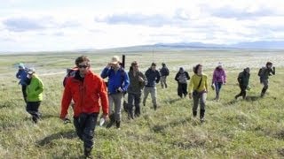


WHRC's Sustainable Science Speaker Series - Dr. Toby McGrath speaks on Sustainable Fisheries