Thomas Stone maps 400 years of land-cover change on Cape Cod, from deforestation in 1800 through mid-20th-century sprawl. Using satellite data from 1951 onward, he documents ongoing forest loss and warns that Cape Cod faces particular risk from sea-level rise and storms as climate changes.
Questions this video answers
About 400 years.
By 1800.
Maine.
1951.
1951 to 1990.
Hi, my name is Tom Stone. I'm a senior research associate here at the Woods Hole Research Center. I use geographic information systems and remote sensing data to look at Cape Cod's land cover over time.
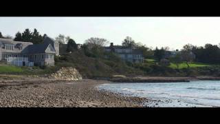
The reason it's quite interesting to me is Cape Cod is one of the first areas to be settled in the United States. It has about 400 years of land cover history. Of course, this dates back to the Pilgrims and so forth. By 1800, most of the forests in Cape Cod had been lost, had been cut, used for fuel, wood and for timber. The situation was so severe that by 1800 they were importing all the fuelwood and all the timber from Maine. So the situation changed around the time of the Civil War in that many people moved west. The railroads had come to Cape Cod, so it no longer had to be self sufficient. People moved to agricultural centers in the west and also to manufacturing facilities as well too. So Cape Cod went into a long population decline until about the 1940s and 1950s. At this point was the beginning of the age of the automobile. And this is when my studies really begin. And I'm using geographic information data that was first started by the University of Massachusetts in 1951. The first product that I made was a land cover map showing land cover change in cape Cod from 1951 to 1990. This was, as I said before, was the beginning of the age of the automobile. Very rapid changes and population changes happened on Cape Cod around this time. You saw losses of forest, increase in development, largely residential development, as the automobile travel became more popular. Right now we're in the process of making a second map which will bring the time series up to 2005. We are still losing forest in natural ecosystems. These natural ecosystems are quite important on Cape Cod as elsewhere, because they provide us with clean air, they clean the water, they protect the fragile coast. And for each one of these natural ecosystems or land covers that we change, we have to replace them with manufactured or engineered solutions such as RIP RAP to protect the coast. One of the images that you're going to see was collected from the space station showing Cape Cod sticking out in the Atlantic Ocean, sort of isolated by itself out there. And that brings both advantages in terms of the tourism industry, but also disadvantages because we're more likely to be hit by hurricanes and tropical storms as they come up the coast. This, to me shows Cape Cod's fragility, particularly when you consider sea level rise and increasing storminess that's predicted over the rest of the century because of climate change.
Why is this work important. First, Cape Cod is our home. It is where we work and live, and it's also the home of our neighbors and many of our supporters. Second, like our building, we need to be a model of how to live.
In the new world that we are entering. That world will be a world of.
Higher temperatures and increased storminess, and we will need to learn to live in this world and how to avoid as much of that change as possible and adapt to it as we can. Cape Cod is uniquely vulnerable. Climate change created Cape Cod during the Pleistocene era and new human induced climate change can irreparably damage Cape Cod.